Trail Notes from the PCT
In 2025 I hiked ~1300 miles of the Pacific Crest Trail in California, over the course of three months. These are some of the highlights, compiled from the email updates I wrote along the trail.
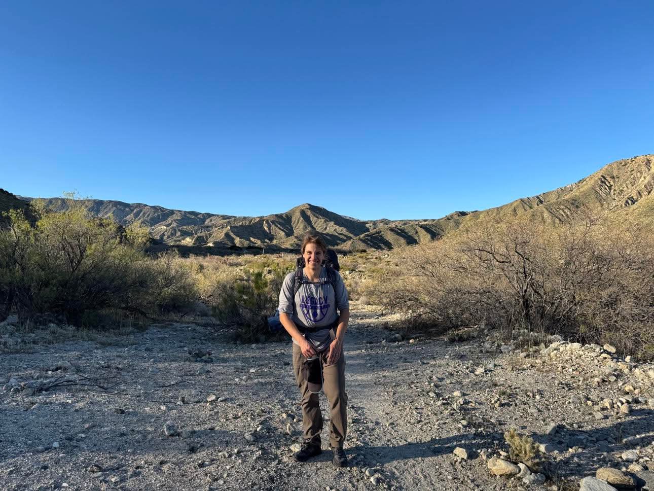
Section 1: Campo to Julian
Today got to the first major resupply point on the PCT: Julian, California. 77 miles down, 1180 to go! Here are some pictures from the first segment.
Last view of the US/Mexico border from the trail.
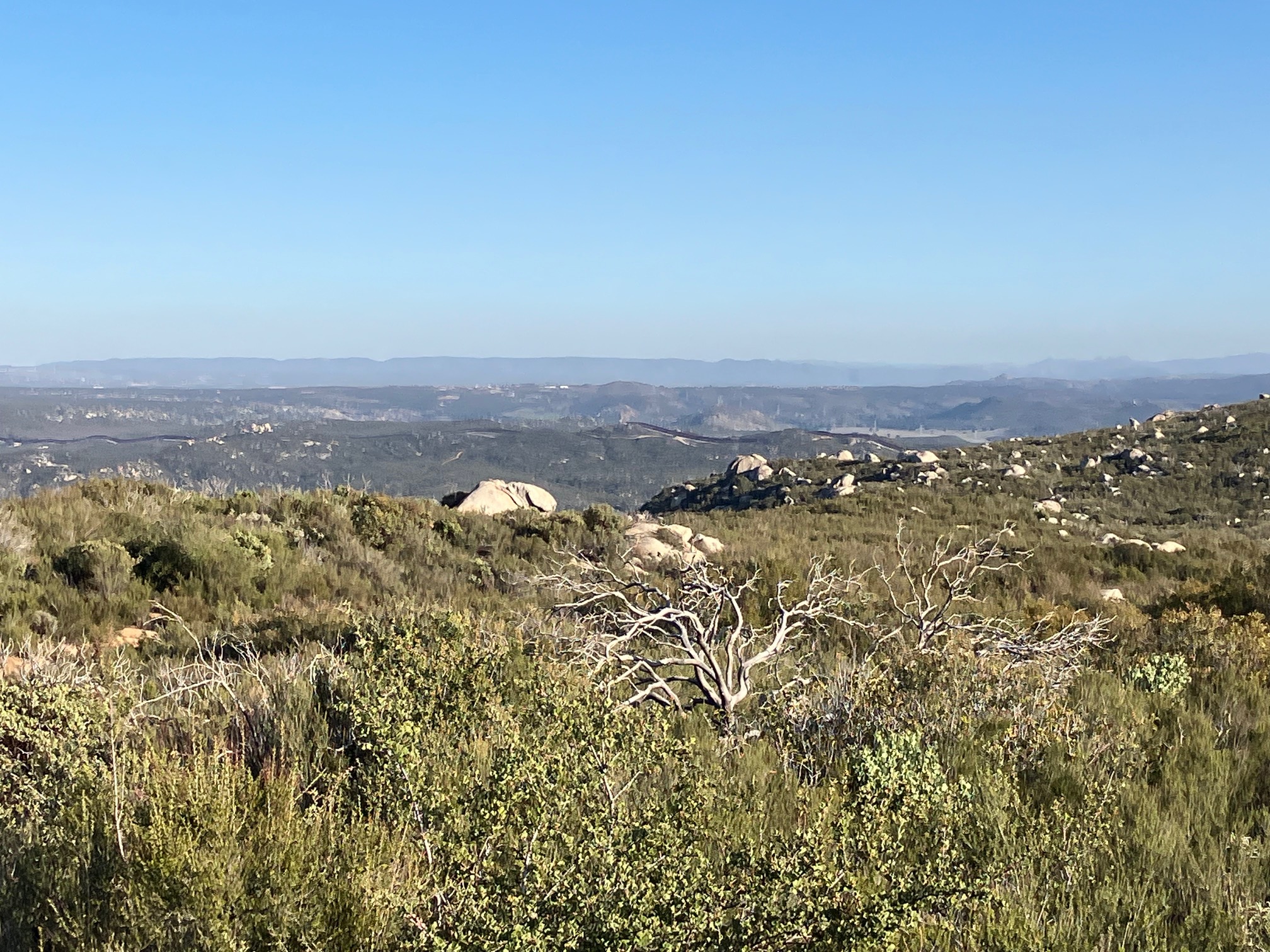
Lake Morena, seen from Morena Bluff, on Day 2.
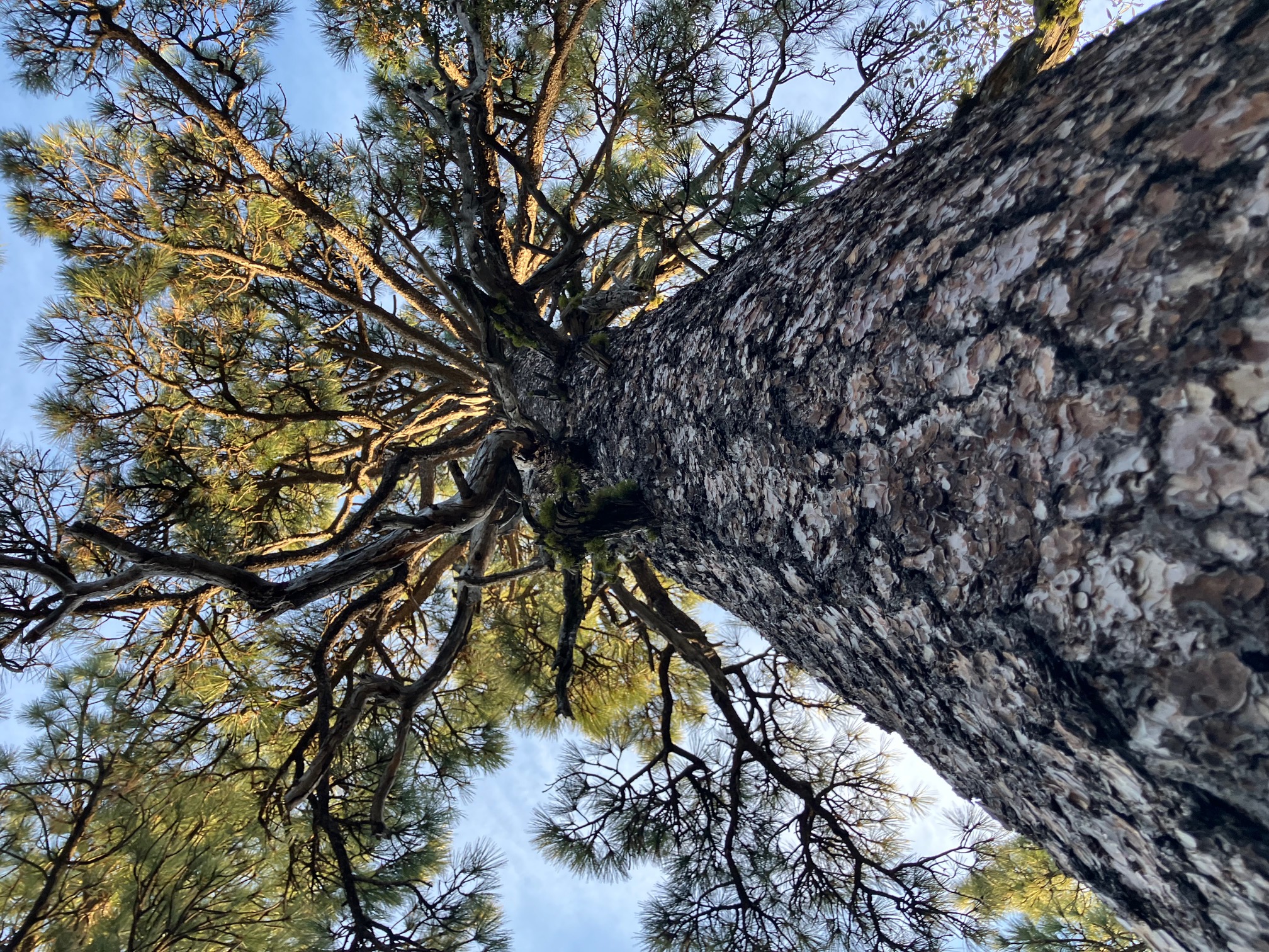
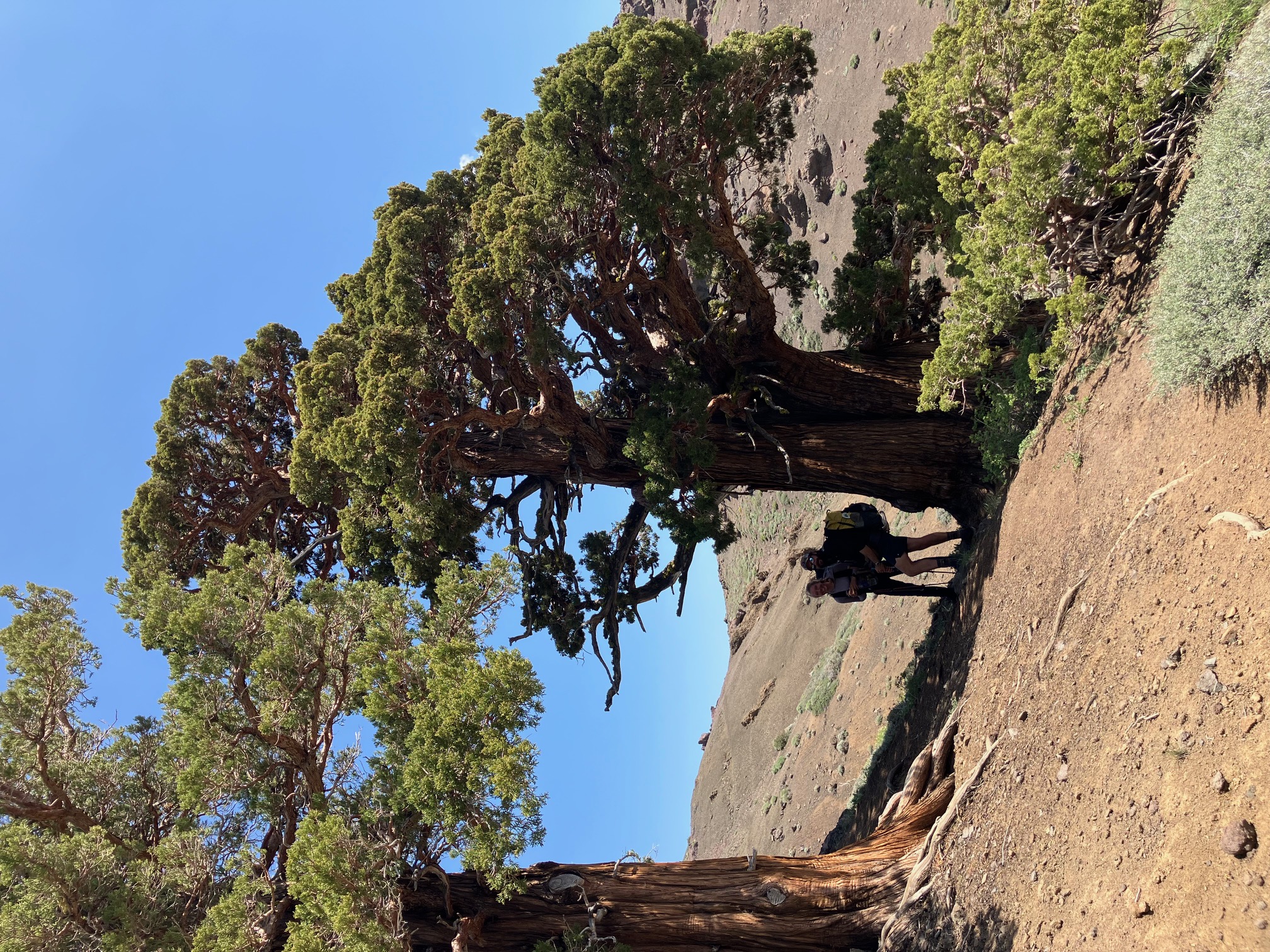
A Jeffery pine near Mount Laguna. The bark of these smells like vanilla and bourbon to me—everyone describes it differently.
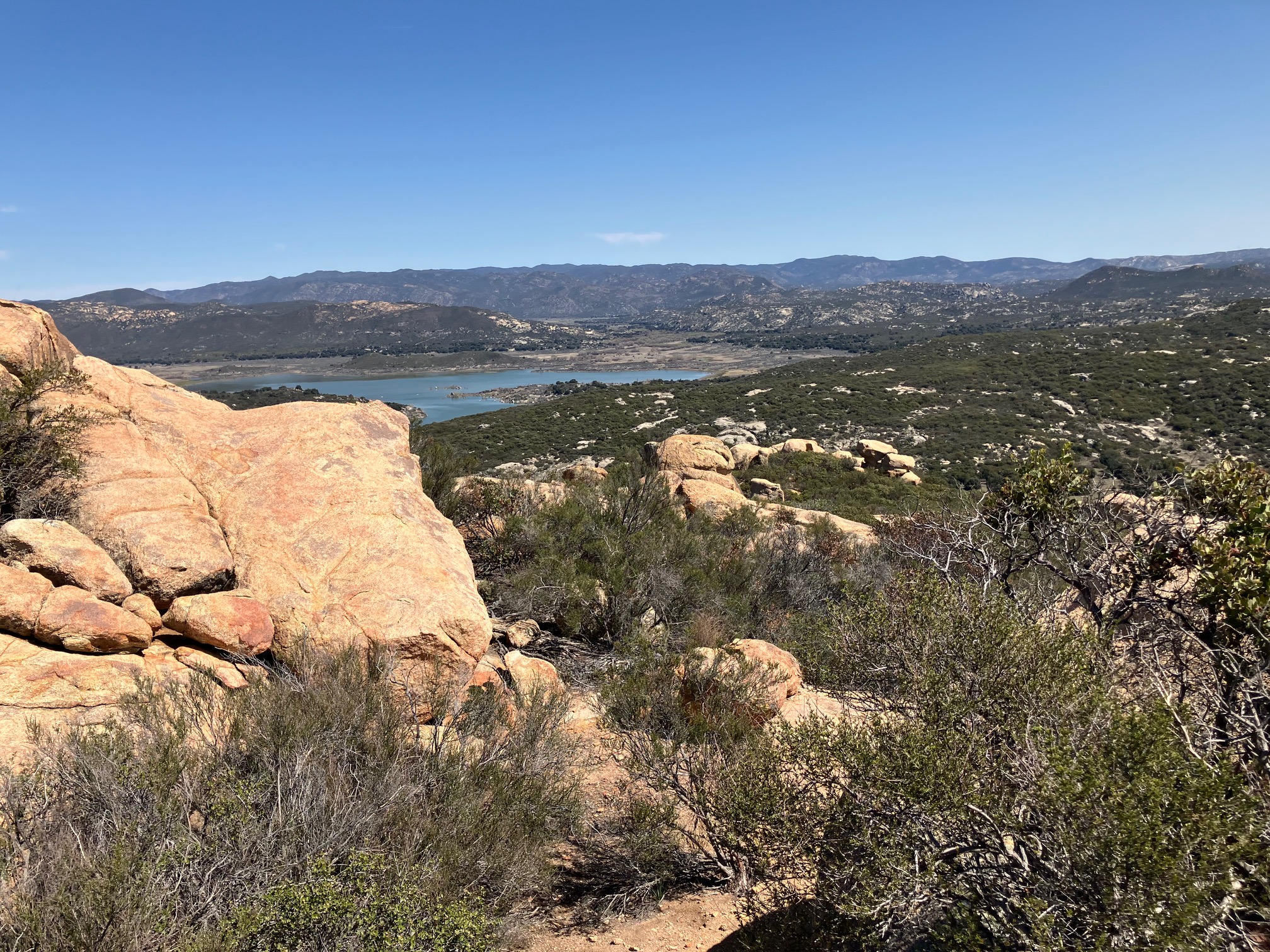
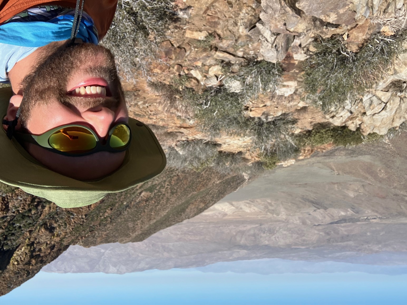
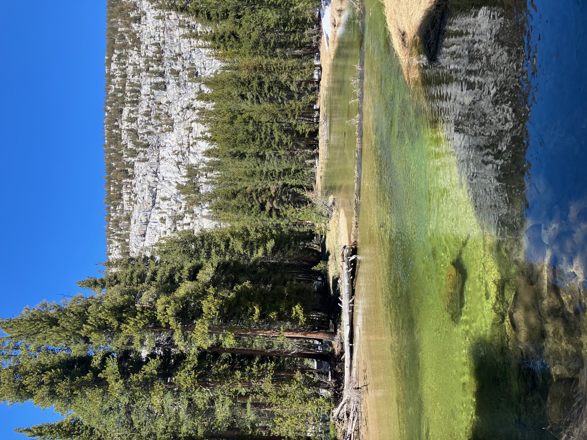
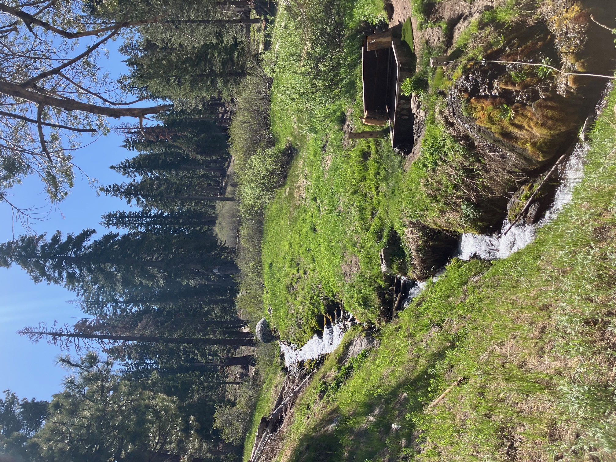
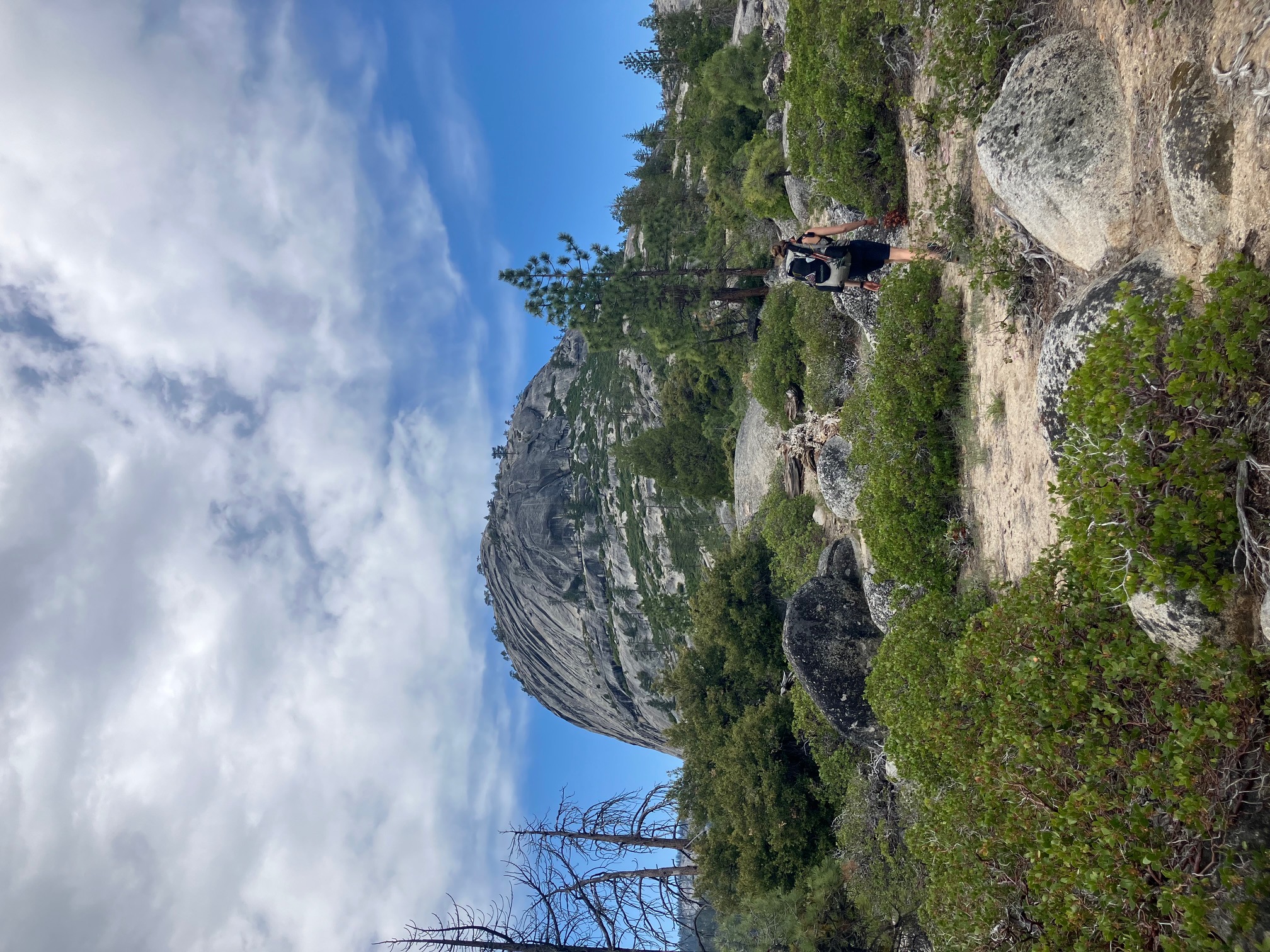
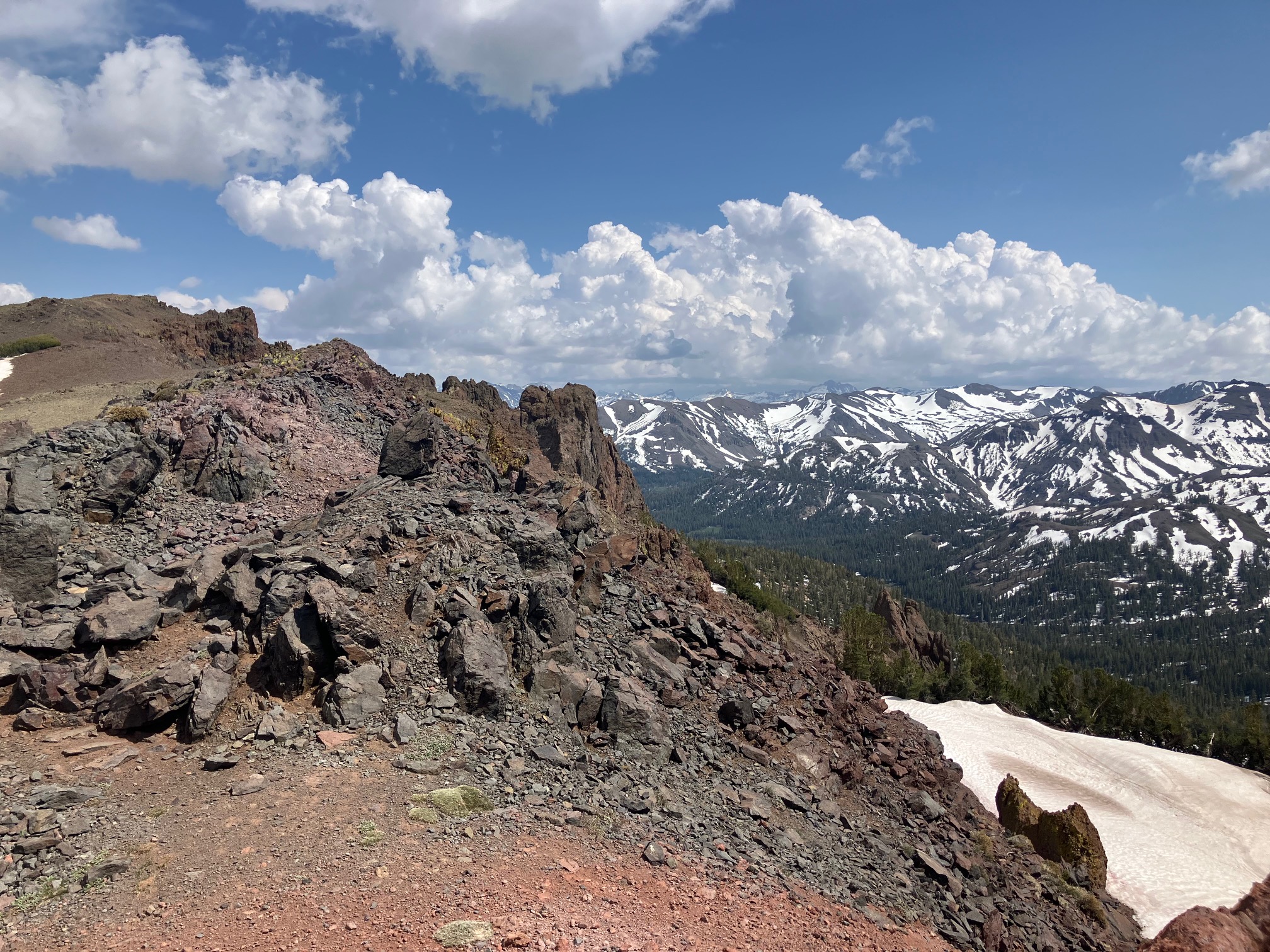
Most of the view from this first section looks like this.
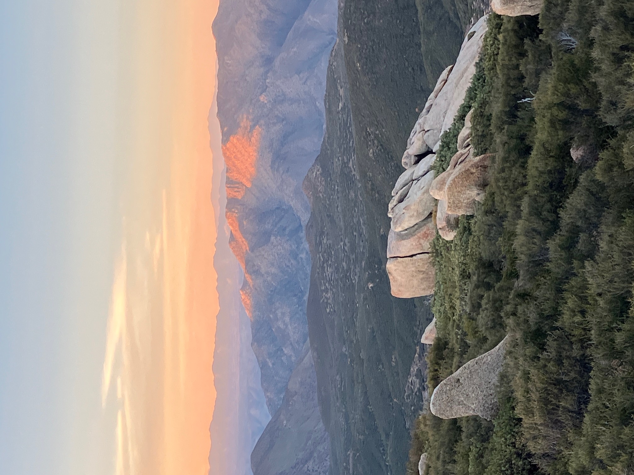
Sunset from camp on day 3.
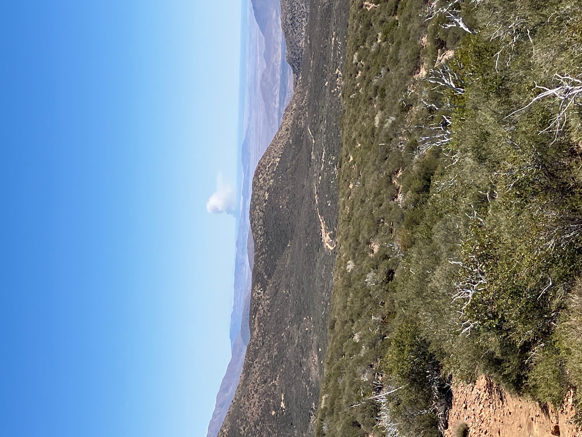
A plume of smoke on the horizon from a prescribed burn (I checked to make sure).
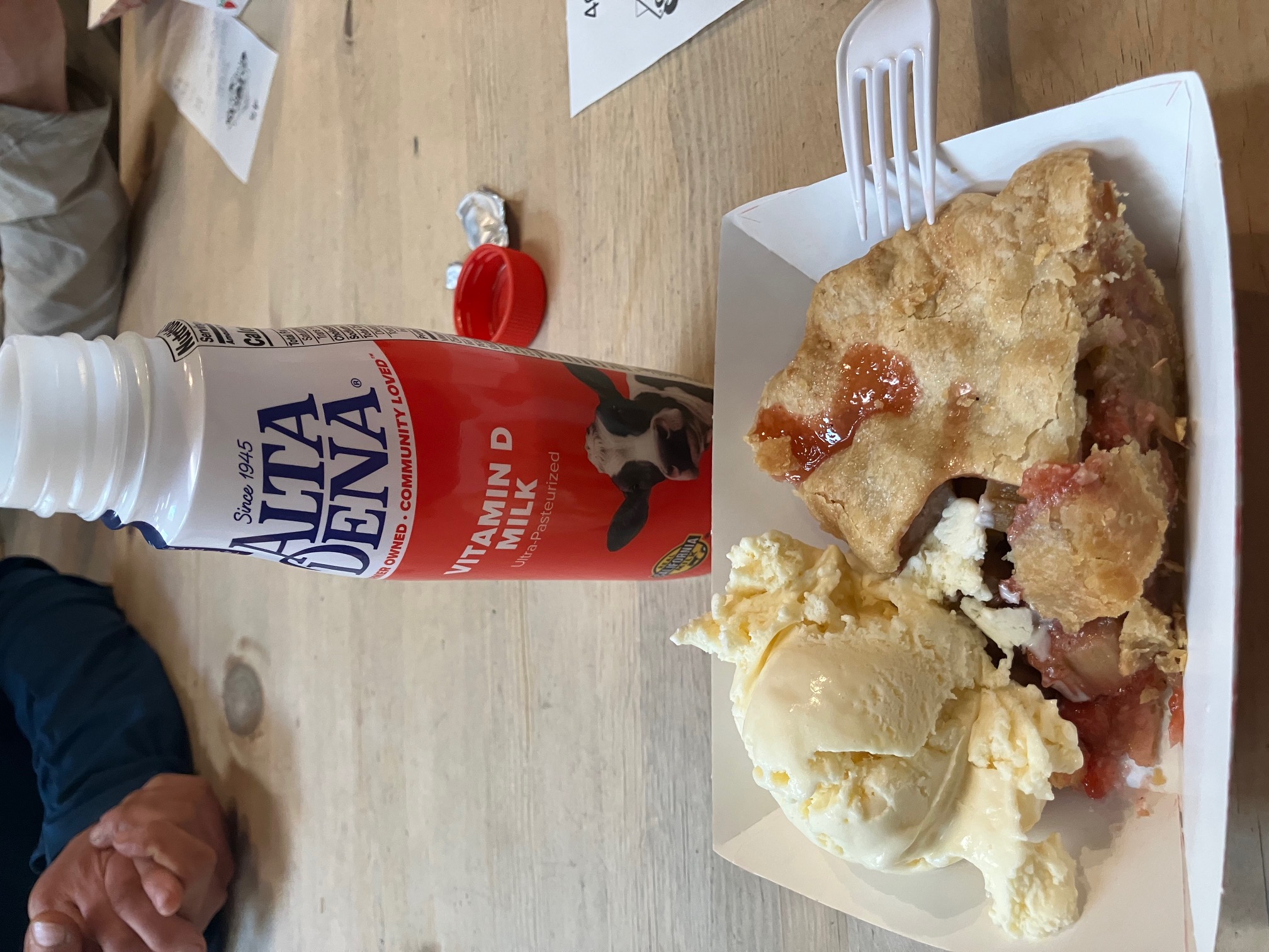
Free pie and ice cream at Mom’s Pies in Julian! And a reunion with all the folks I met on the way.
Next stop is Paradise Valley!
Section 2: Julian to Idyllwild.
I’m hunkered down in Idyllwild, CA, waiting out a storm before heading back up into the San Jacinto mountains. So far I’ve gotten 170 miles into the trail! Here are some of the highlights of the last section.
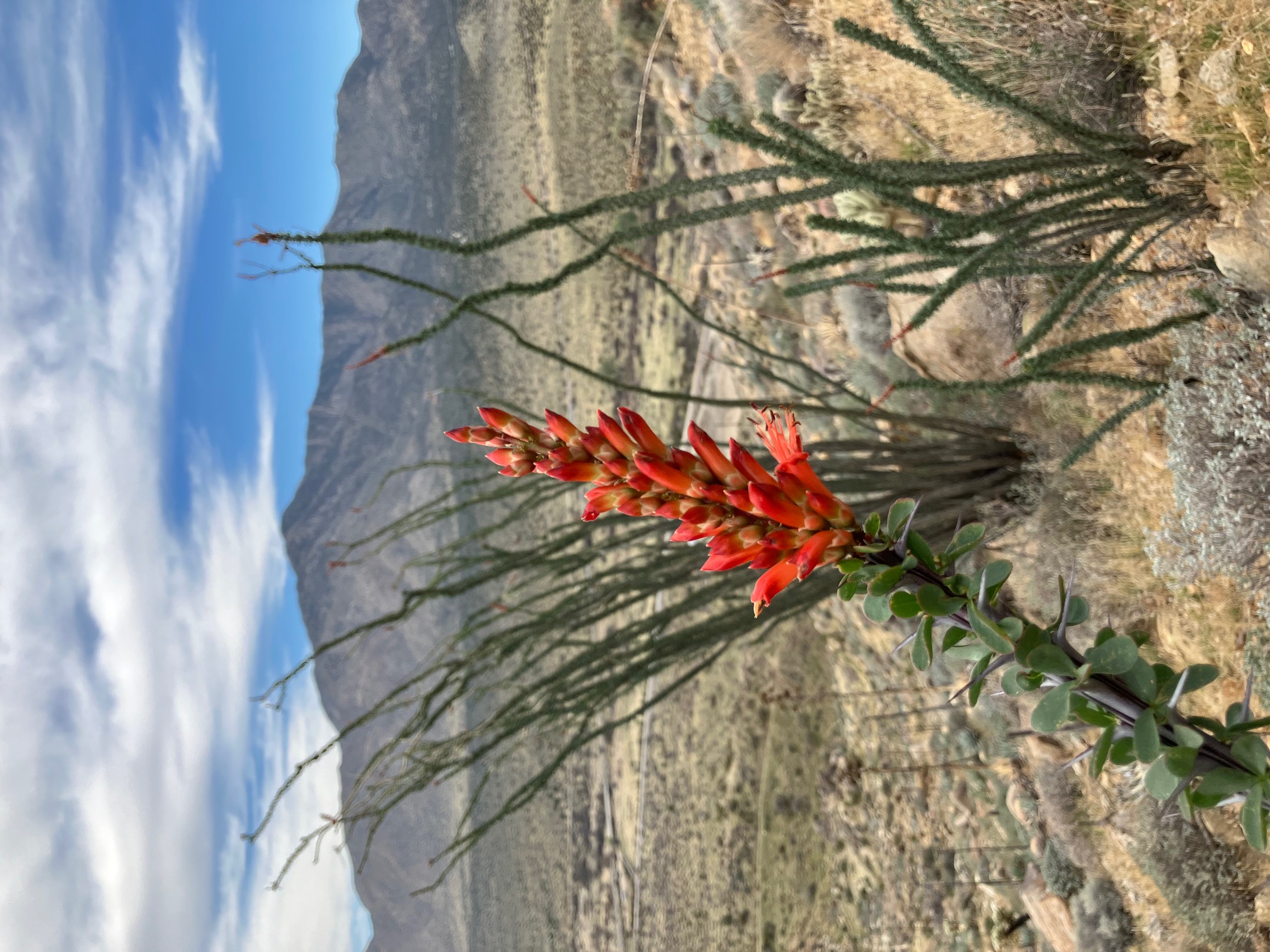
A flowering cactusy friend on the hike up from interstate 78. There were some trail angels making pancakes for hikers under the overpass, so I was very well fed for this section…
Meadows coming into Warner Springs. This section was lovely, full of cows, and very flat.
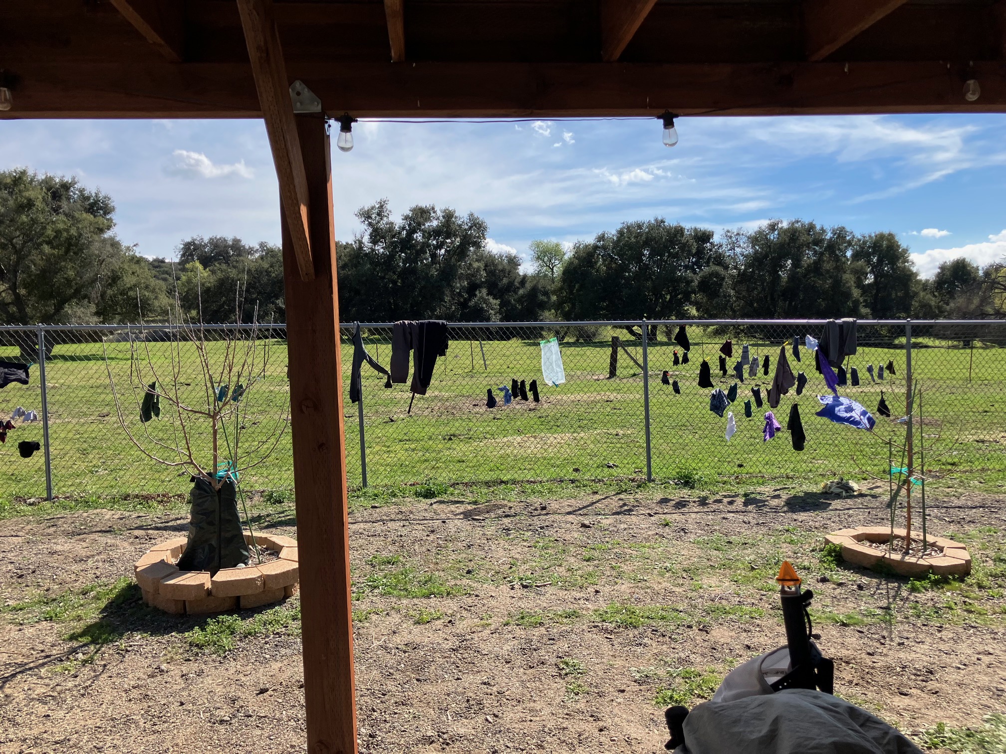
Clothes drying on the fence at the Warner Springs community resource center.
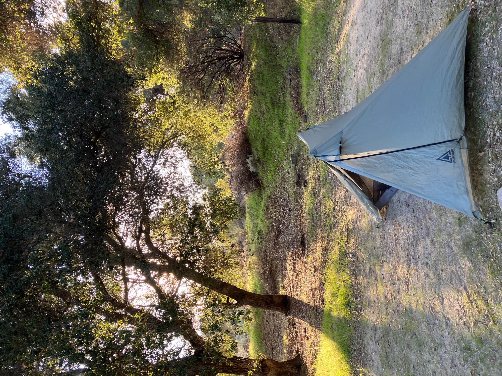
Lovely campsite under an oak tree by a stream outside of Warner Springs.
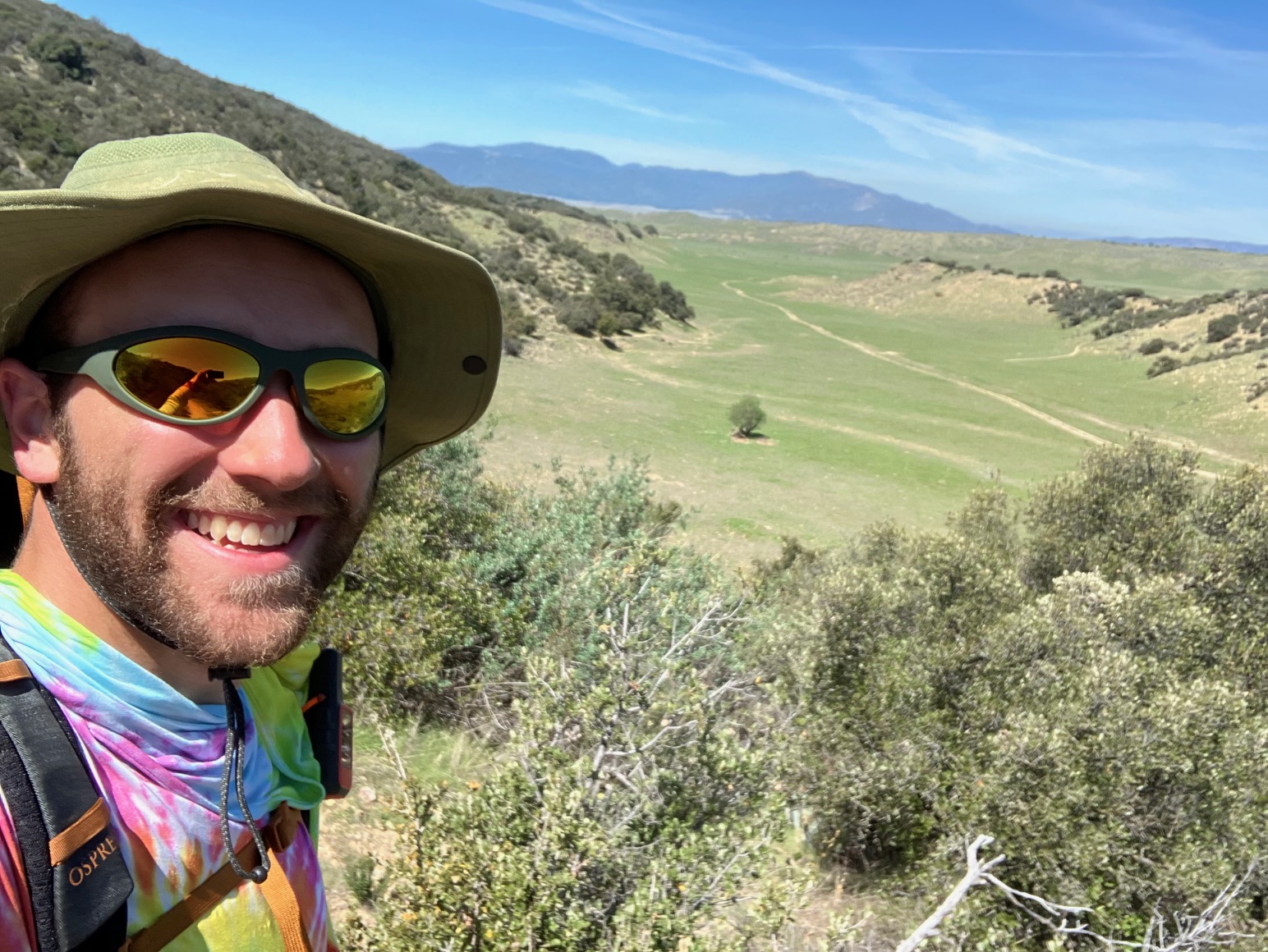
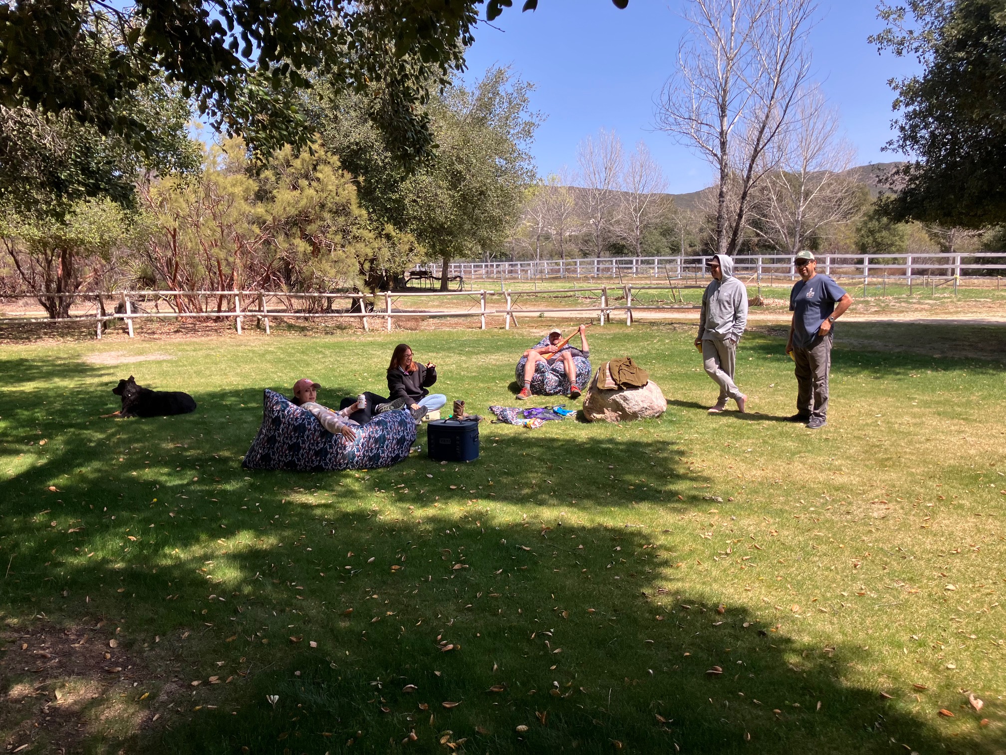
Zero-mile day with the Murrieta family at their ranch/winery. I met these folks the day before on the trail and they invited me to rest for a day with them.
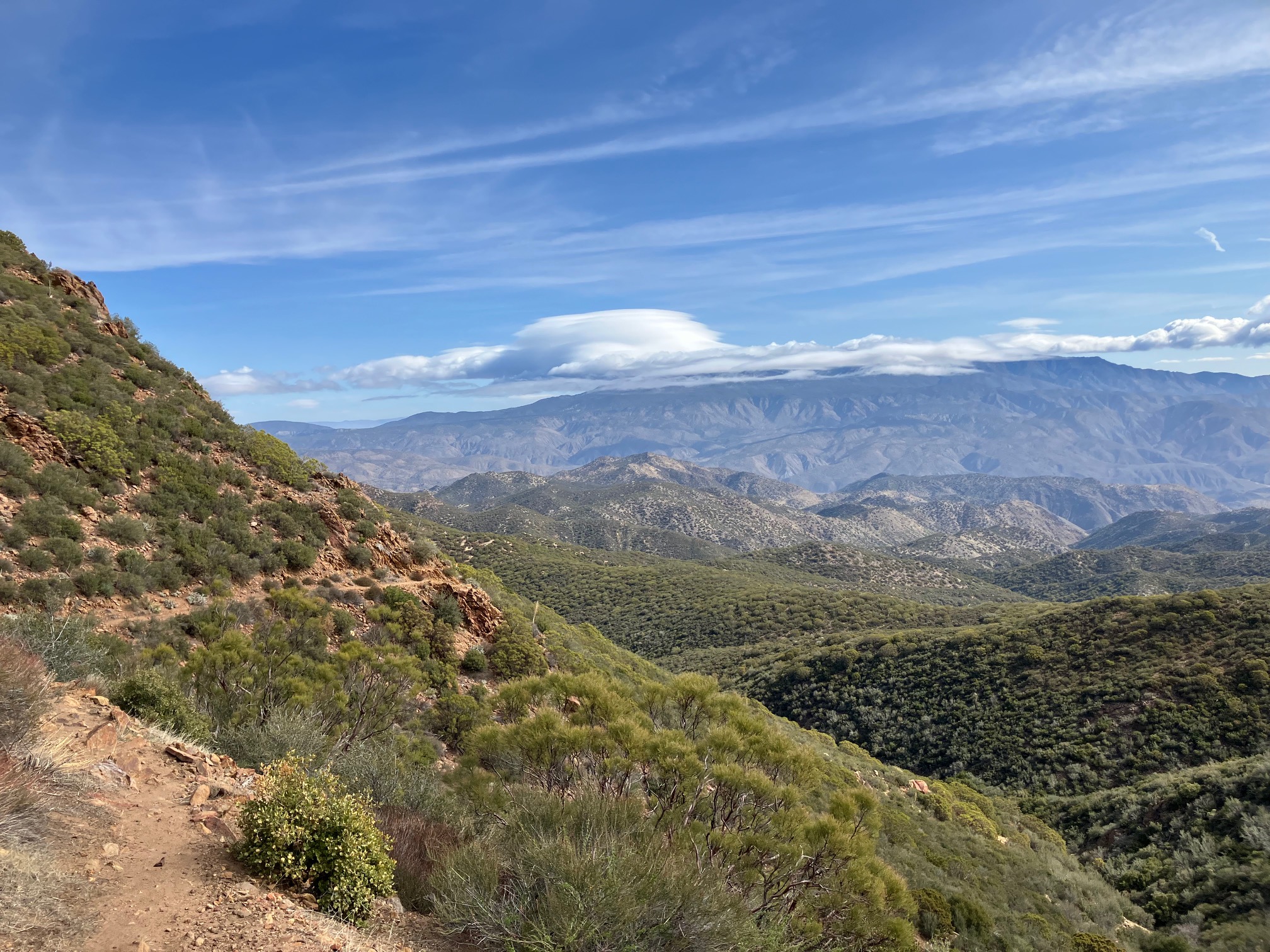
Lenticular cloud over the San Jacinto mountains in the distance. These signify very high winds, which turned out to be accurate…
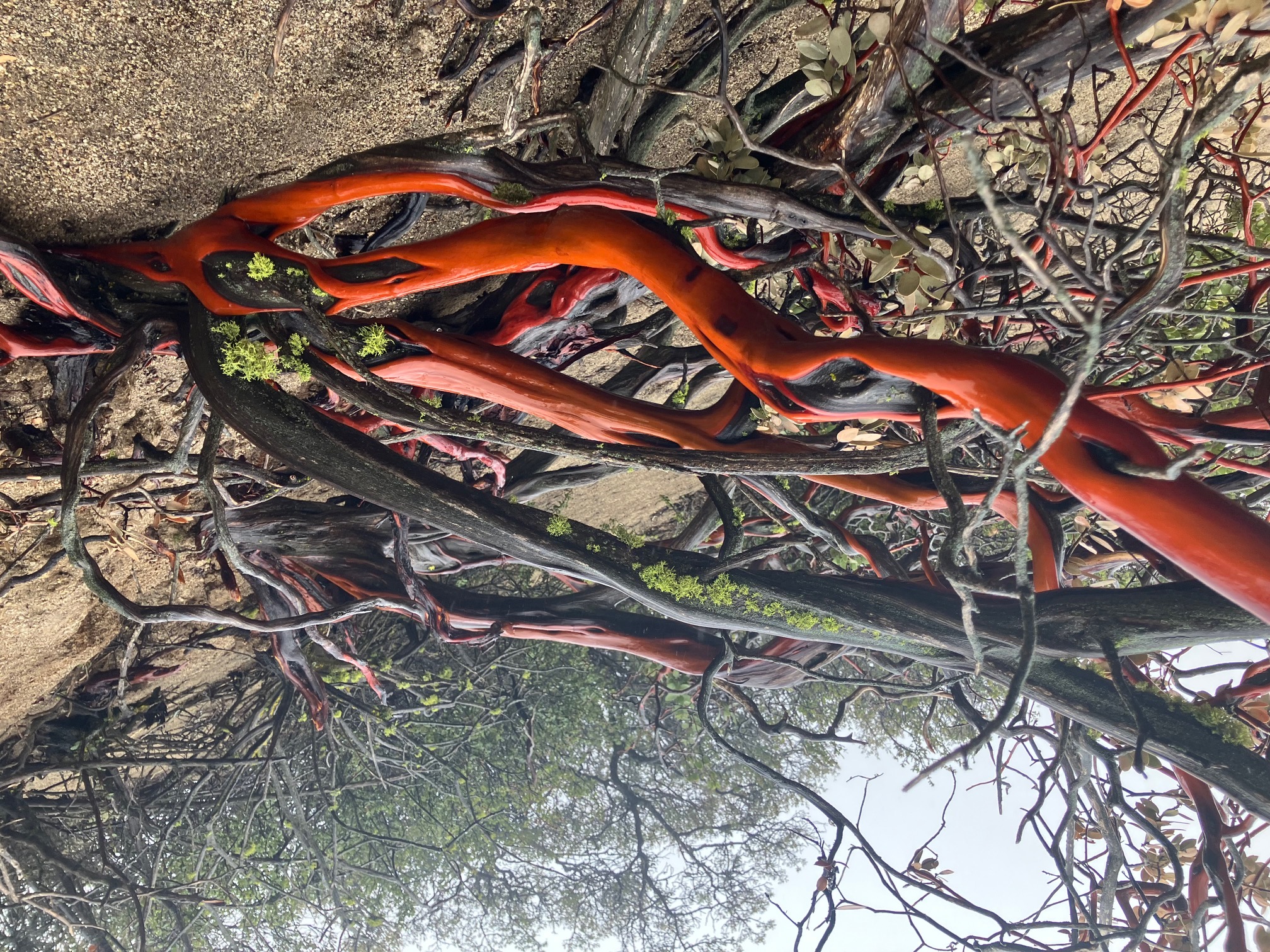
A manzanita tree high up on a windy ridge. The colors are even more vibrant in person.
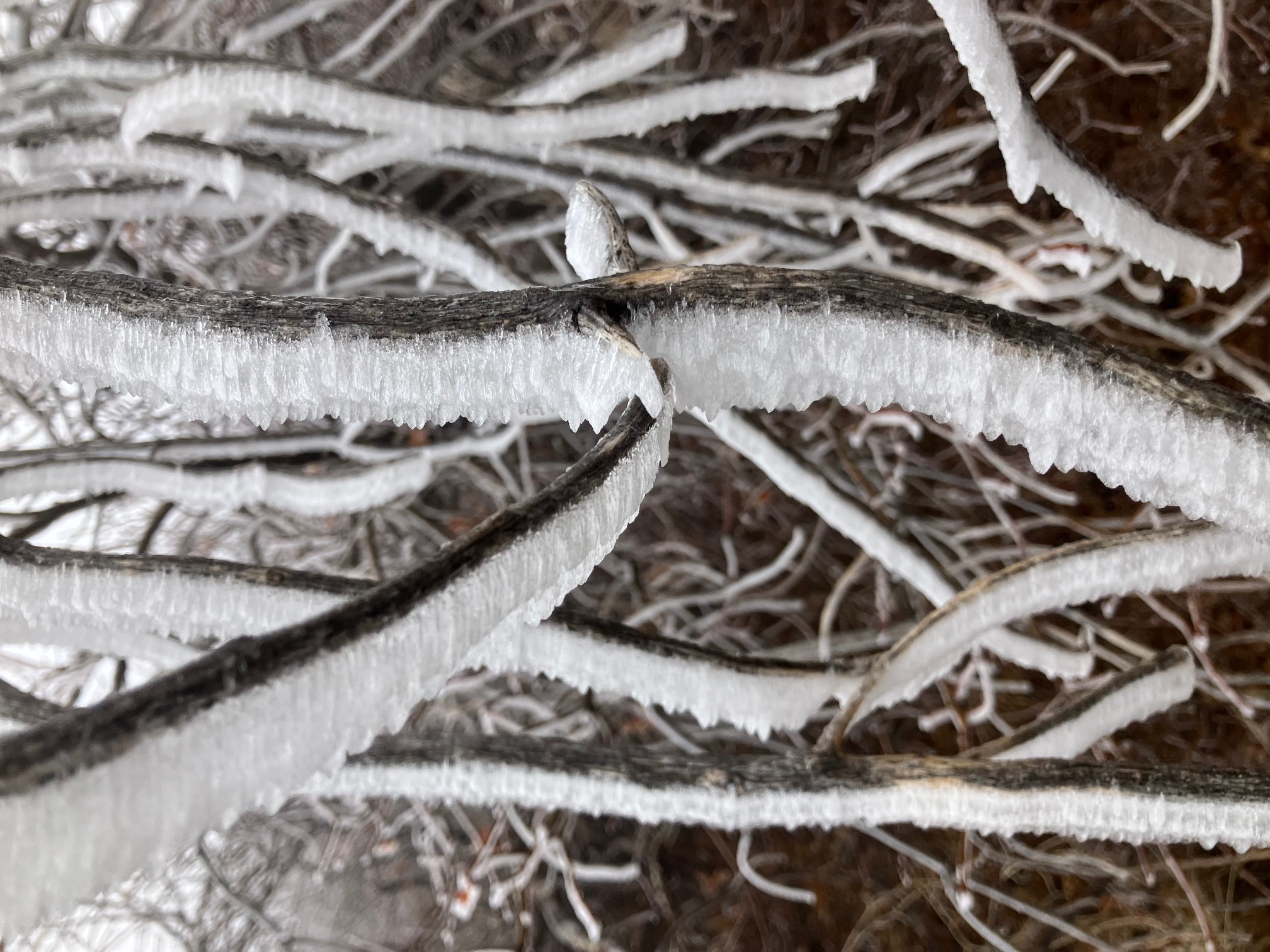
Ice scales after a windy, freezing night. This altitude had 60 mph winds all night and constant freezing fog. Quite an experience to walk through.
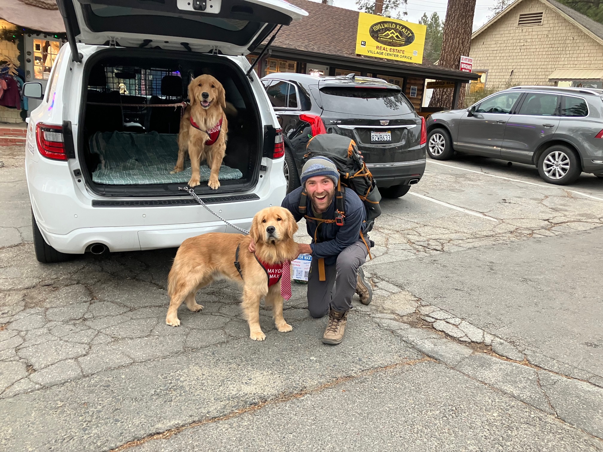
I decided to come down from the trail into Idyllwild to wait for warmer weather, and I ran into the Mayor! His name is Max, and he’s the fourth generation of Mayors of Idyllwild in his family.
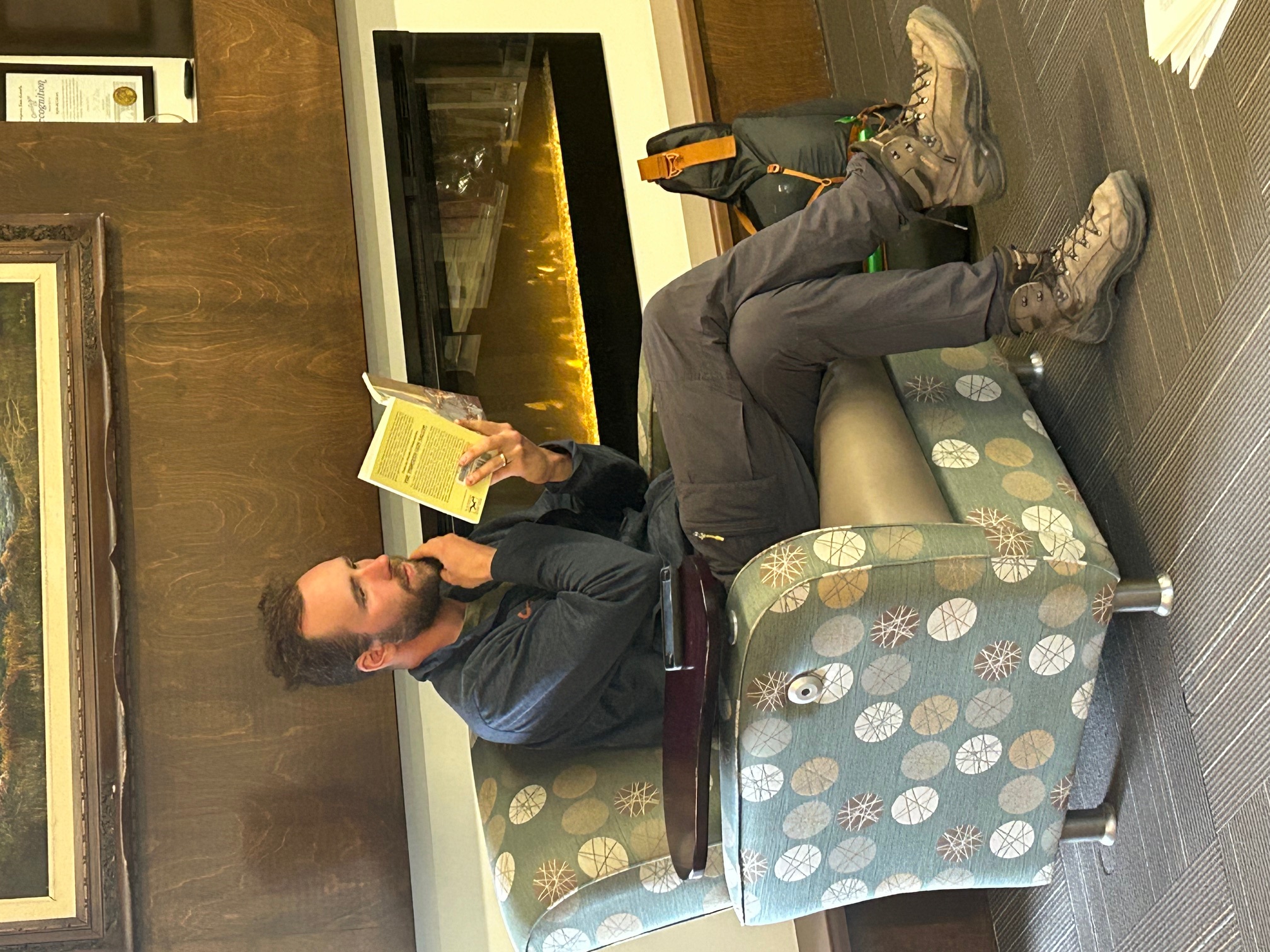
Chilling at the Idyllwild public library (photo credit Timber, who snuck up on me)
This afternoon I’m heading back up for the next section—100 miles, to big bear city.
Section 3: Idyllwild to Wrightwood
I’m writing this from the lovely town of Wrightwood, CA—342 miles into the trail. The last section has been a bit of a whirlwind, including big weather extremes and some very long days. Here are some of the highlights.
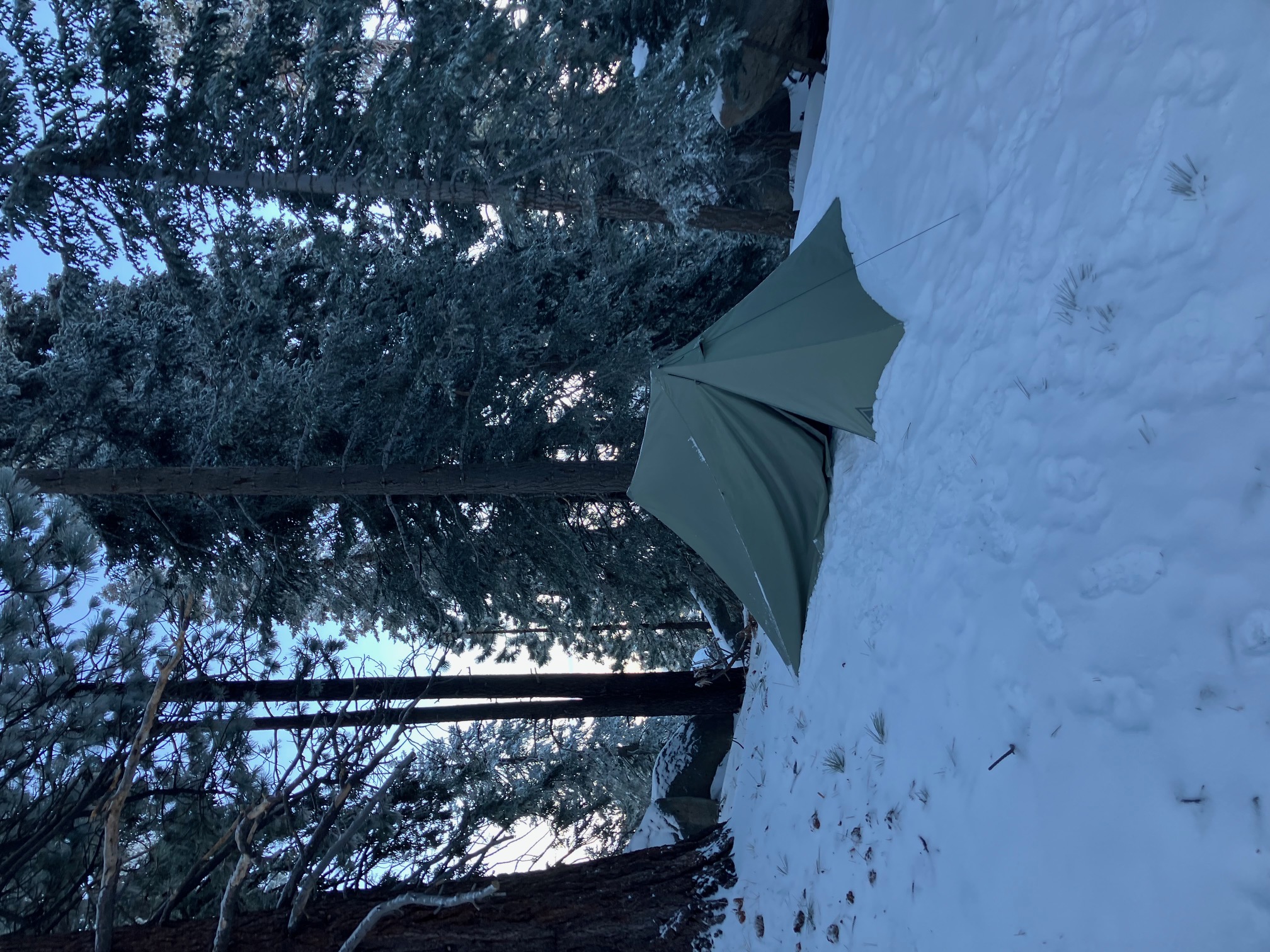
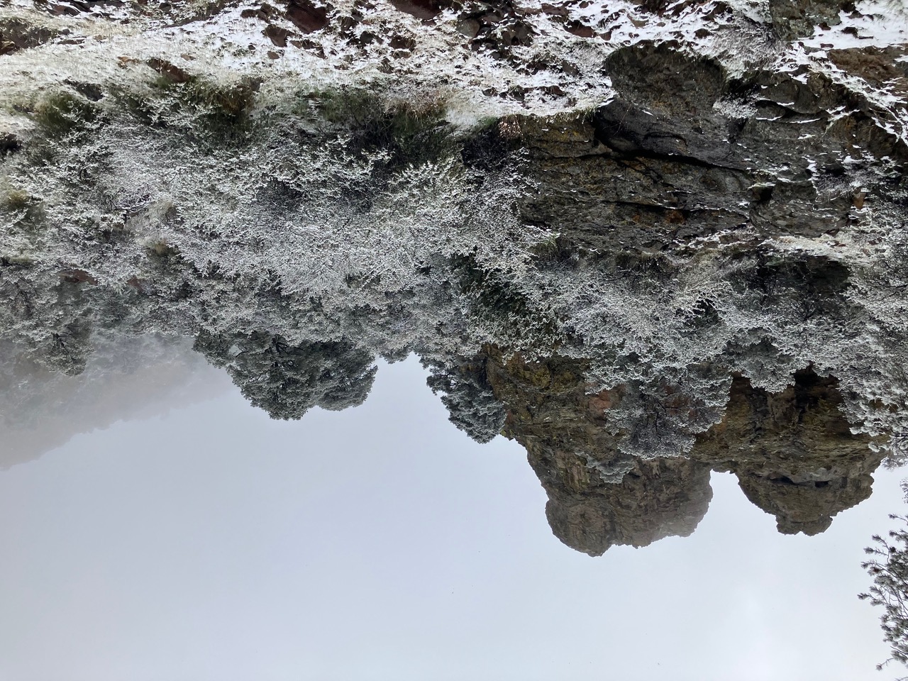
Snow camping the first night out of Idyllwild. I was making the first tracks on the trail for 8 miles or so.
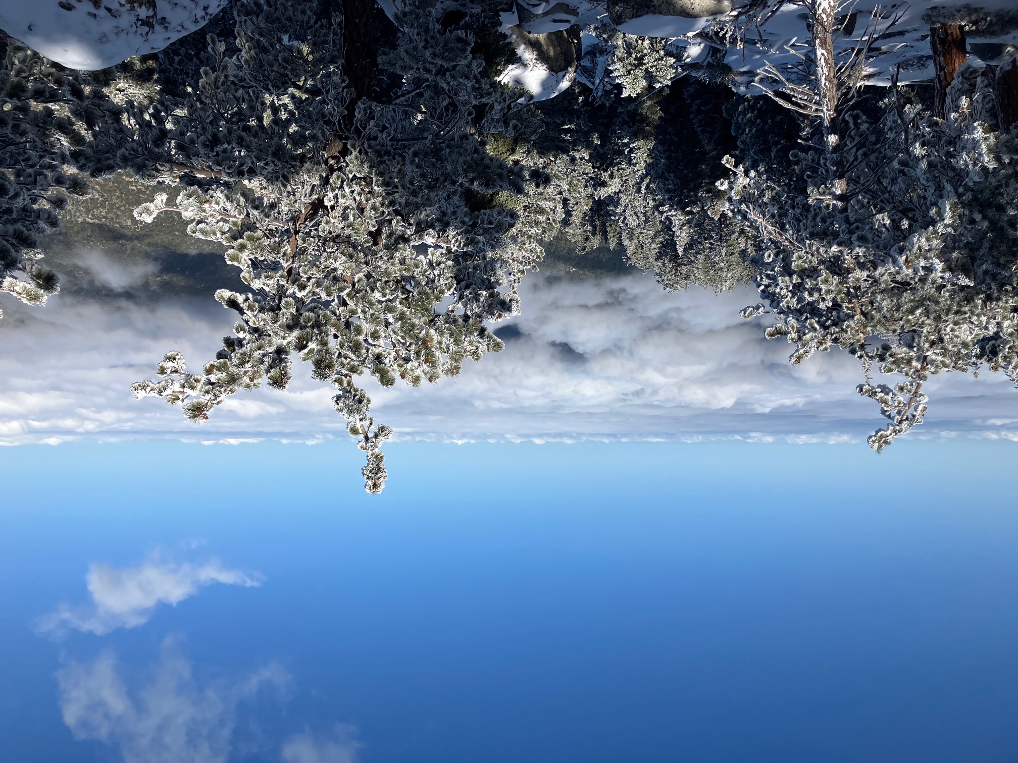
Looking west from the slope of San Jacinto. Apparently Idyllwild (under those clouds) was having some nasty sleet, but up high it was lovely.
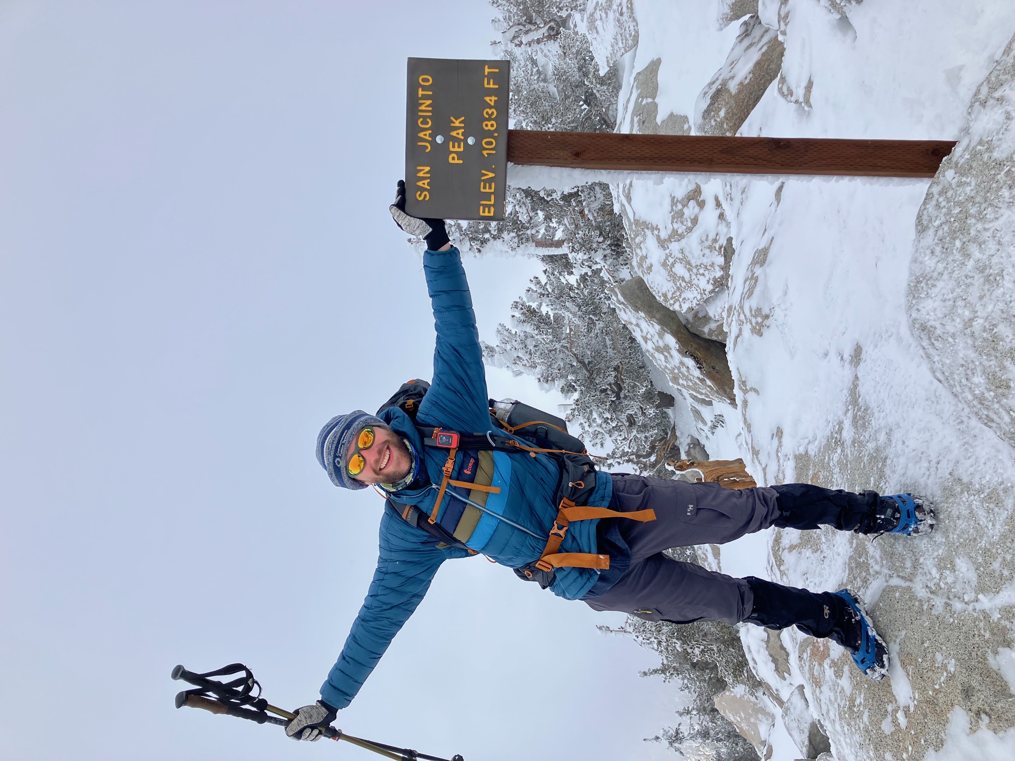
The summit of San Jacinto.
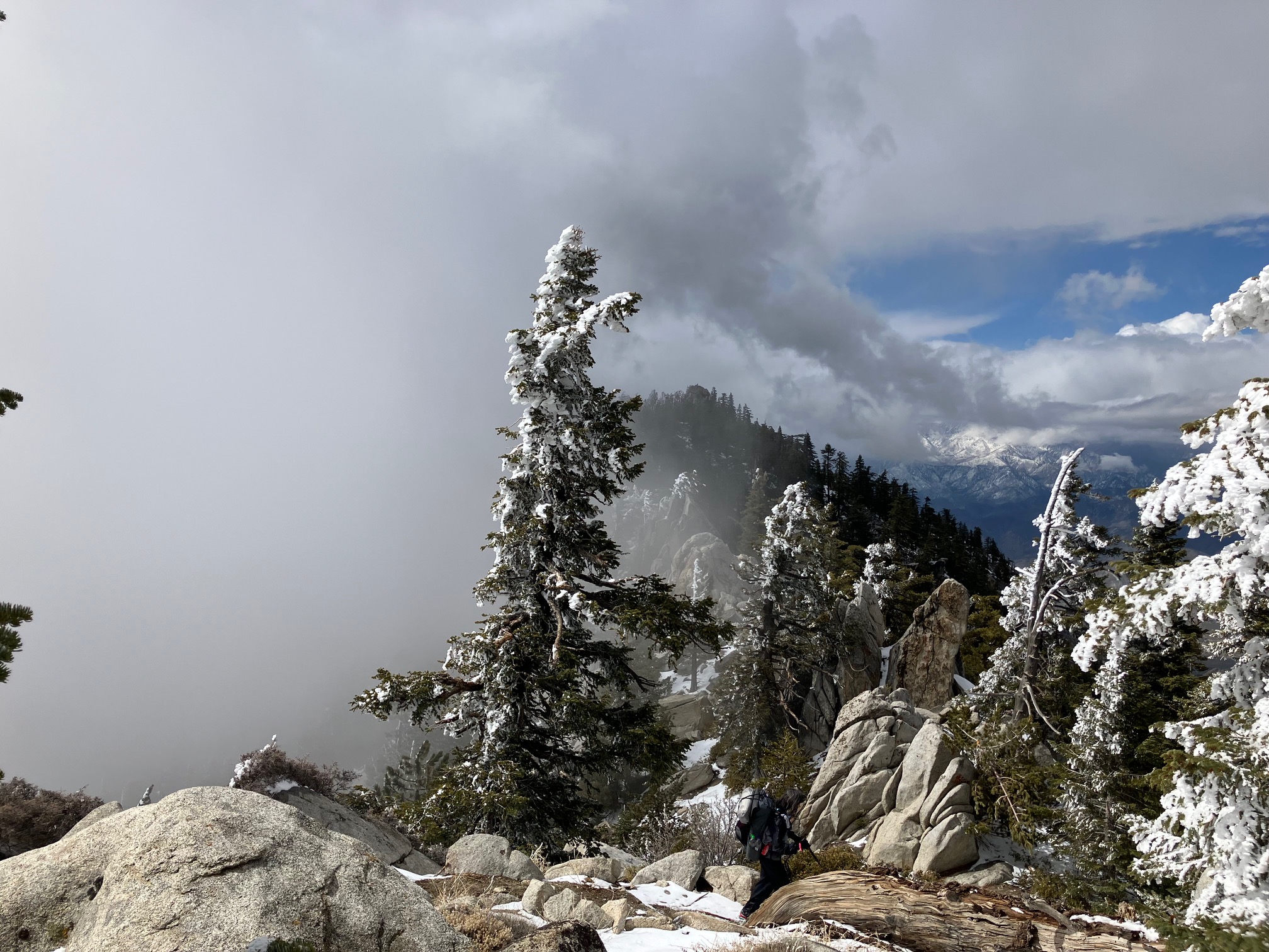
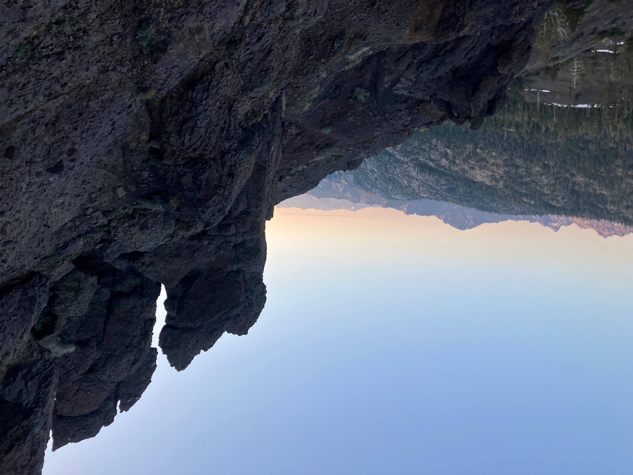
A really cool atmospheric effect coming down fuller ridge—the clouds are contained on one side of the valley.
Hanging out at Nitzy’s Hiker Hostel in Browning.
Fields of wildflowers on the way out of Cabazon.
The indomitable Quinn joined me for a weekend!
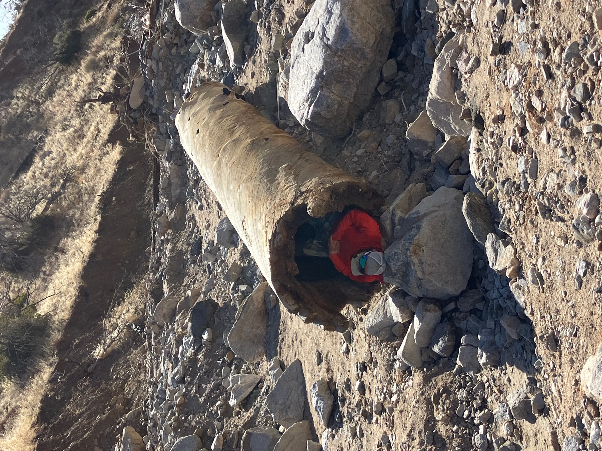
Ty taking a nap in a very Ty-shaped log after 10 miles of rock hopping up mission creek.
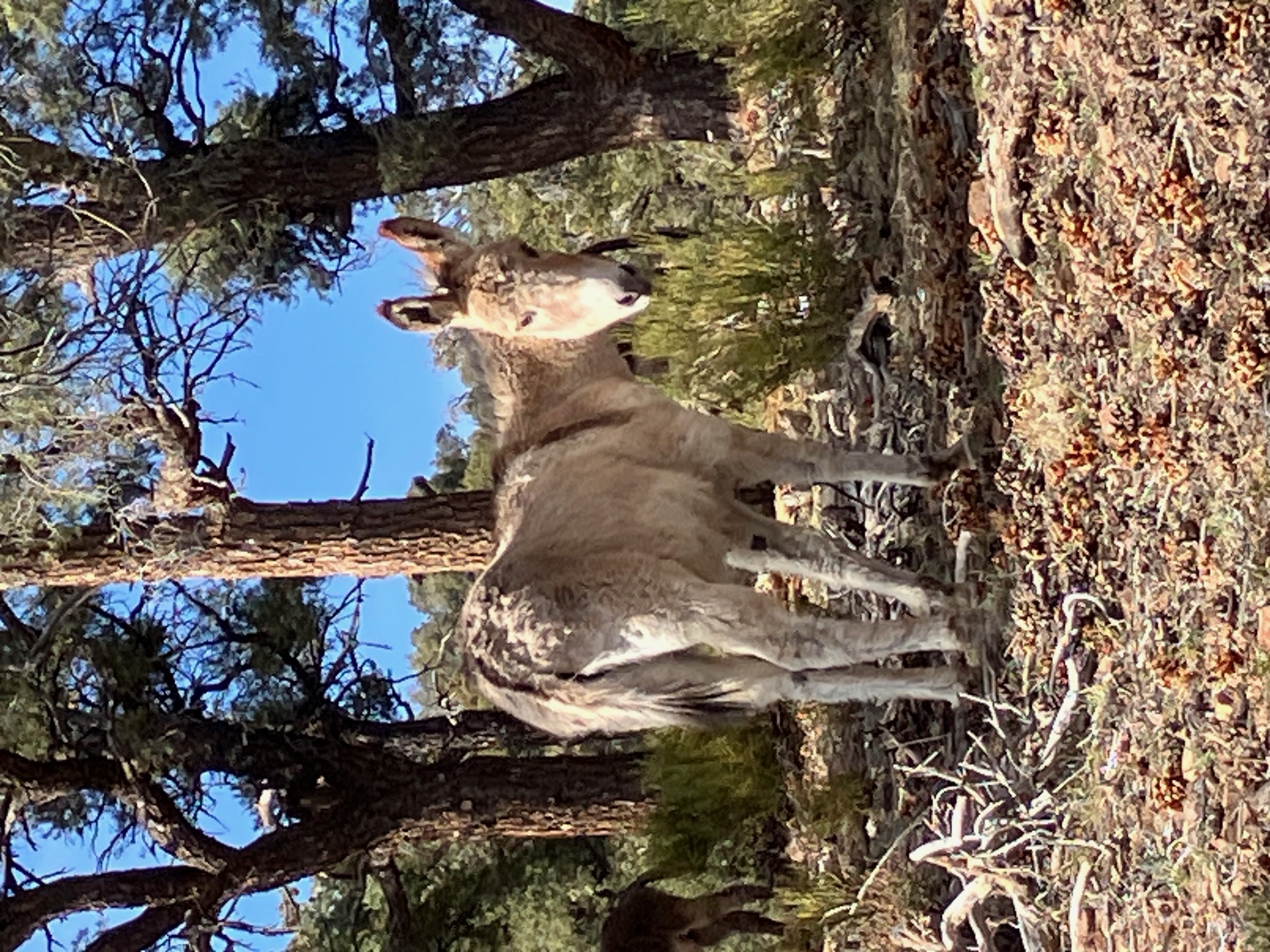
A very photogenic donkey near big bear city. There was a whole herd, but this one stared me down until I took a picture.
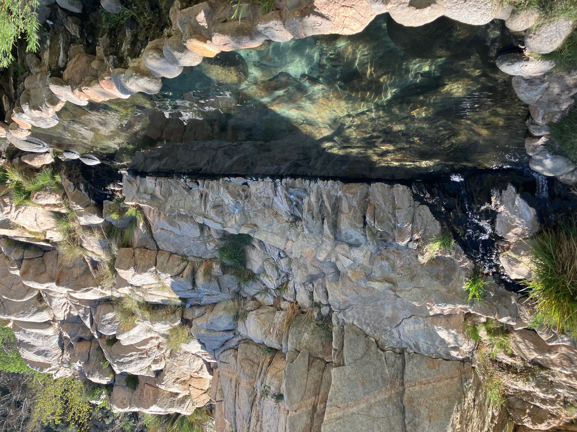
One of the pools at Deep Creek hot springs. I hung out for about three hours and had a spa day!
Turns out the PCT goes right by the entrance to the Mines of Moria! Who knew.
Unbelievably lush walk along the Deep Creek floodplain.
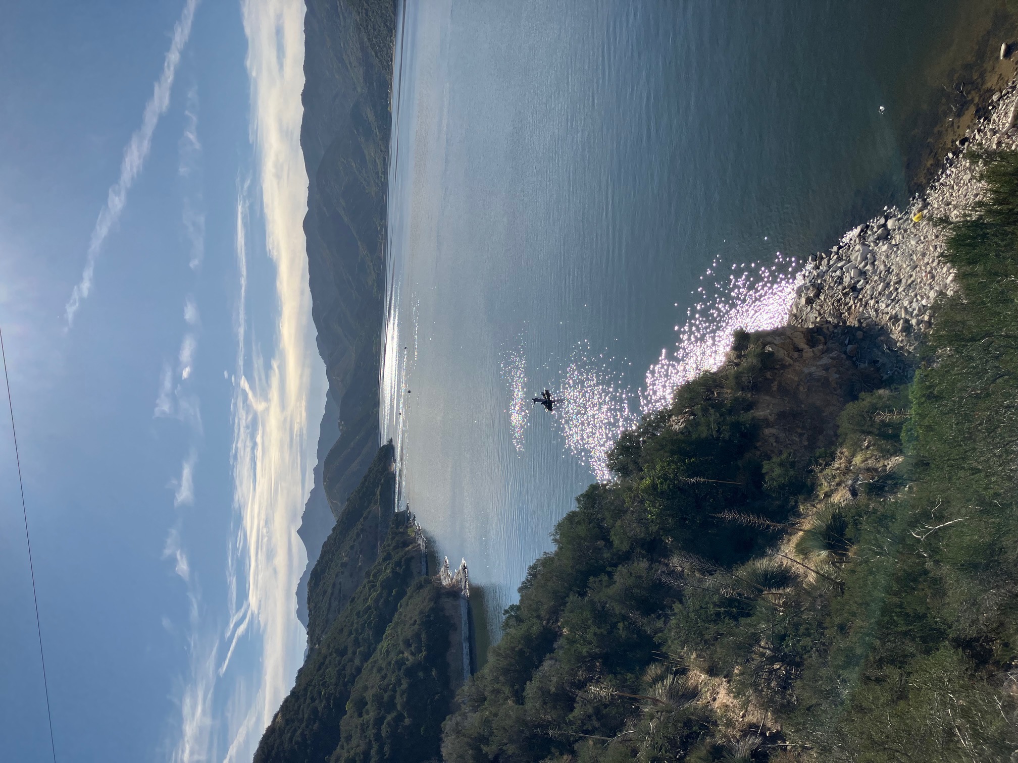
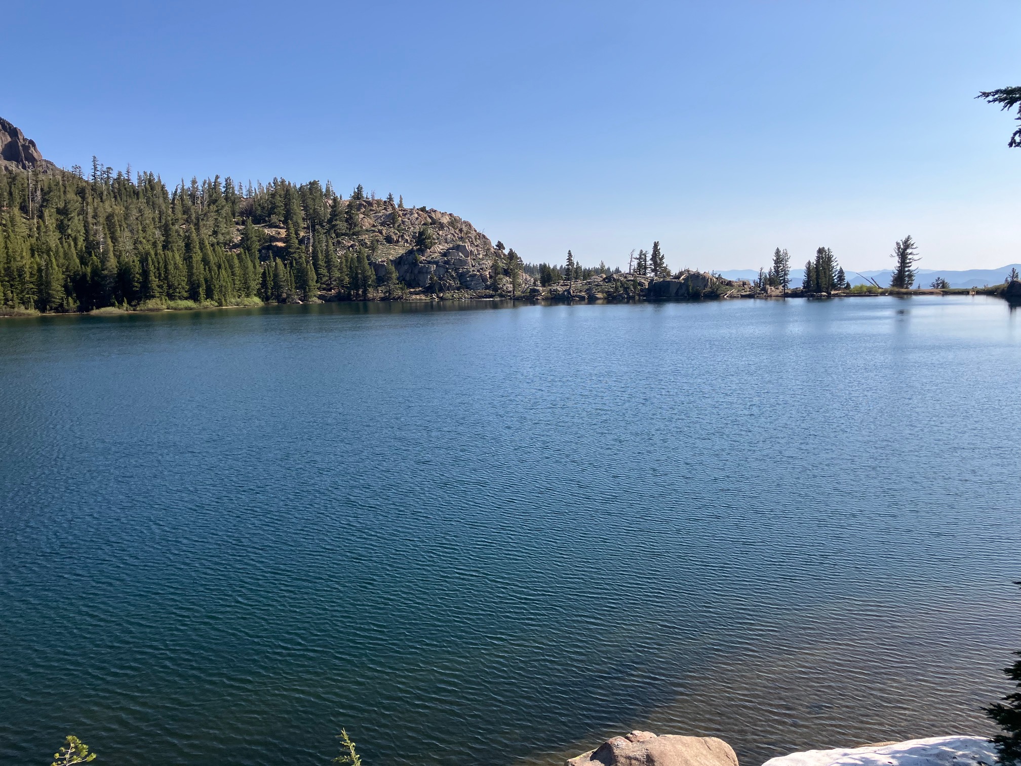
Overlooking Silverwood lake (also had a lovely swim here).
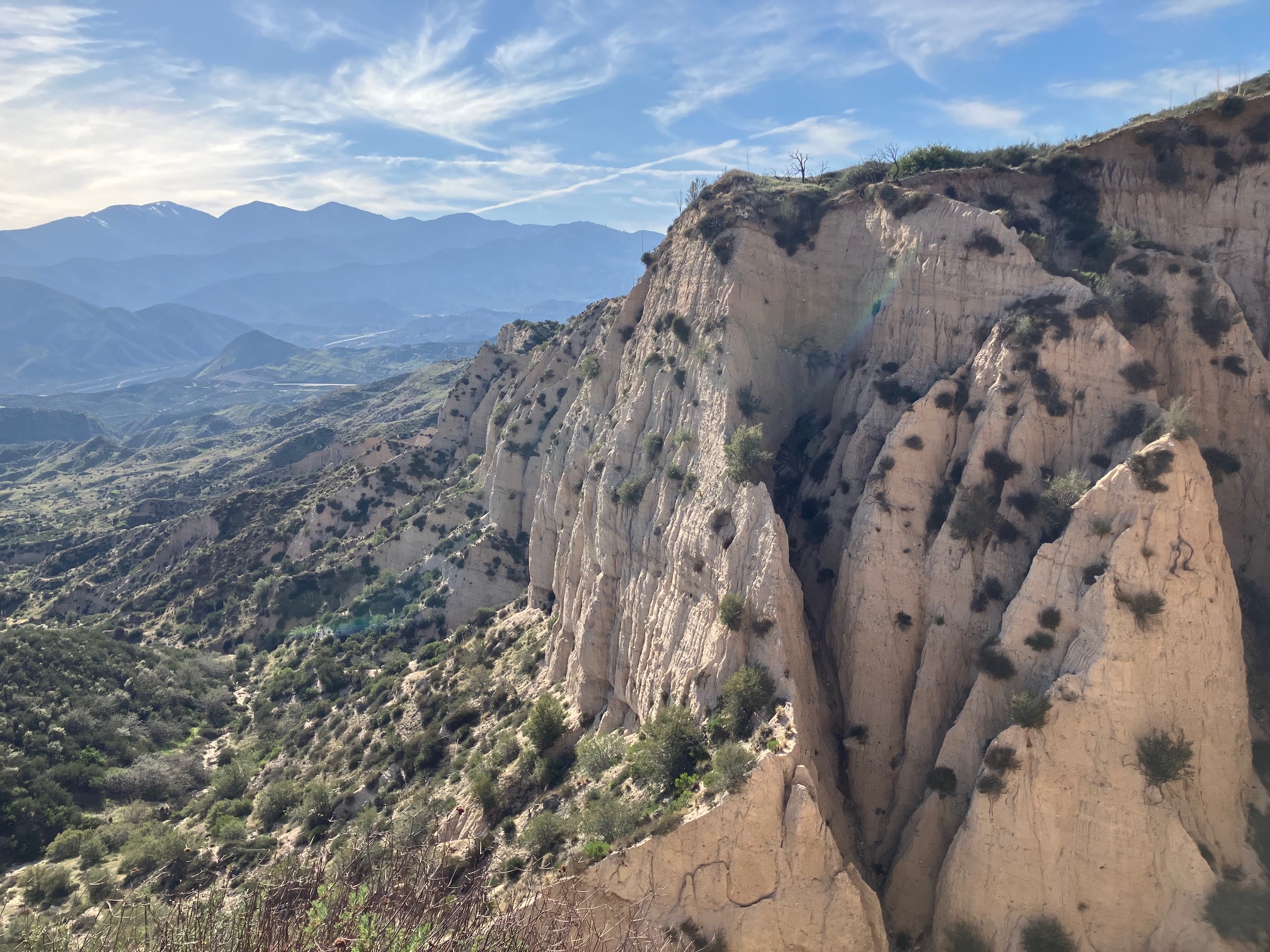
Sandstone cliffs near Cajon Pass.
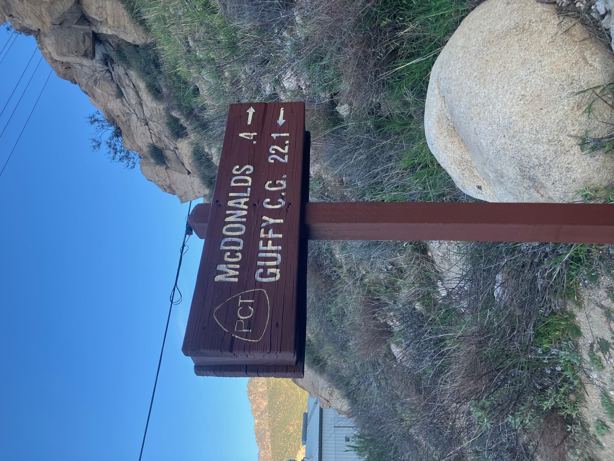
The sign to the famed McDonalds that marks the end of this section. Don’t let anyone tell you ice cream isn’t a breakfast food.
The next 40 miles of the trail are closed because of a forest fire last year, so I’m skipping up to Mount Baden Powell tomorrow to continue north.
Section 4: Wrightwood to Agua Dulce
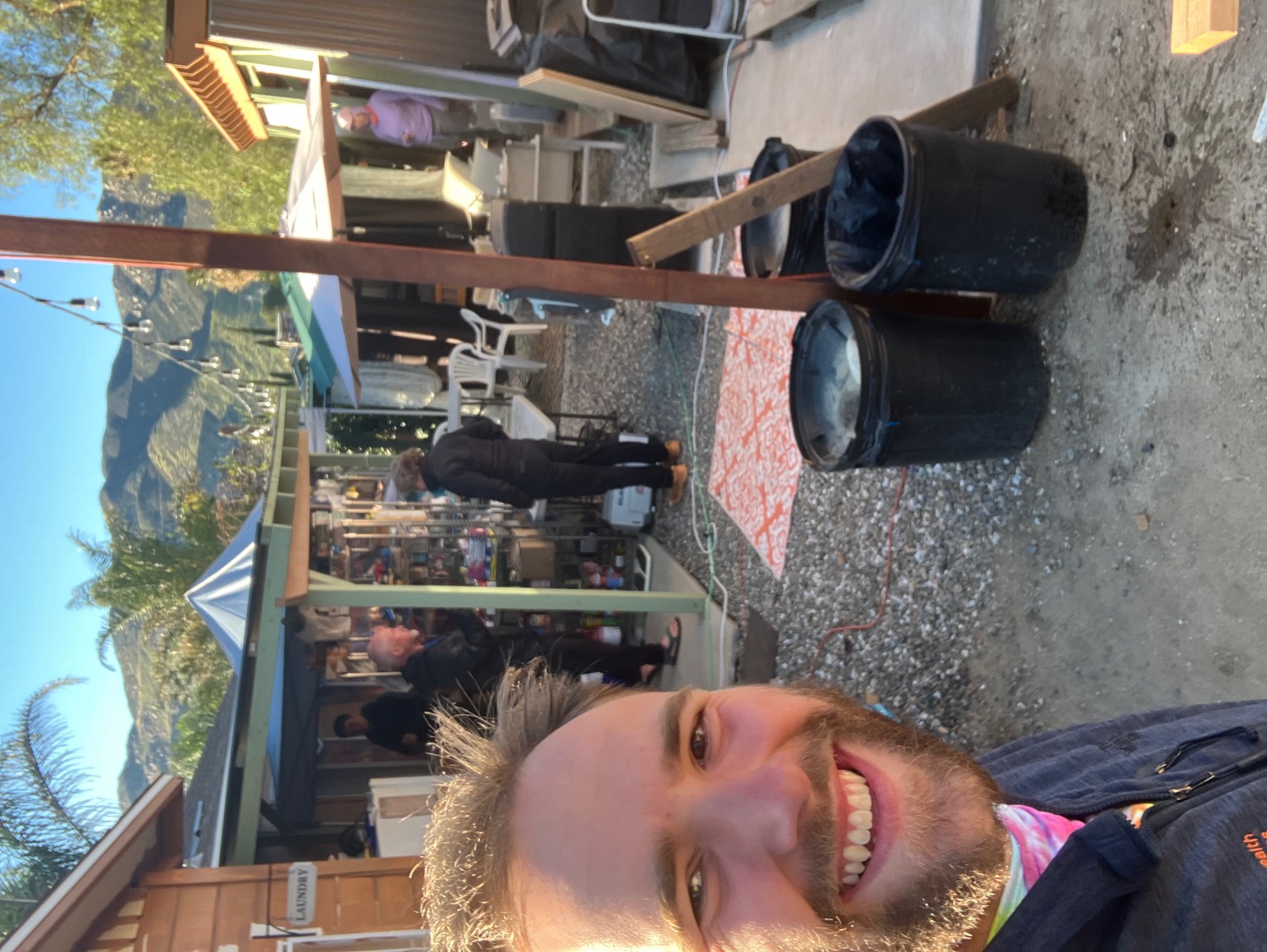
I’m writing this from Serenity’s Oasis (a well-stocked backyard along the trail) in Agua Dulce, near mile 450 of the PCT. The last few days have had more crazy weather, ranging from high winds and thick fog to clear skies. Here are a few highlights.
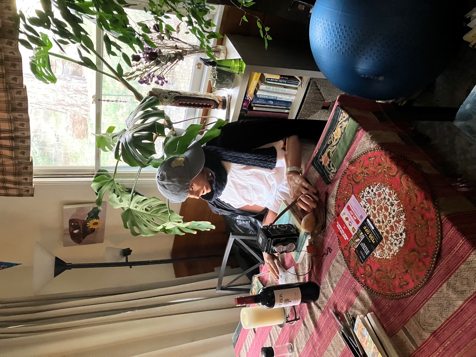
Anita, the trail angel I was staying with in Wrightwood, teaches nursing and adopted this practice dummy that the university was throwing away. It terrifies me.
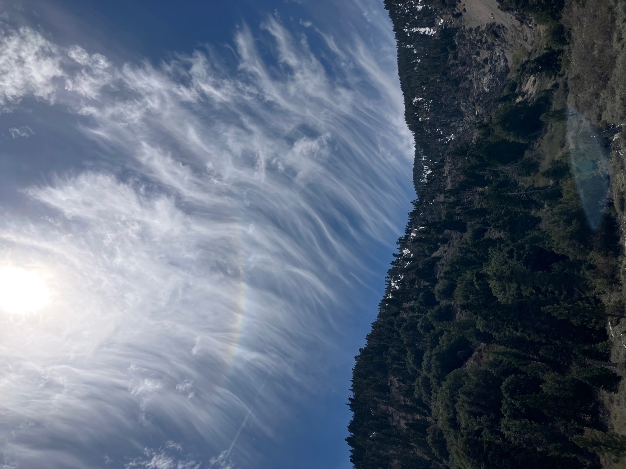
Some cool clouds coming up the north face of Mt. Baden-Powell.
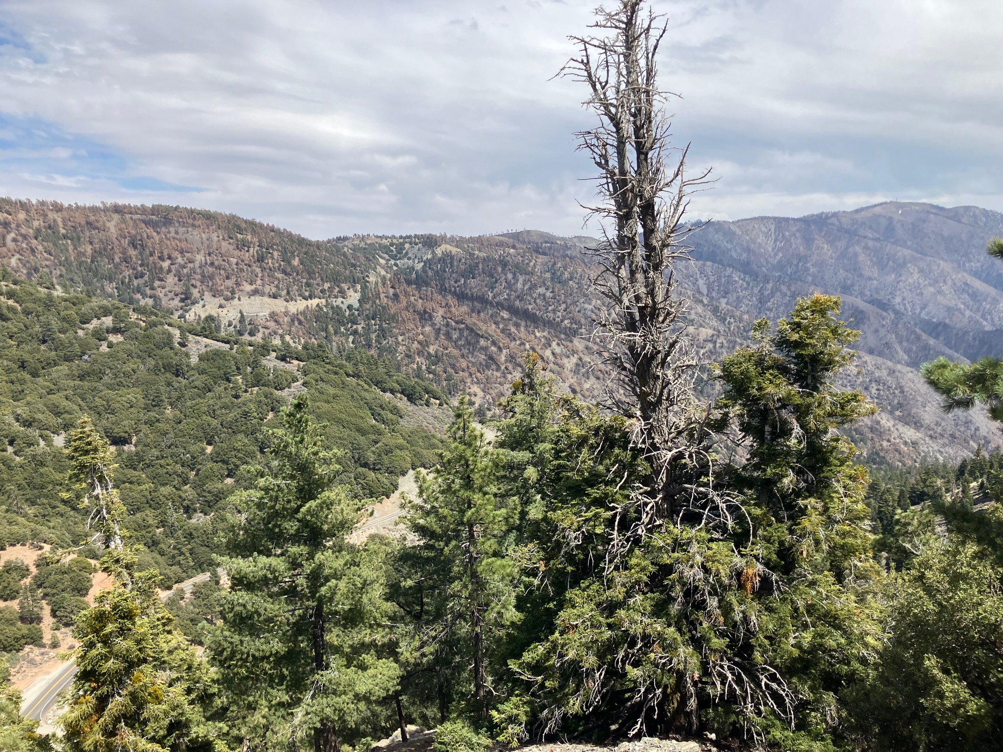
Looking out from Baden-Powell at the burn zone of the 2024 Bridge Fire. The PCT was closed in this section, so the trail angels of wrightwood organized a shuttle to get around it.
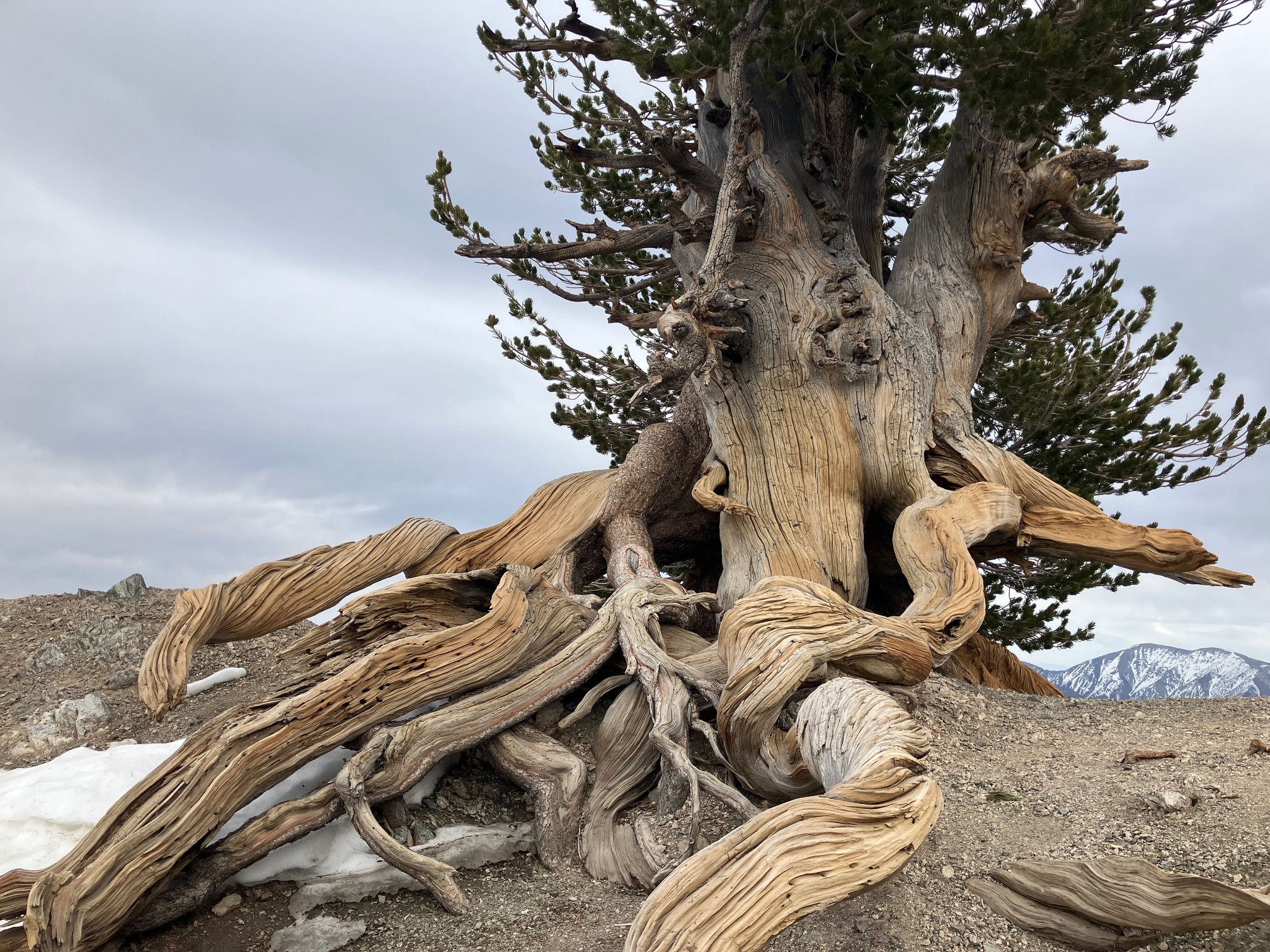
Really cool tree near the summit of Baden-Powell.
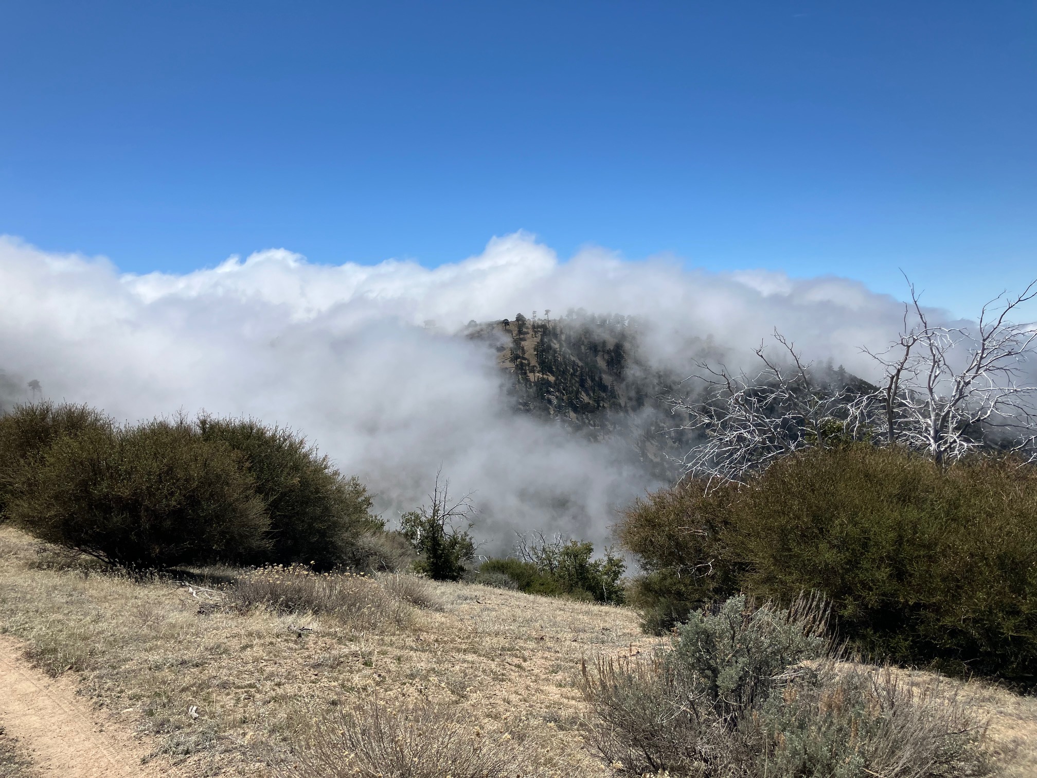
Fog rolling in from the sea in the early afternoon. I didn’t realize it at the time, but I’d be living in this fog for the next two days.
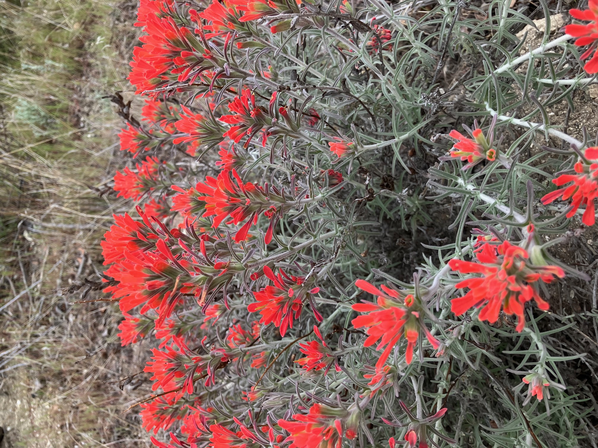
Indian Paintbrush along the trail. The moisture from the fog and recent rain has made the desert bloom.
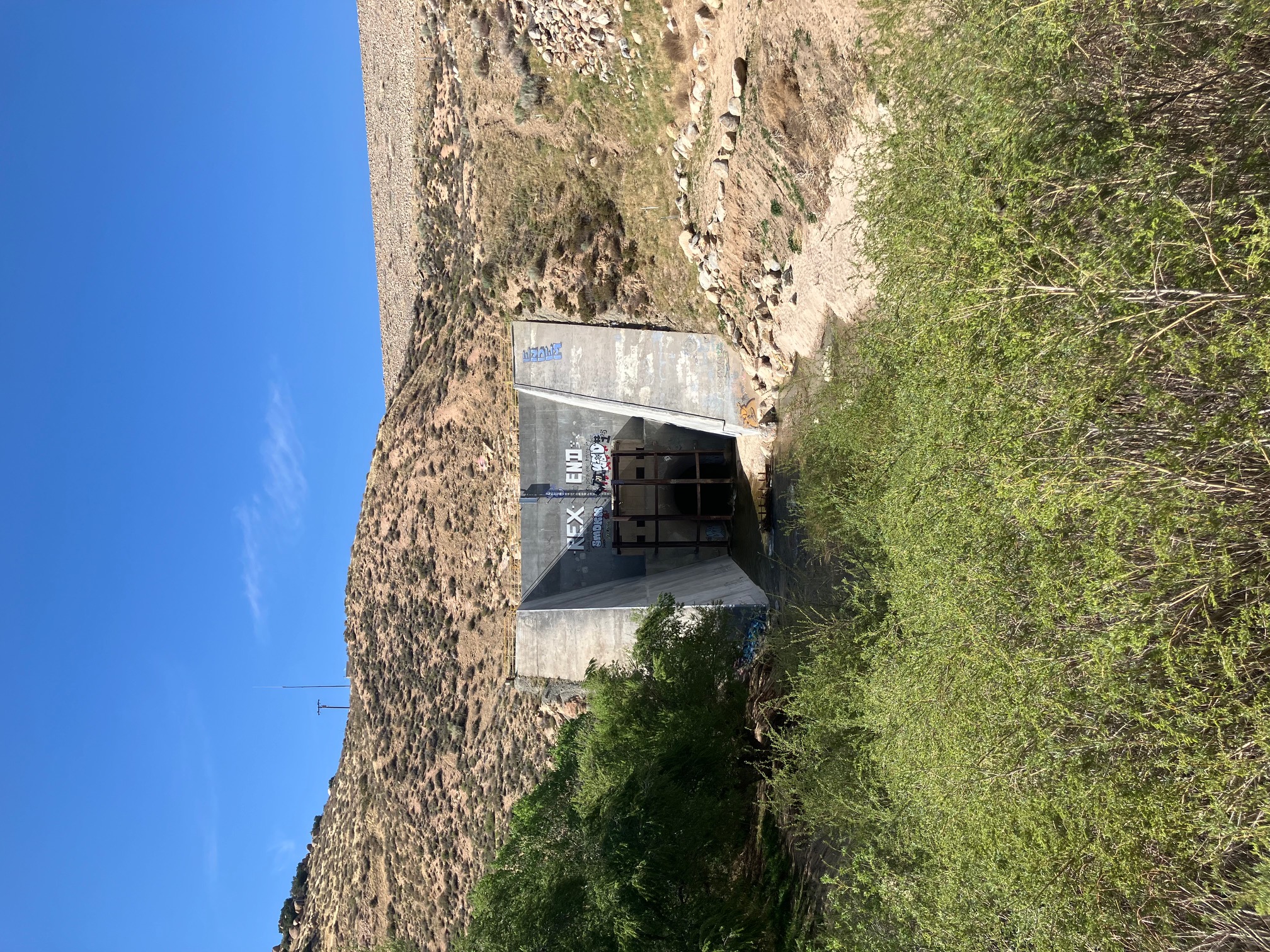
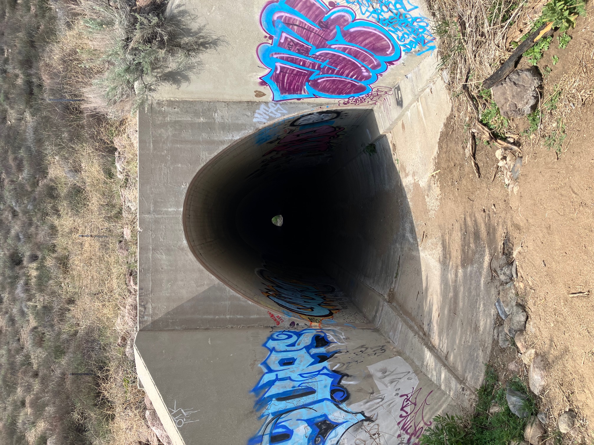
The highway 14 underpass. This tunnel has really cool acoustics—I hung out for a while making spooky noises.
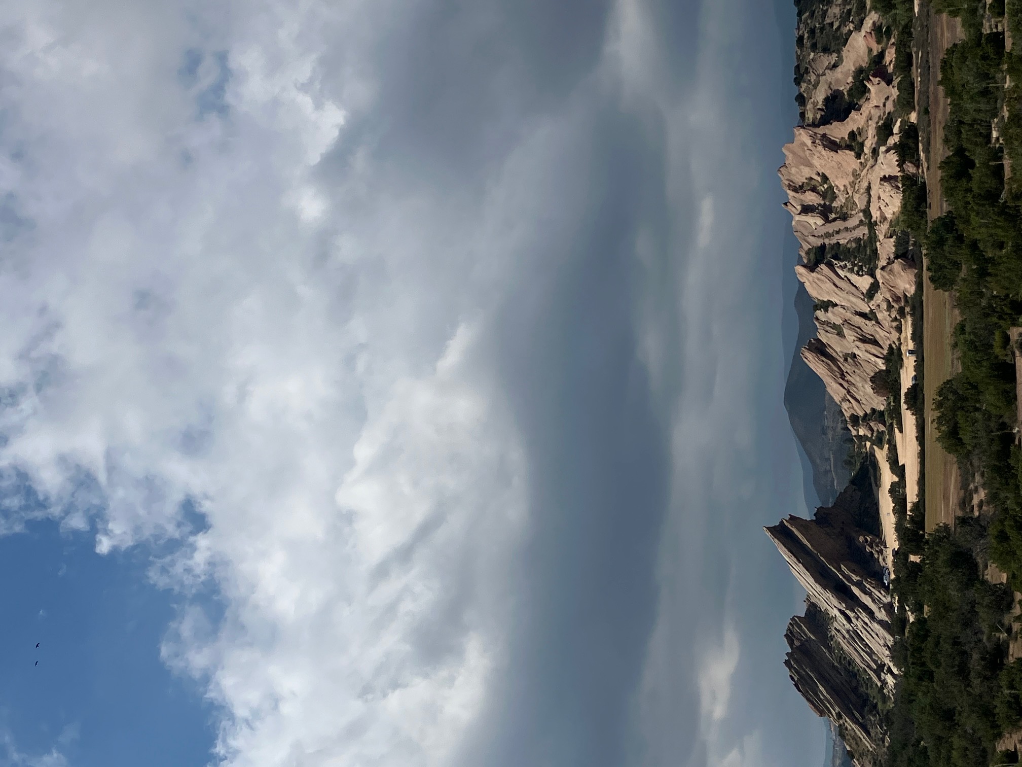
The Vasquez Rocks near Agua Dulce. These are very cool and have been the set of a shocking number of movies and shows, partly because they’re so close to LA, including may Star Trek episodes and Blazing Saddles.
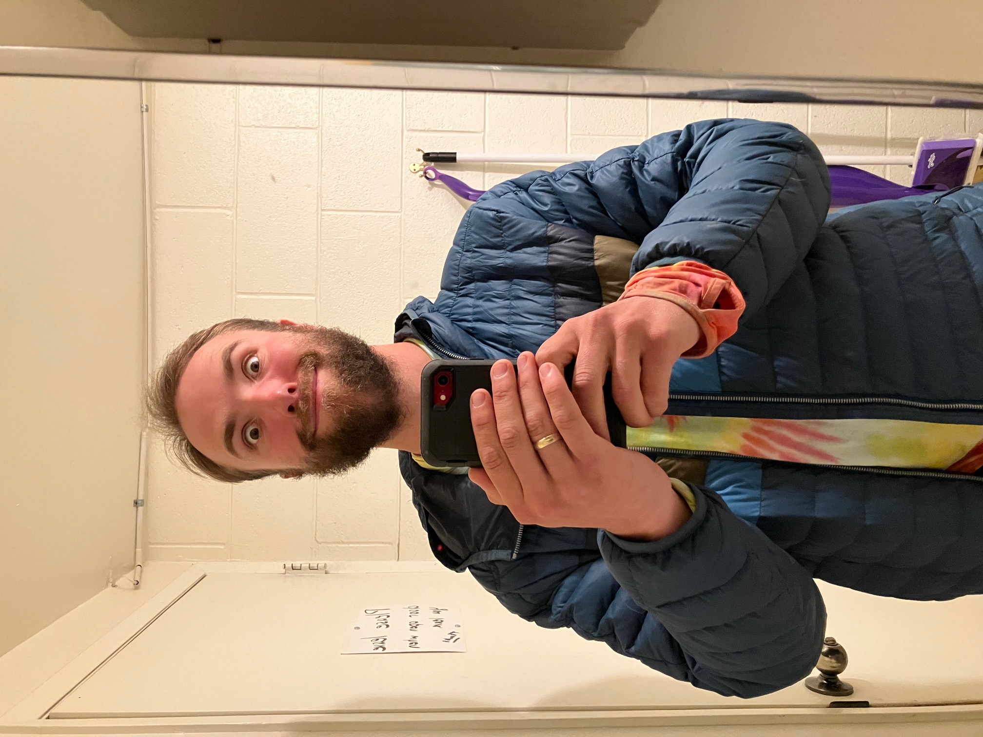
One month in, the beard is getting a bit puffy 😂.
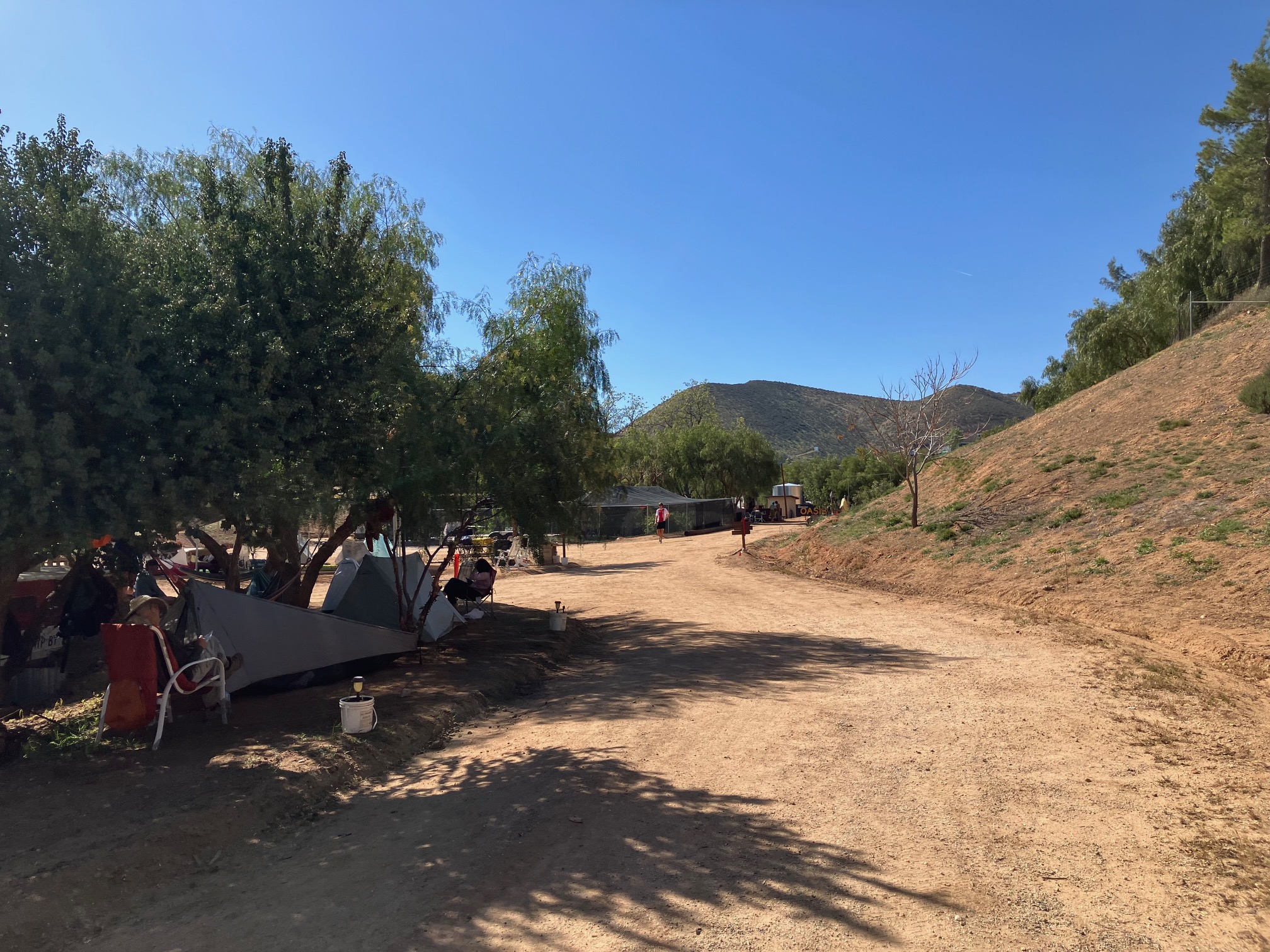
The Serenity’s Oasis in Agua Dulce, which is also a weed farm, is a popular place to take a day off. They’ve got soap! And nice flat ground!
Section 5: Agua Dulce to Kennedy Meadows South
I’m writing this from Grumpy Bear’s Retreat in Kennedy Meadows, at mile 703 of the PCT! This is a significant milestone because it marks the end of the southern California desert section and the start of the Sierra Nevada. The next section will take me up into the snowy mountains, over Forester Pass (the highest point on the trail) and possibly with a side trip to summit Mt. Whitney (the highest point in the contiguous US). This last section really felt like a grand finale of the desert. I had a taste of just about every kind of weather and landscape I’ve had since I started, and at 136 miles it was my longest stretch between resupply so far. I’ve been more than ever blown away by how this trail runs on generosity—of hikers and of the locals who support the trail.
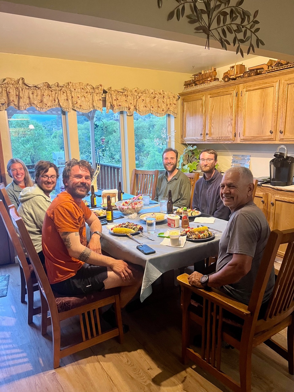
A feast in Tahachapie. Abel (at the head of the table) hosted us in his beautiful home and made some delicious food. He also made the truck and train on top of the cabinet!
Right after leaving Tehachapi we had a blizzard/hailstorm.
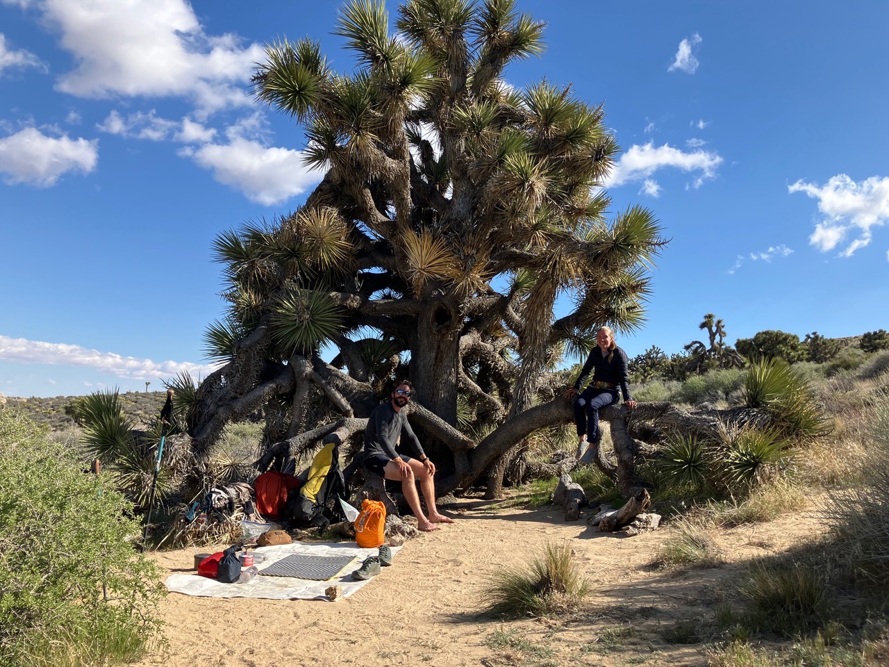
Cowboy camping under a Joshua Tree.
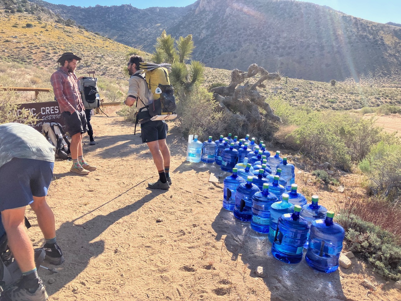
One of the three large water caches along this section. These are maintained by local self-organized volunteers. Without them I would’ve had to carry water for 32 miles of hot desert, which would have about doubled my pack weight.
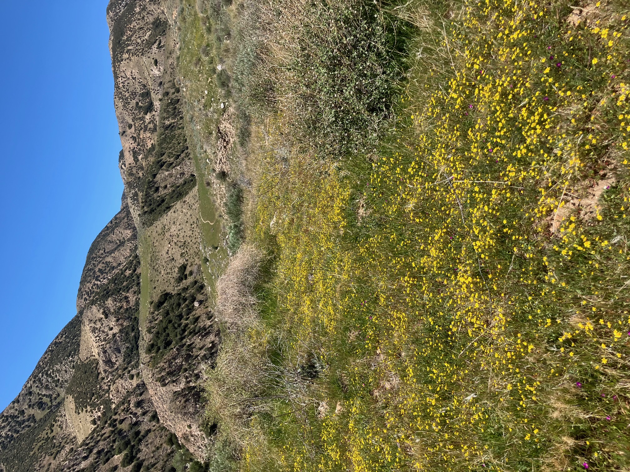
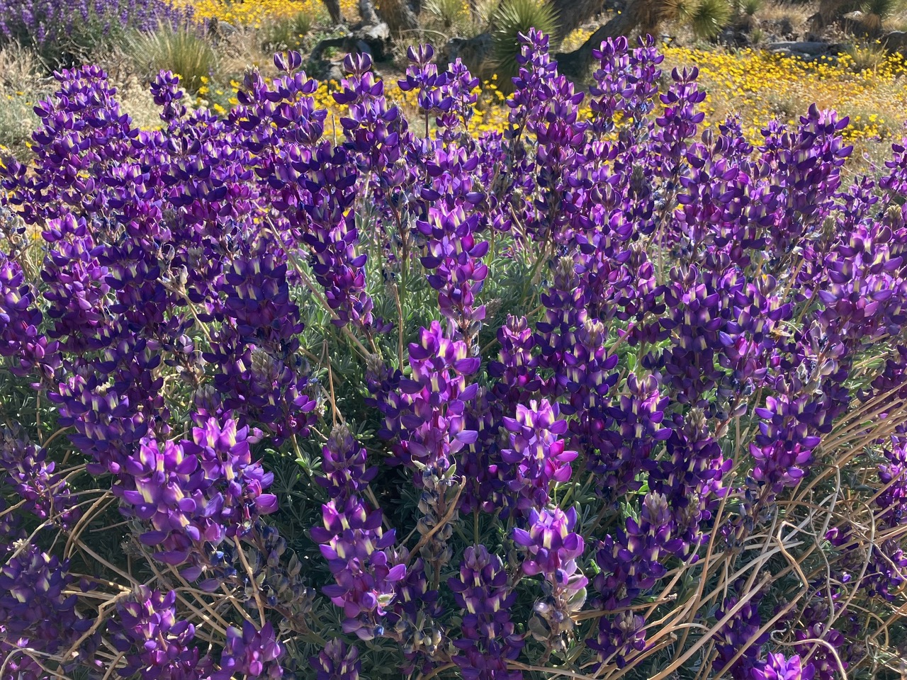
The wildflowers in this section were unbelievable. The shaded faces of the hills were completely covered in purple and yellow.
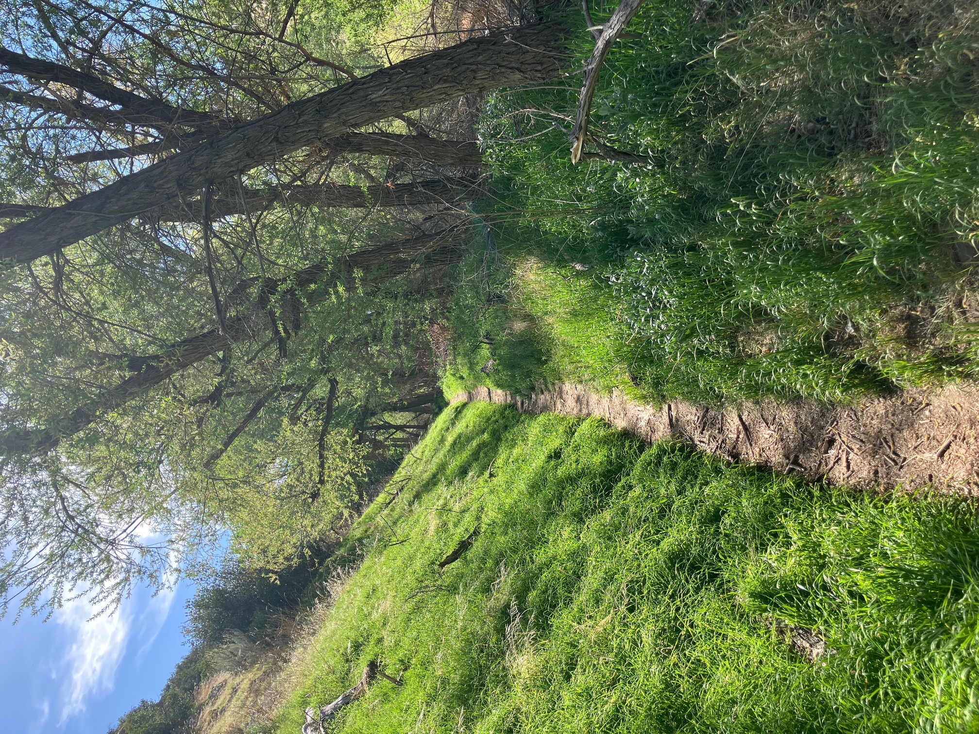
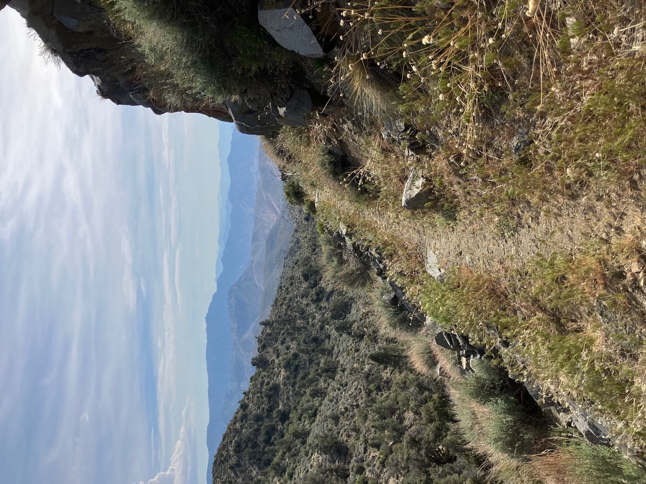
A representative snippet of the trail from this section. Some impressive construction went into building this.
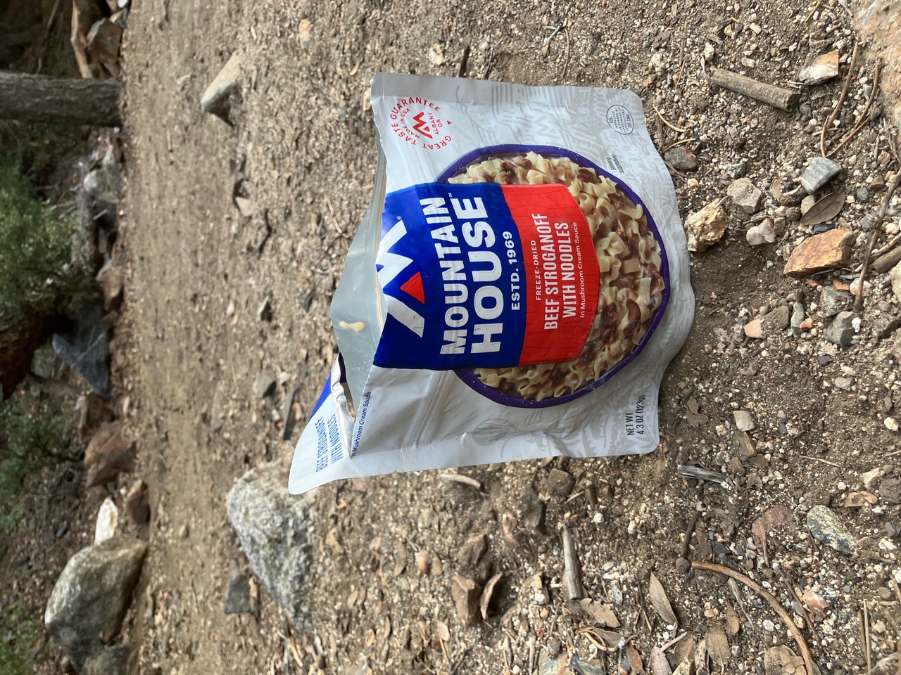
On day two of this section I passed someone going the other way who gave me two extra meals, including my favorite flavor of mountain house. The extra food let me skip one of the intermediate towns and stick with the same group for the whole section.
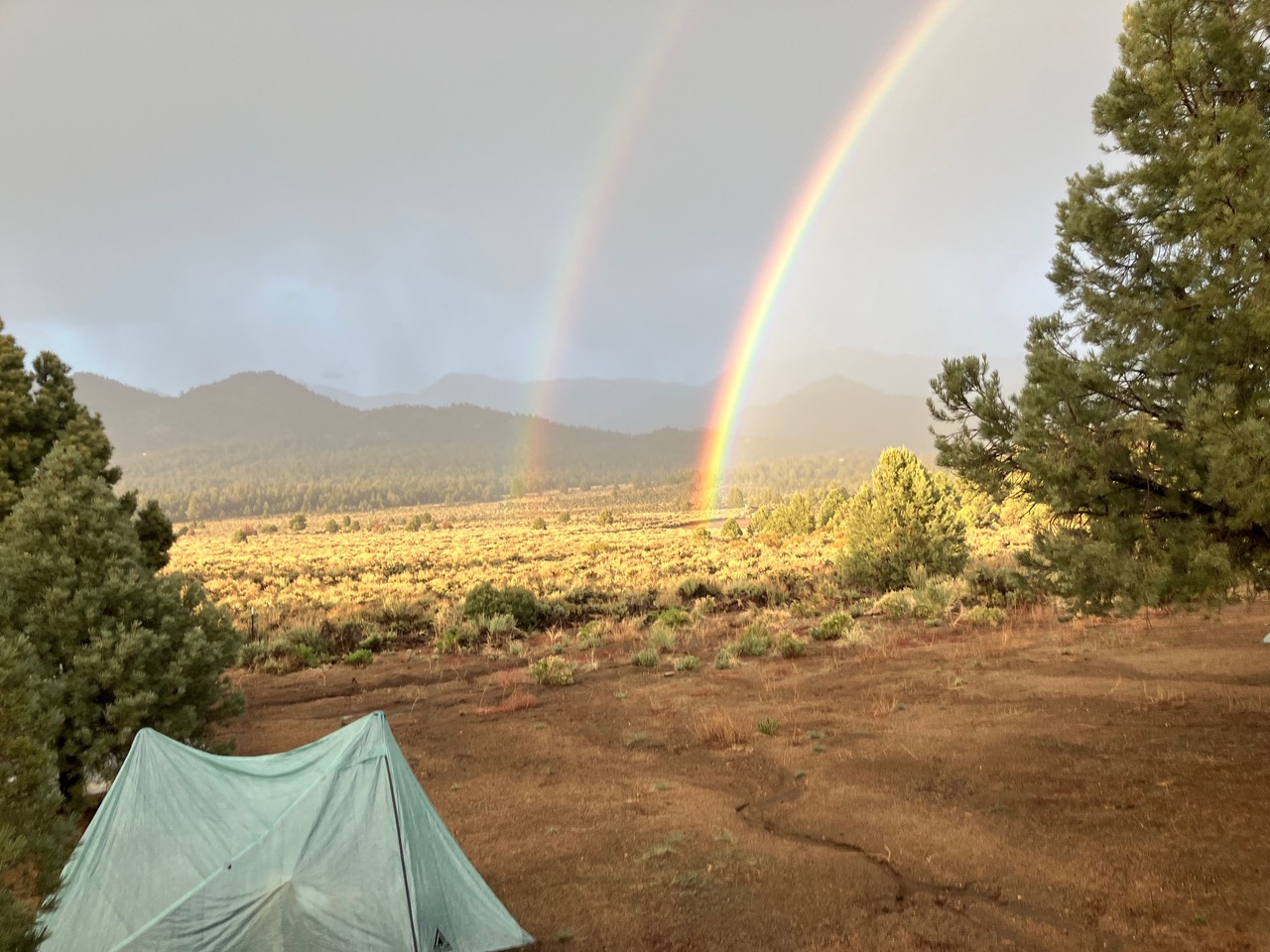
Right after I got to the resupply store we were hit by a huge downpour and hailstorm. At sunset it gave us this awesome double rainbow.
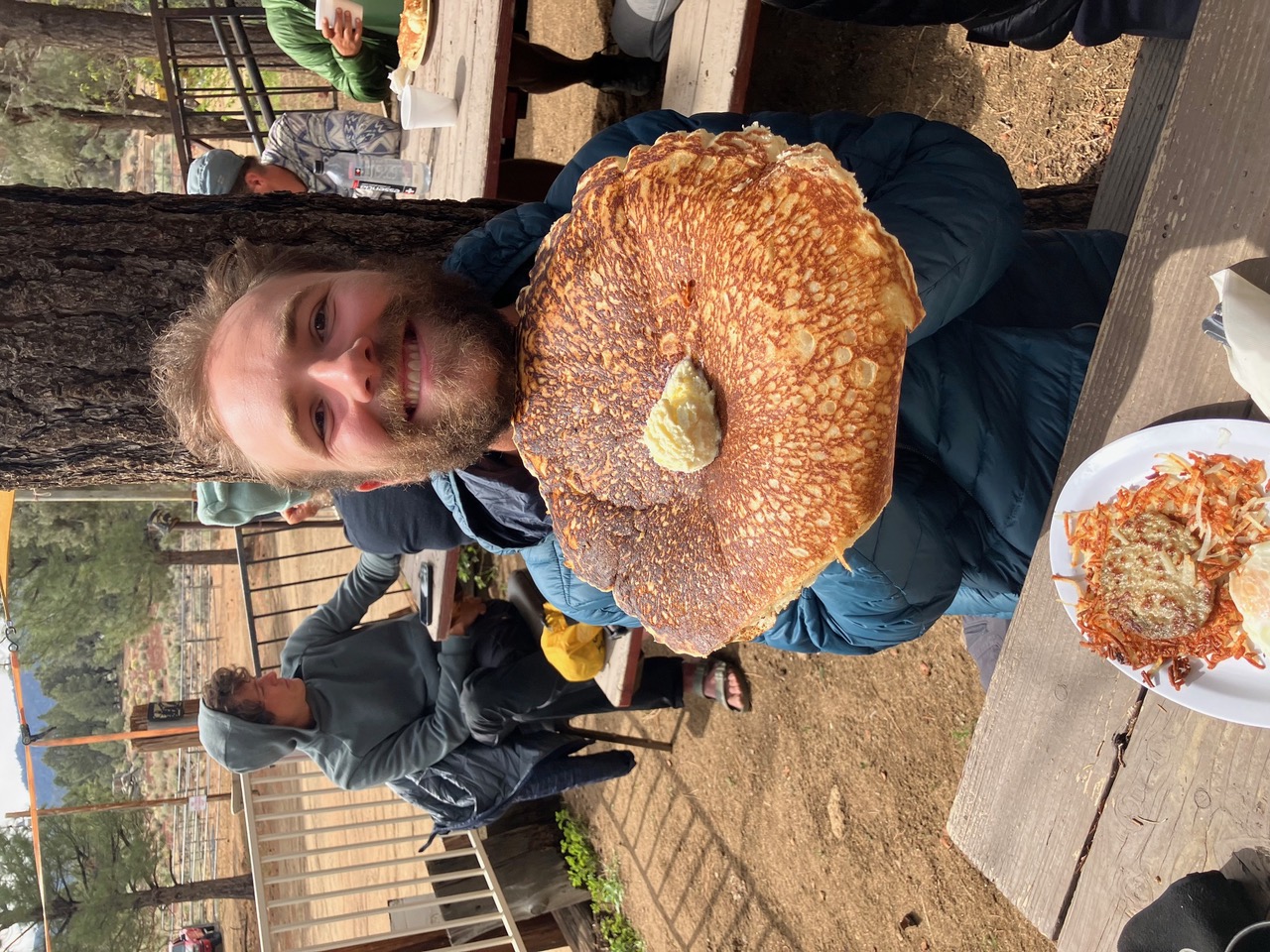
Yours truly with one of the famously enormous pancakes at Grumpy Bear’s. The pancakes are all-you-can-eat, but almost no one finishes even one.
 The next section will be snow, snow, snow! I’m picking up more gear and clothing here, so I should be warm.
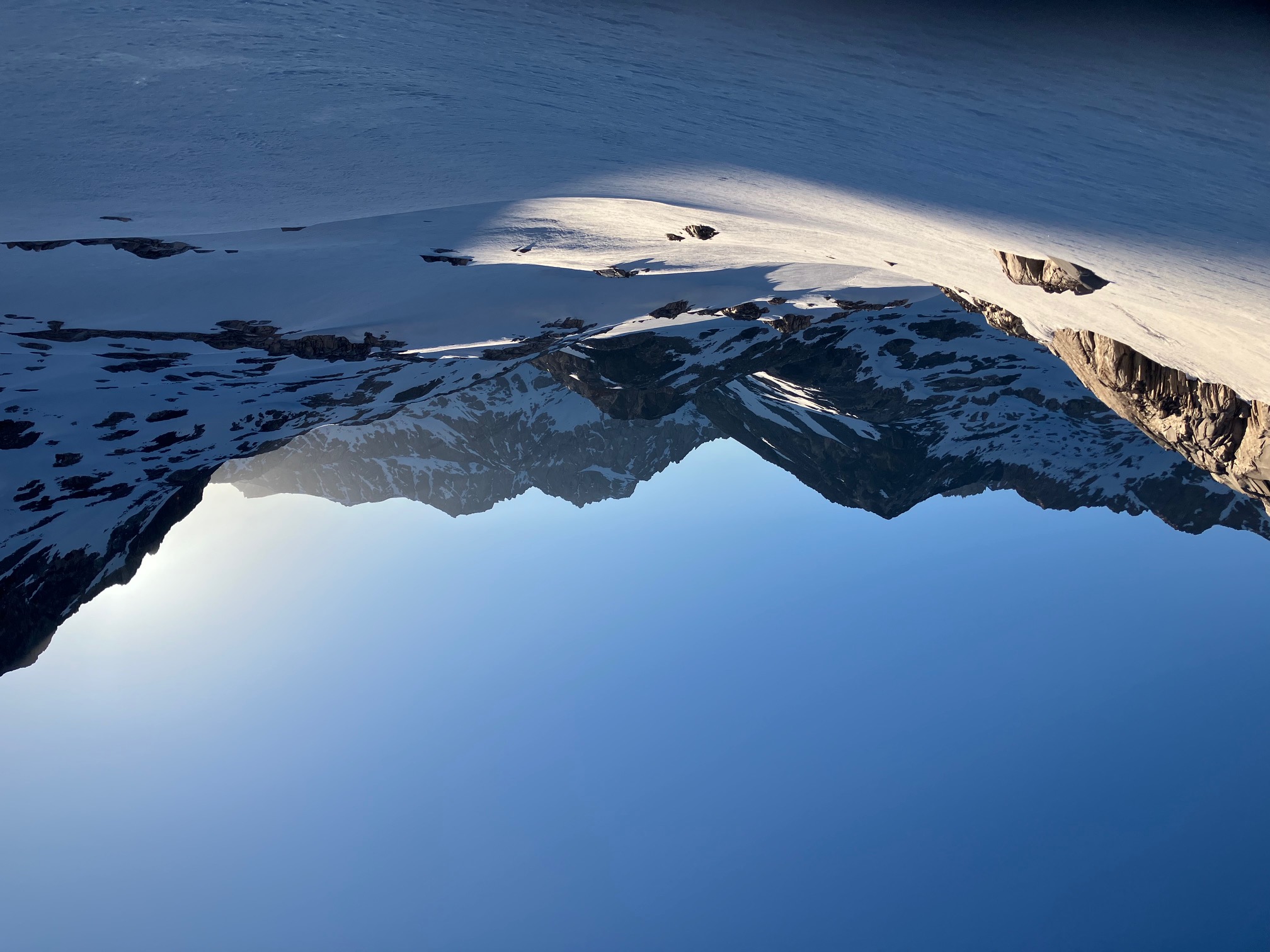
Section 6: Kennedy Meadows to Bishop
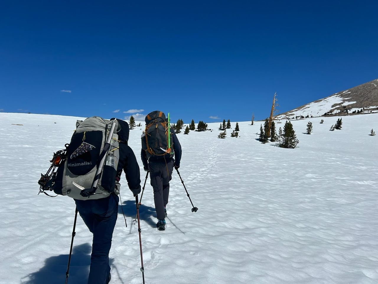
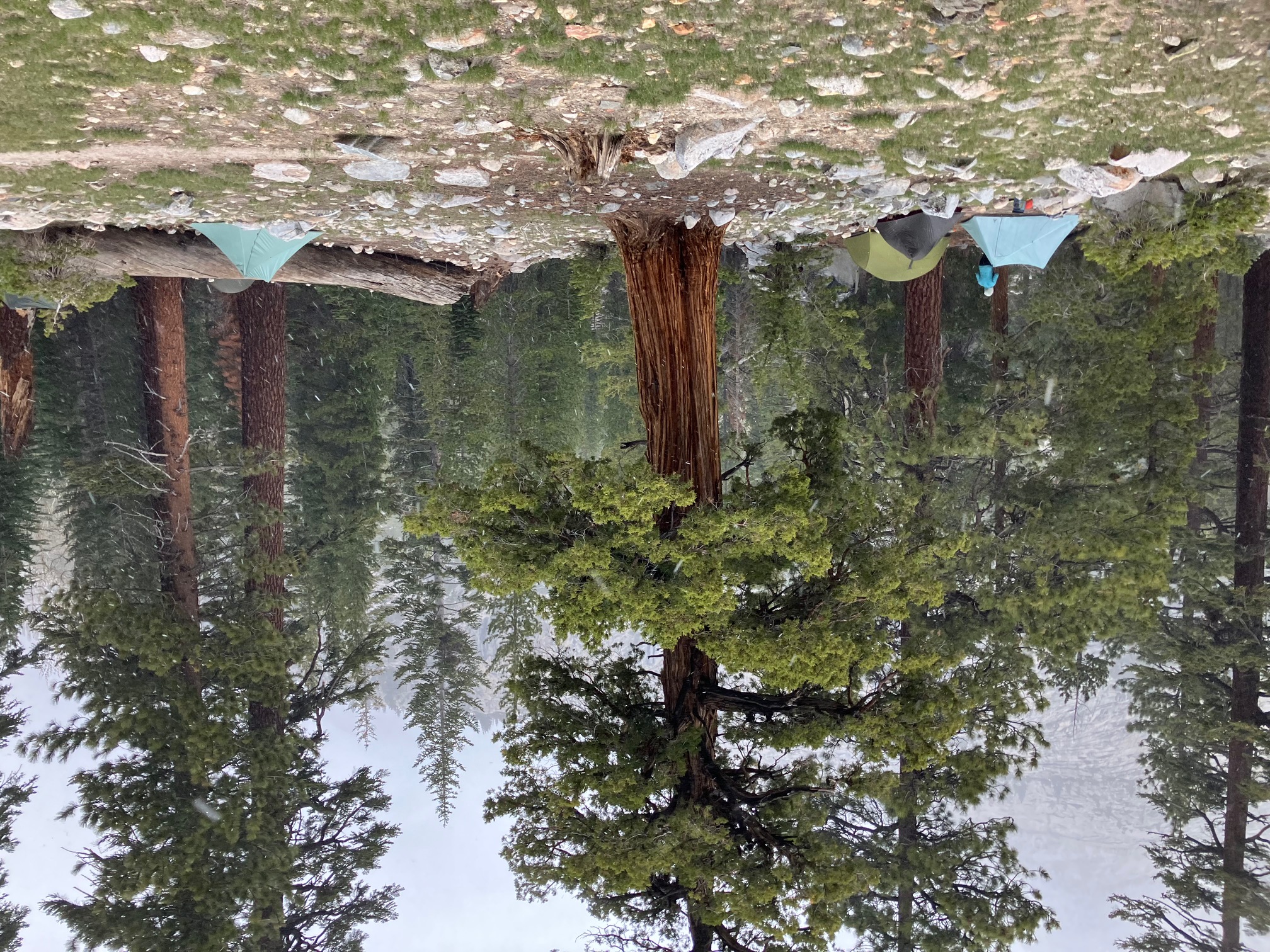
I’ve finished the first leg of the sierra section of the PCT: 100 miles from Kennedy Meadows to Kearsarge pass. This section has been by far the most challenging so far—snow hiding almost all the trail, tricky river crossings, steep ascents, and big temperature changes. It’s also been breathtakingly beautiful and very rewarding, and I’ve had an awesome team to tackle it with.
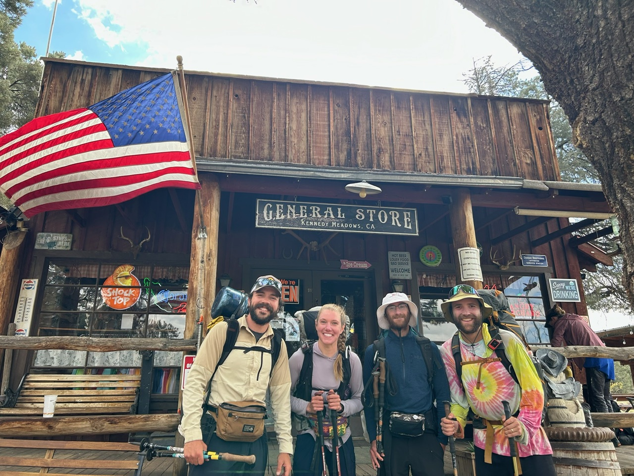
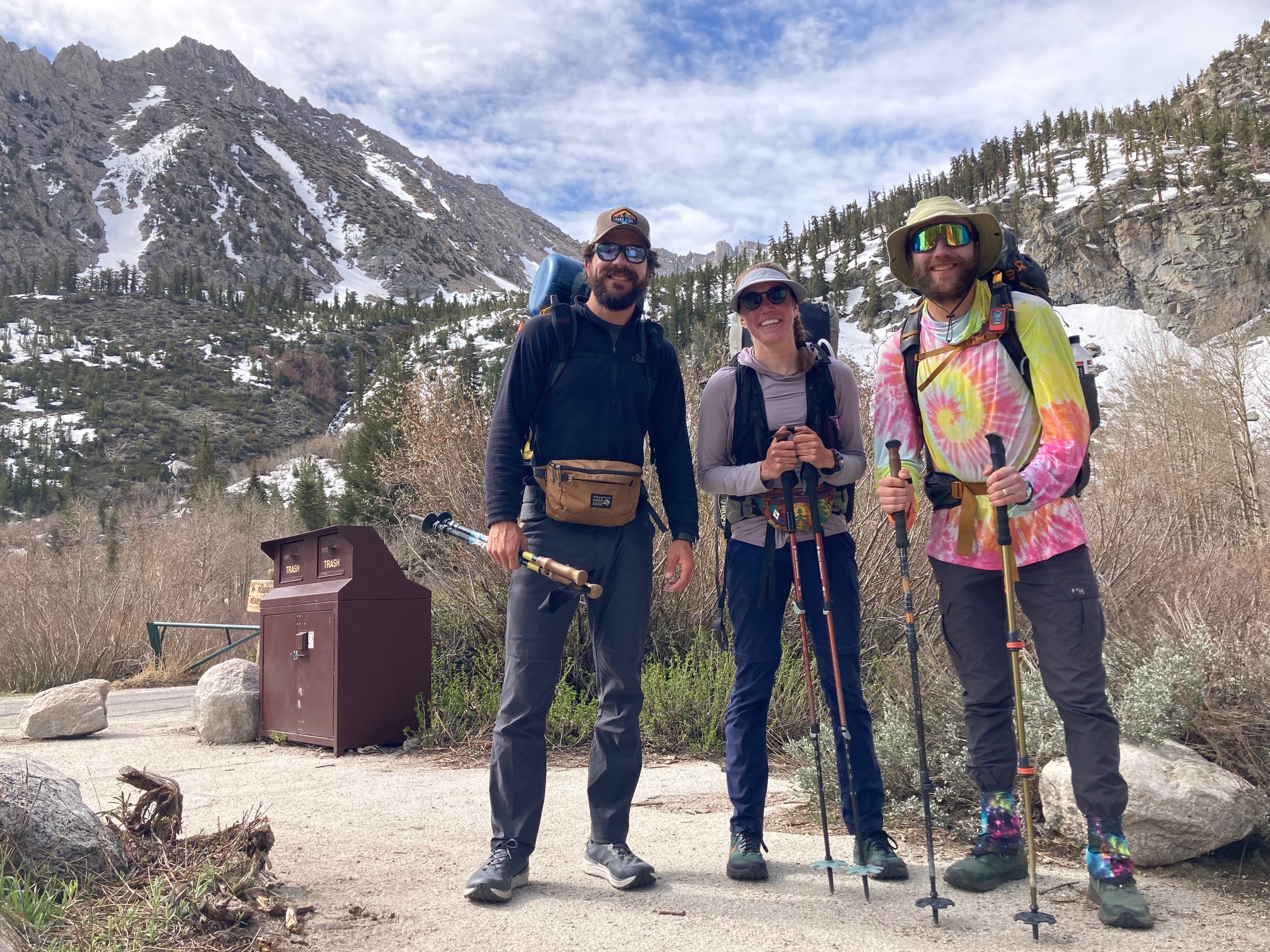
The gang leaving the Kennedy Meadows general store to head up into the mountains. From left: Kiss, Zigzag, Narly, and myself (PopTart)
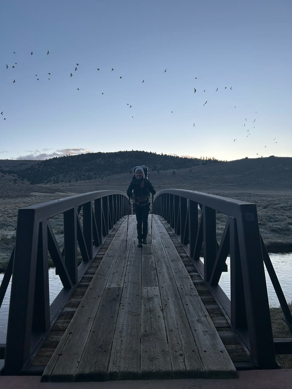
Crossing the bridge over the Kern River at dawn on our first snowy day. The birds are a colony of swallows who live under the bridge and come out a dawn and dusk.
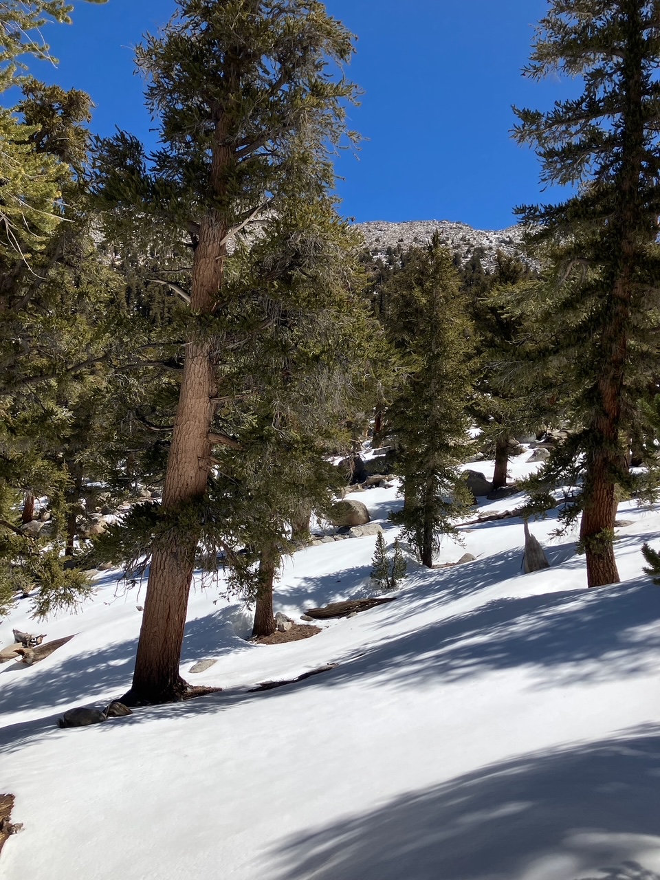
Our first snowy forest. The trail vanished almost immediately, and the sun turned the snow into knee-deep slush in some places.
Looking back south over the desert behind.
Sometimes the trees give way to big open snowfields that become meadows later in the summer.
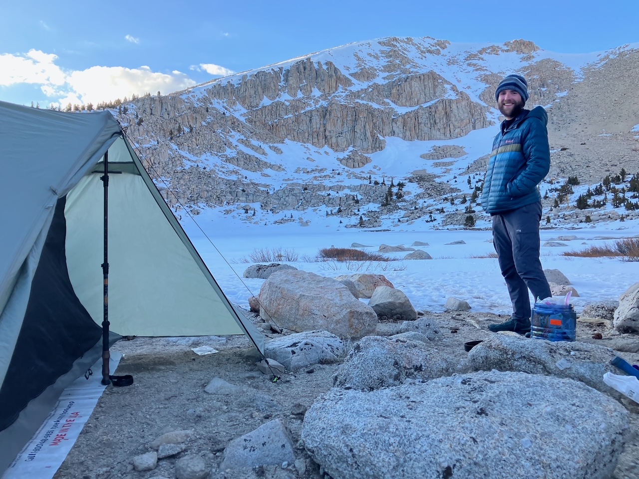
Camping by chicken spring lake at 11,000 feet.
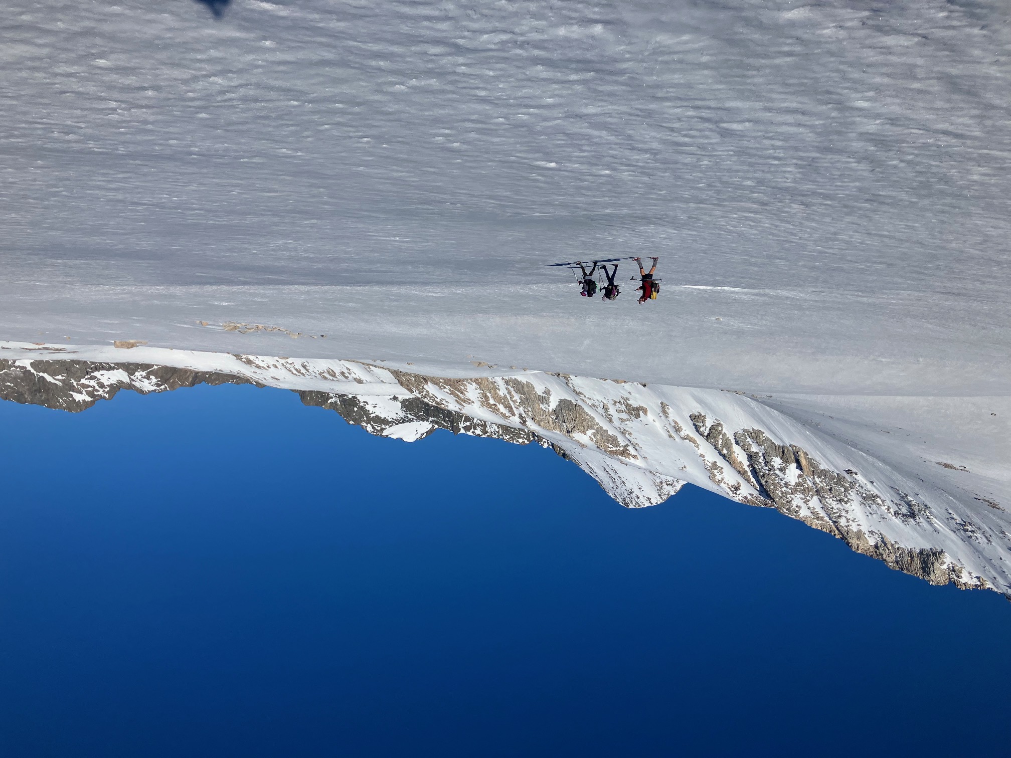
To avoid the soft snow, we started hiking at around 3 am each day, wayfinding by starlight.

We got about halfway up Mt. Whitney before deciding to turn around to avoid softening snow.
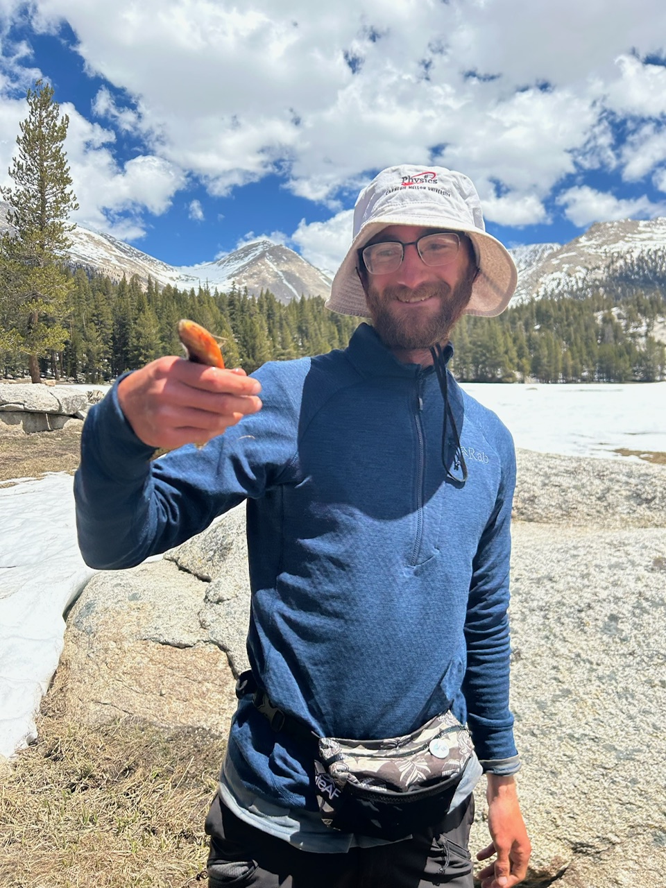
Narly caught some fish! They were delicious.
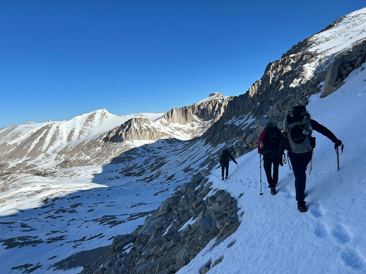
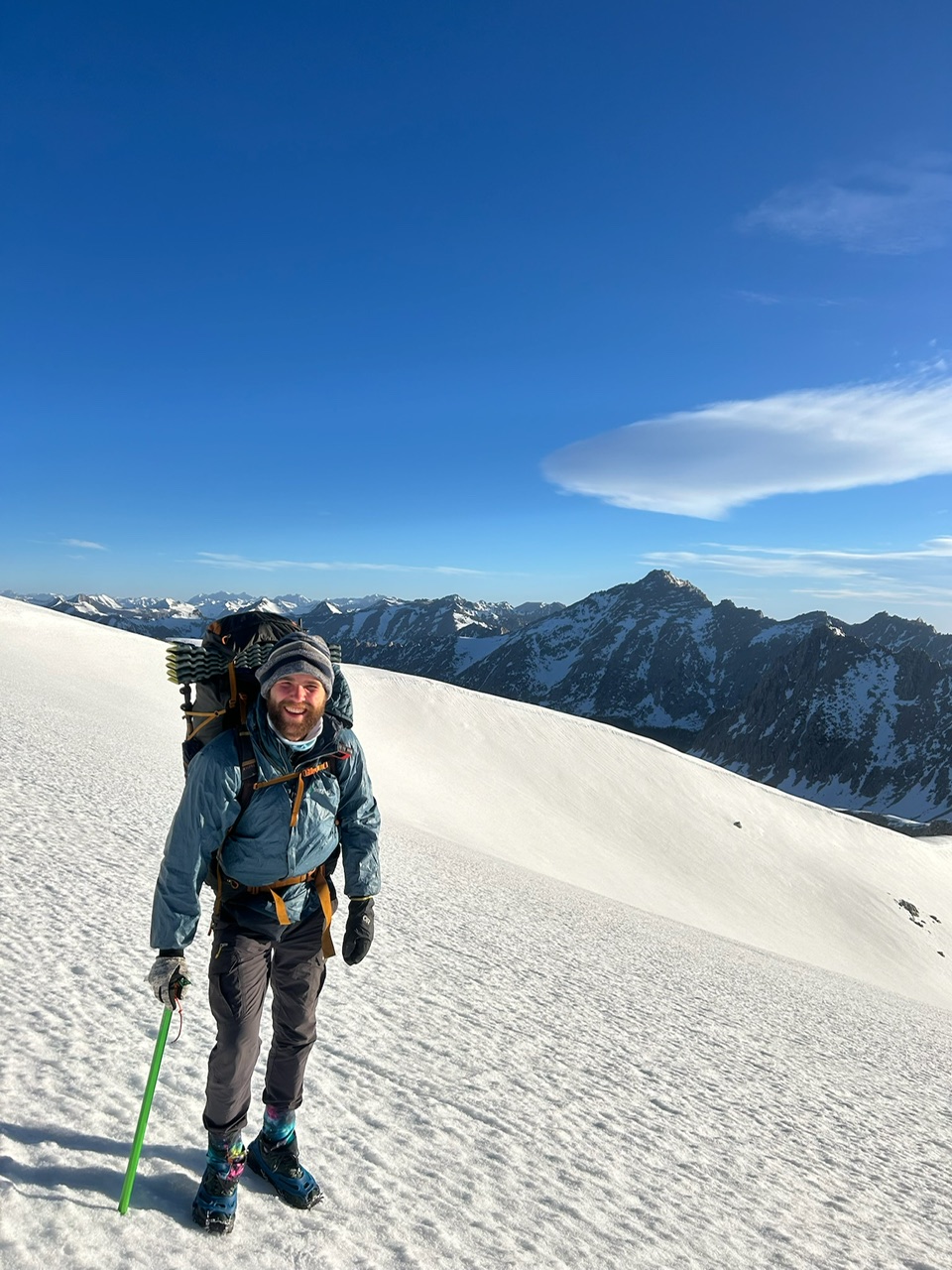
Yours truly at the top of forester pass, the highest point on the PCT.
The north face of Forester pass is an enormous snowfield at 12,000 feet. It was a crazy place to be walking.
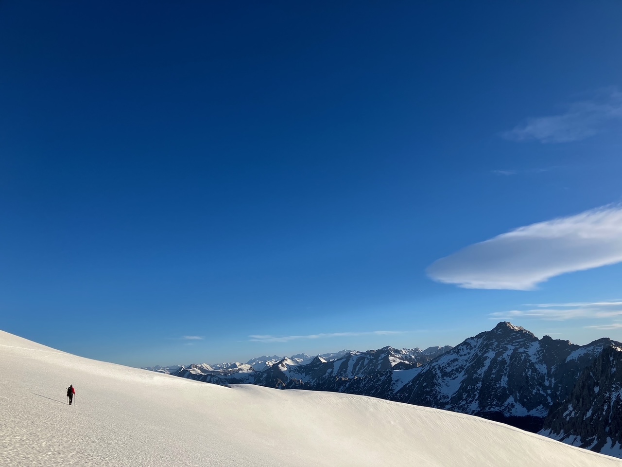
A snowy ridge on the way down from forester pass.
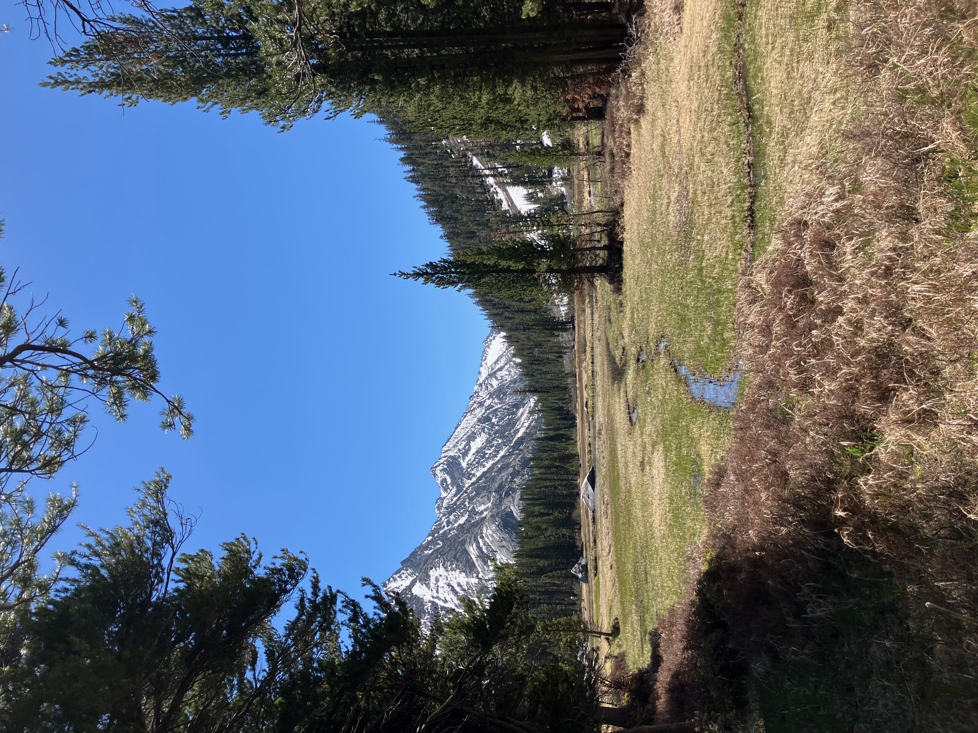
Section 7: Bishop to Mammoth Lakes
This last section has had more snow, more passes, and more lovely streams. The highlights for me were definitely Muir Pass, which sits between two spectacular snowy valleys dotted with frozen lakes, and our lovely campsite by Grouse Meadows. Enjoy!
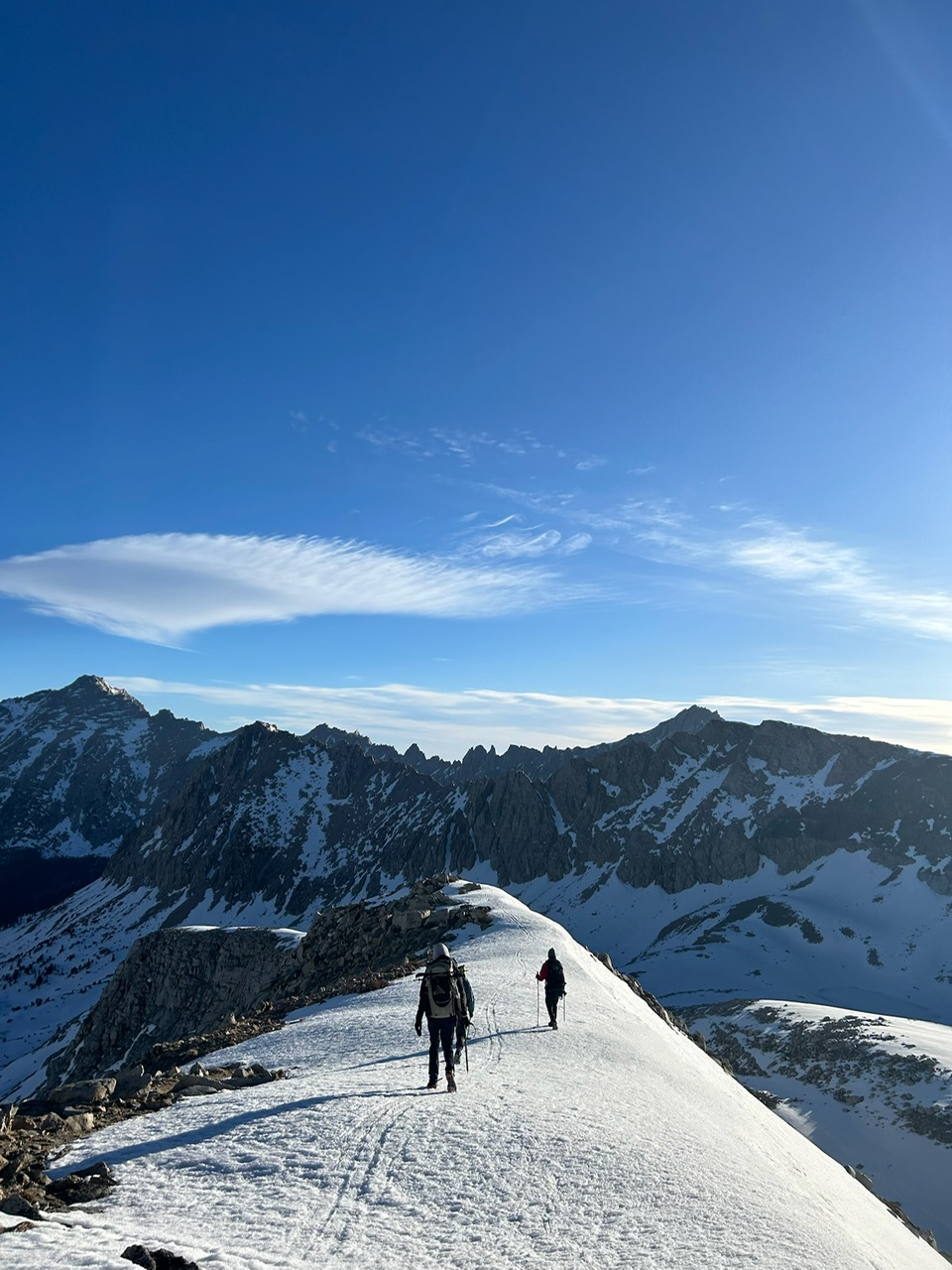
The gang getting ready to head back into the mountains over Kearsarge pass.
A magnificent tree (some sort of cedar?) in our campsite the night after Glen Pass.
Looking south across Grouse Meadow. We liked this spot so much we stayed here for almost a whole day. I spent four hours sitting on a rock watching the golden trout and the caustics.
Sunrise over the approach to Muir Pass.
Walking down from Muir Pass through an enormous snow field.
The start of Evolution Creek in the valley above Muir Pass.

A slow curve of the San Joaquin river, a few miles downstream from the last photo.
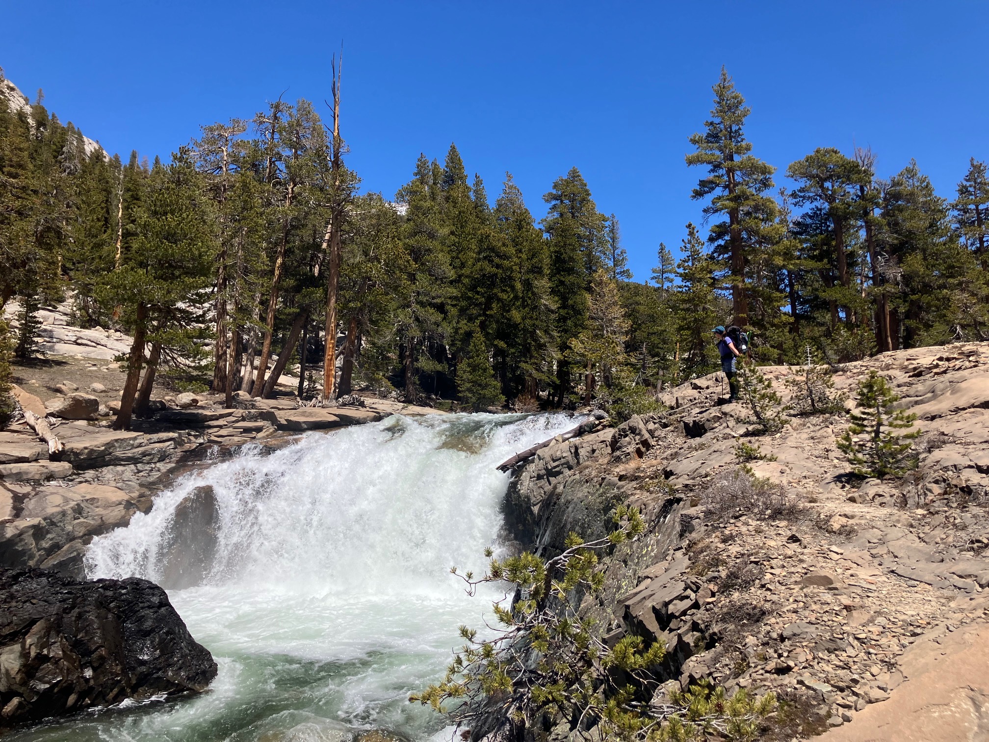
One of the spectacular waterfalls in the San Joaquin watershed.
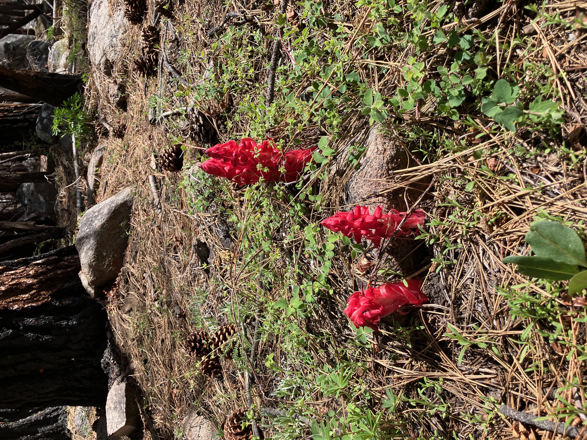
Snow Flowers growing along the north shore of Lake Edison. These have some wacky biology—they eat fungus around tree roots instead of photosynthesizing.
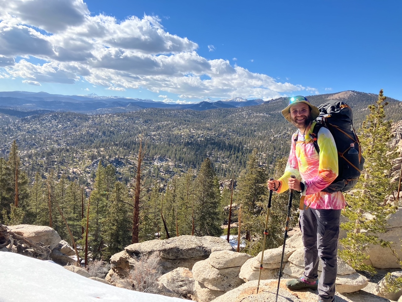
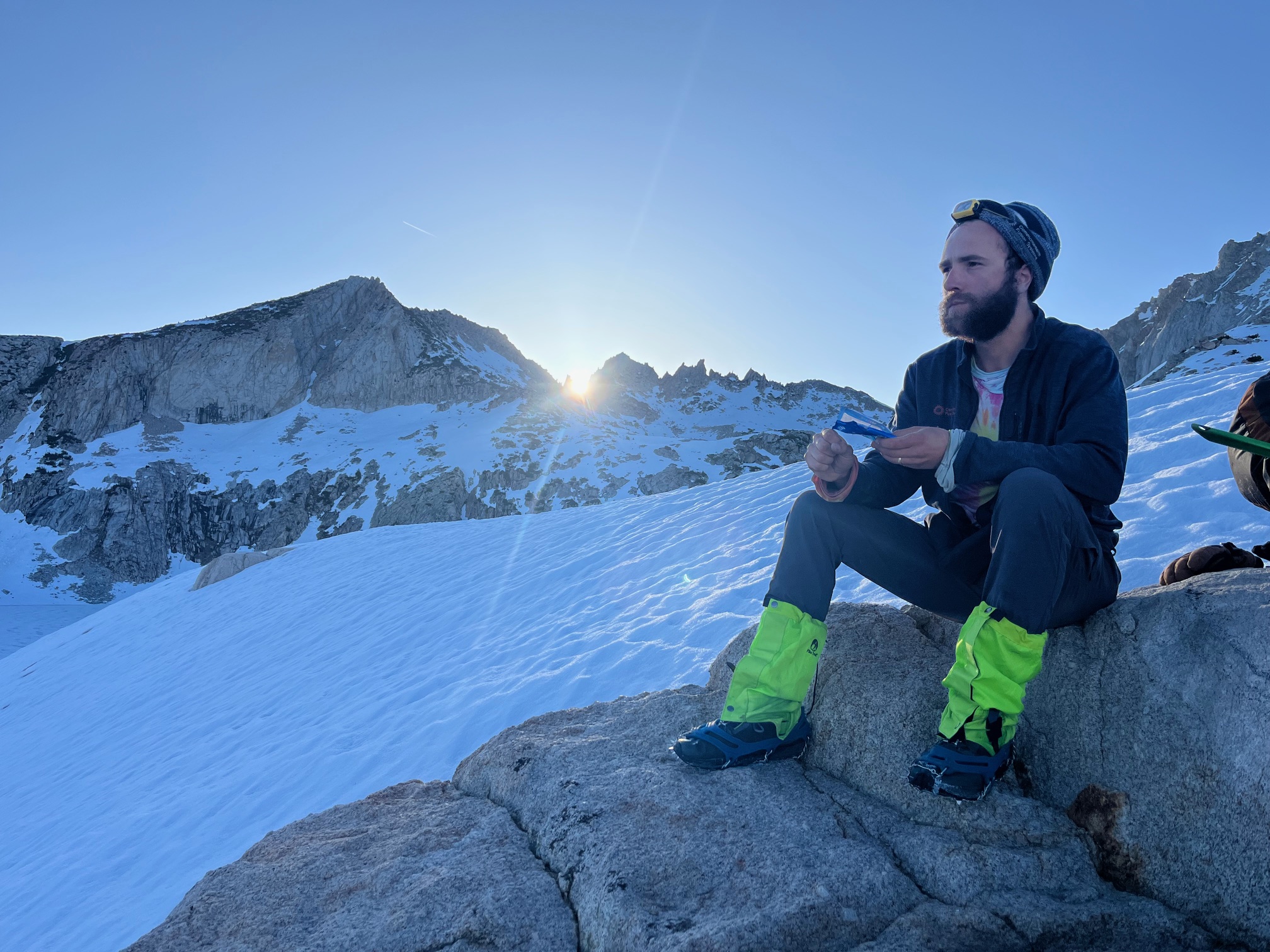
Eating a PopTart on the top of Silver pass, with some stylish snow gaiters I picked up in a hiker box.
The next section should be slightly less snowy, and includes a side trip to Yosemite Valley!
Section 8: Mammoth Lakes to Kennedy Meadows North
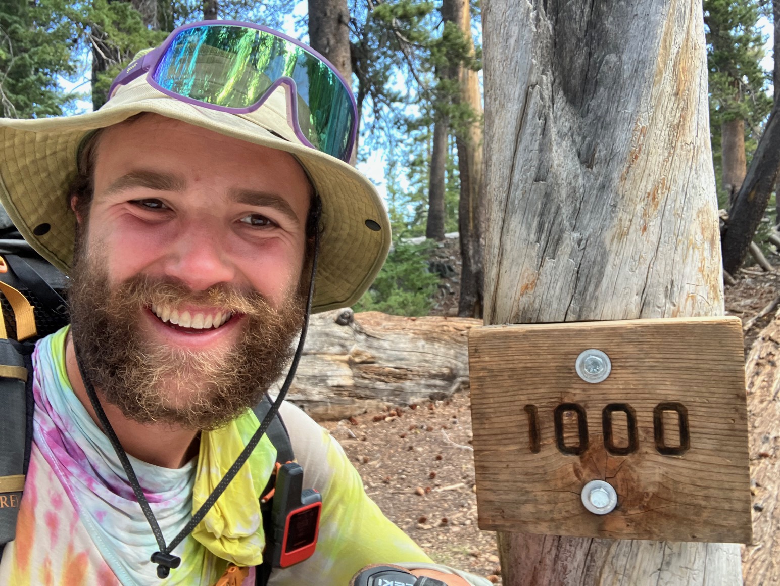
Yesterday I got to mile 1000 of the PCT! This last section has been an absolute blast and included a side trip to Yosemite Valley. The snow has been melting rapidly, which gave us more clear trail but also new challenges.
Our first day out of Mammoth included a detour to the lovely Red’s Meadow hot spring.
In many places the snow has been gone long enough for the plants to wake up, making this section much greener than the last. 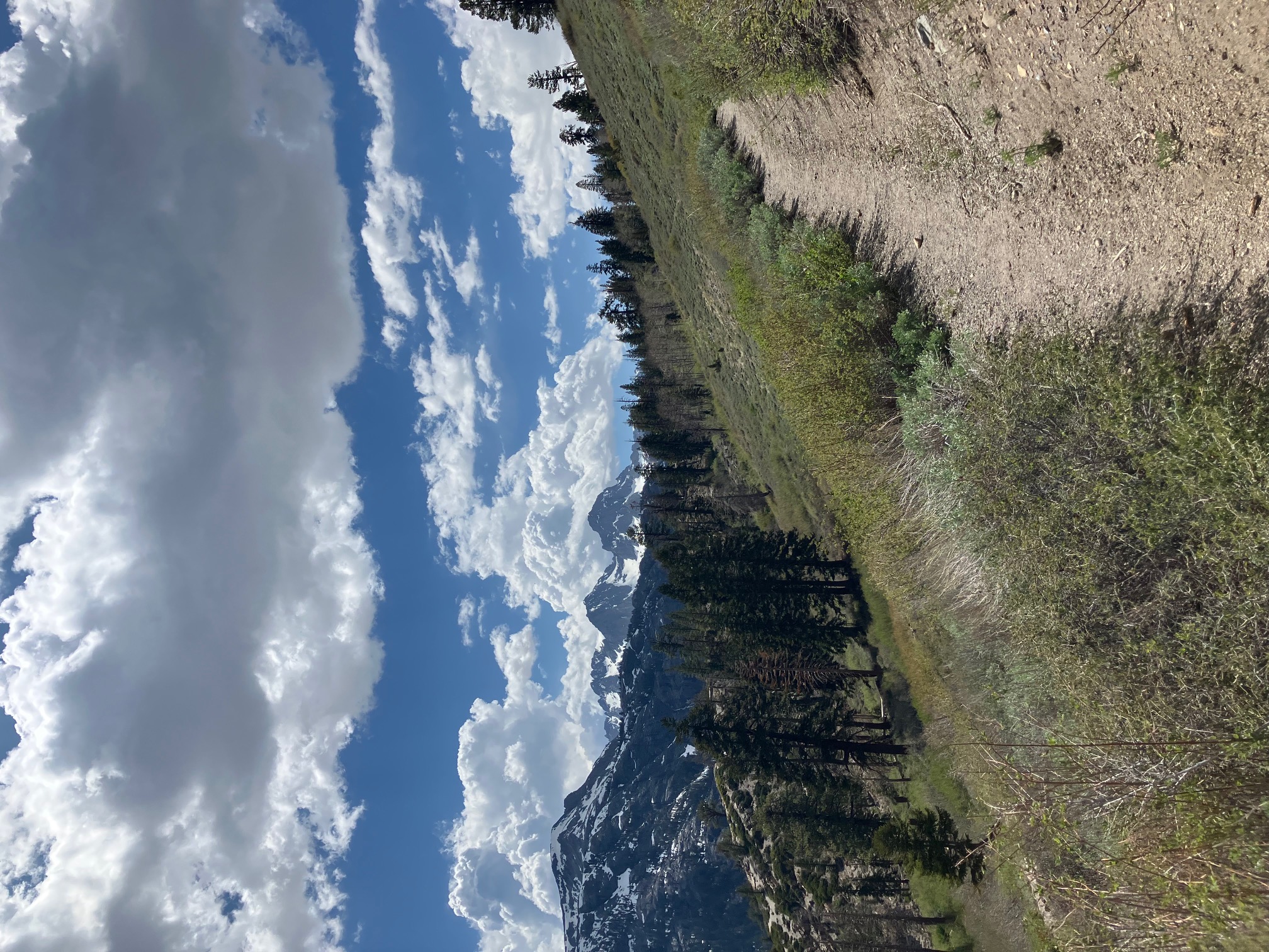
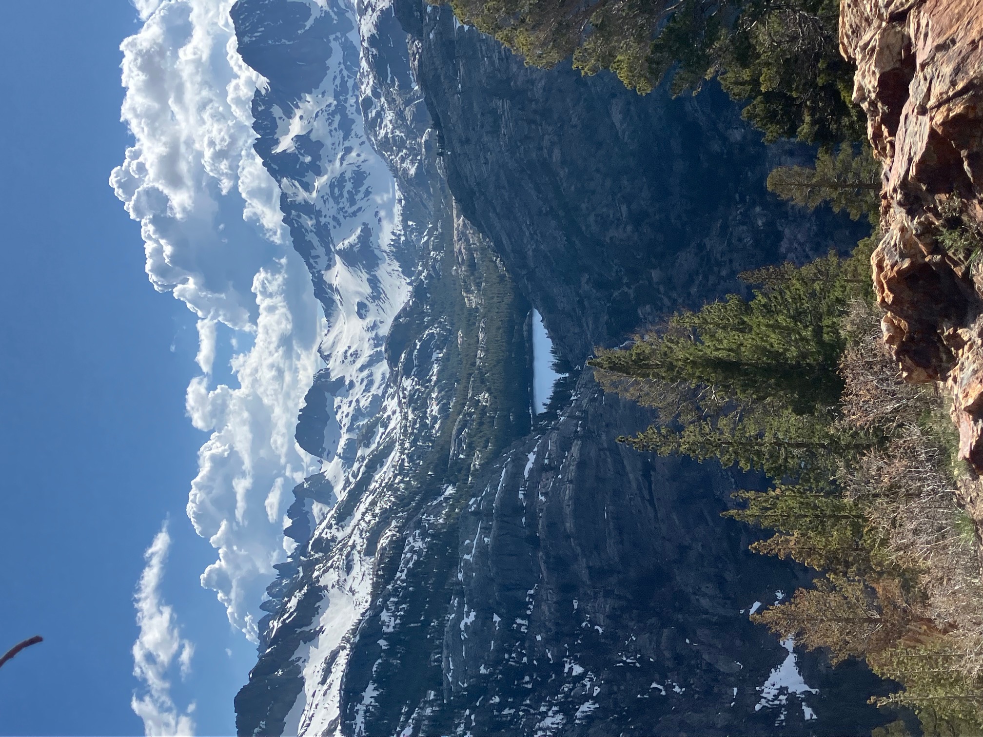
A newly melted lake across the valley from the trail.
One of the more spectacular tent sites of the trip so far. Unfortunately this one was also home to some voracious kangaroo mice who stole four socks that I left out to dry.
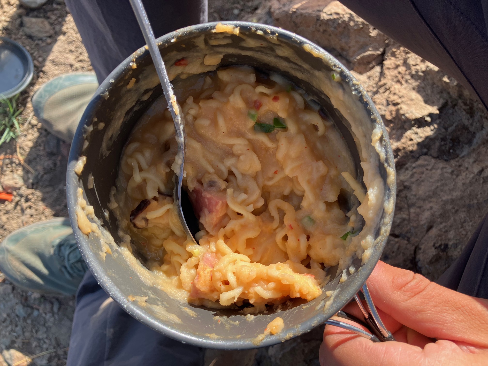
A gourmet trail dinner: ramen and mashed potatoes with sausage, cheese, and fresh wild onions.
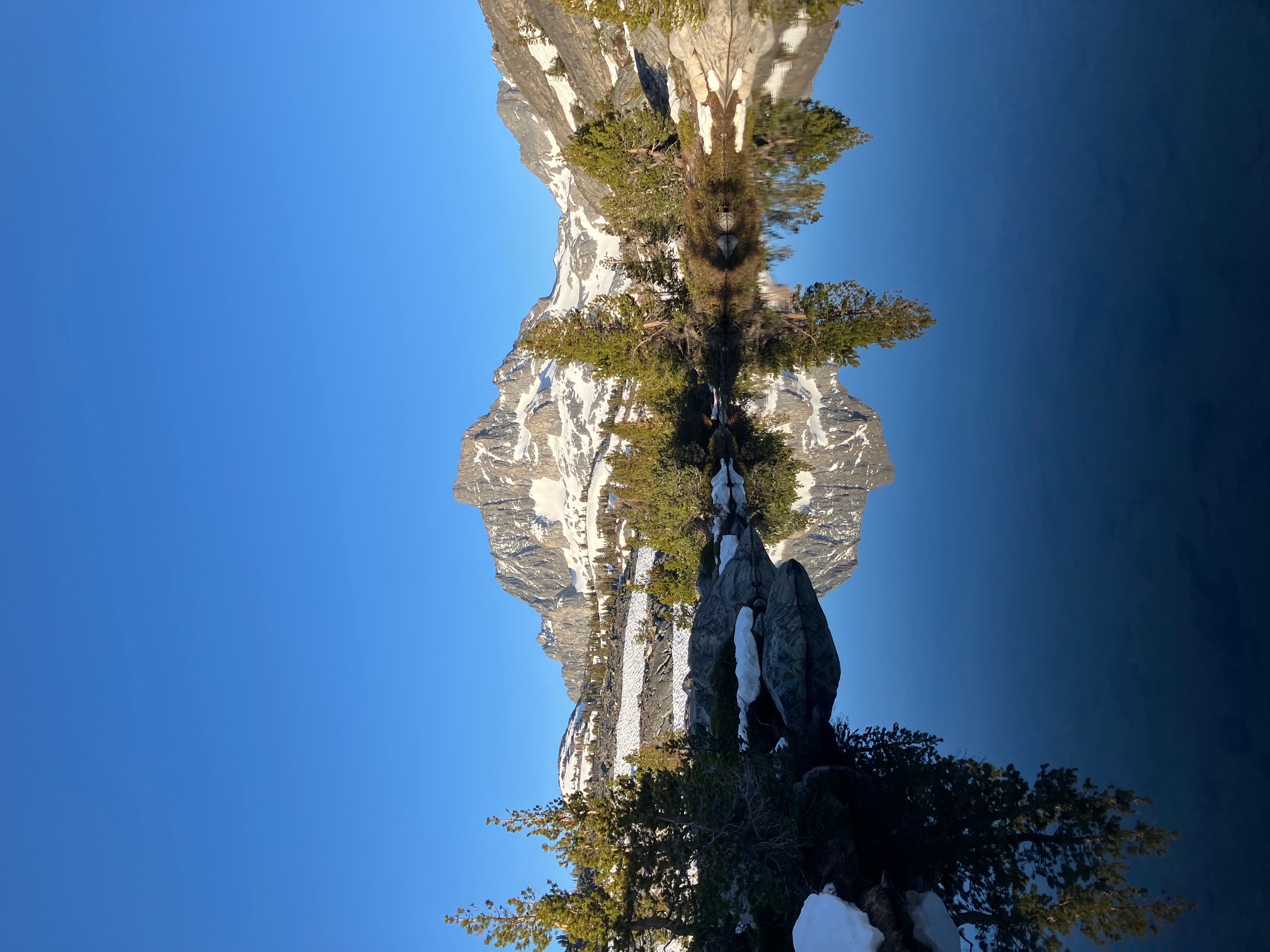
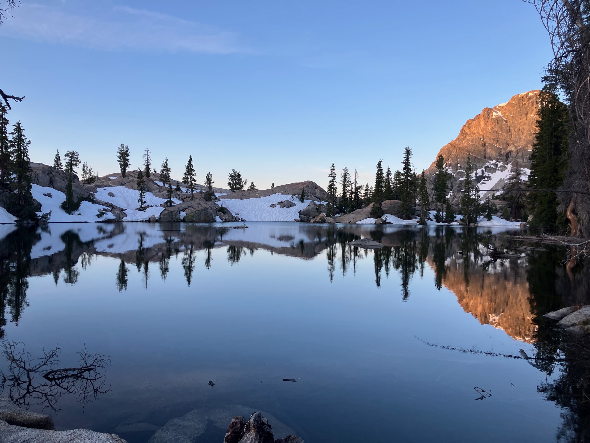
Yet another stunning alpine lake!
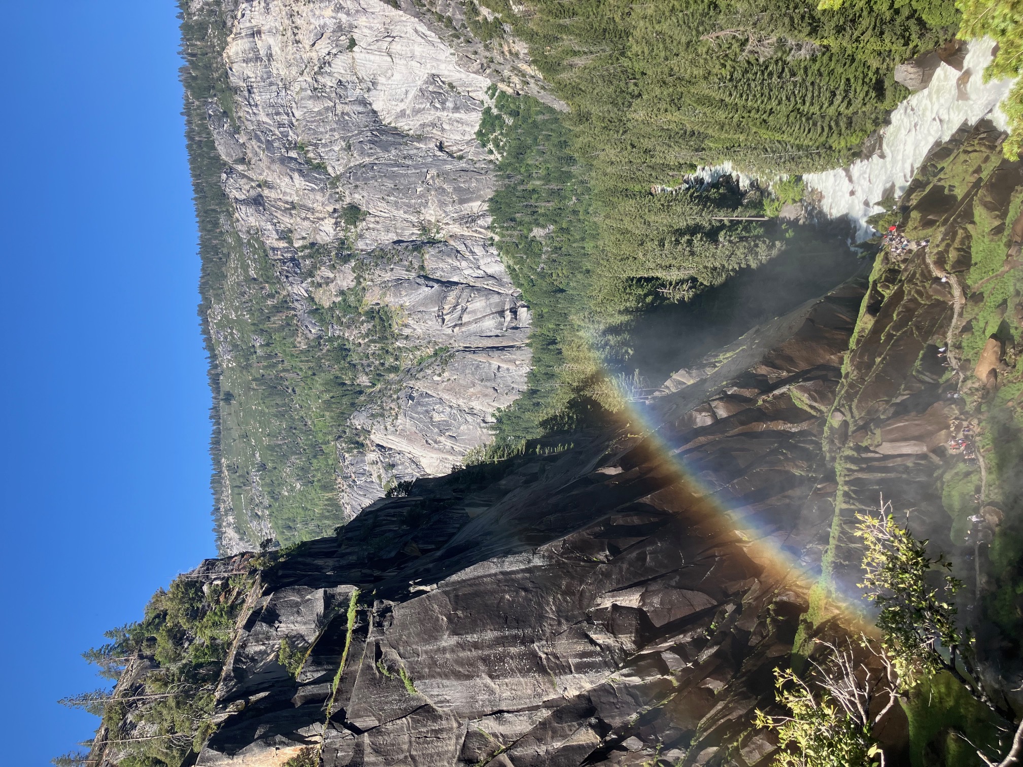
The mist trail in Yosemite Valley. It was a bit surreal to suddenly be a day hiker.
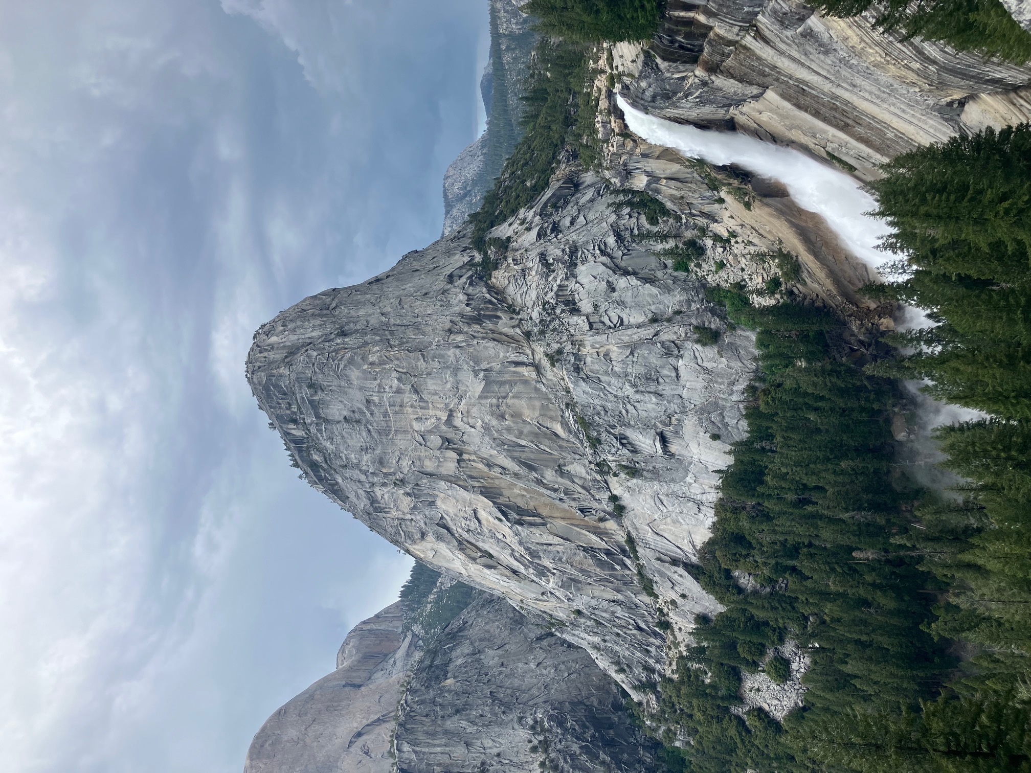
Liberty Cap in Yosemite Valley, with Nevada Falls in the foreground. We climbed the cap up the back, which is a bit less steep…
The easier way up Liberty Cap. Without full backpacks and with denser air (this is 5000’ lower than we’re acclimated to) we felt like superman.
We got a ride back to the trailhead in a converted sprinter van.
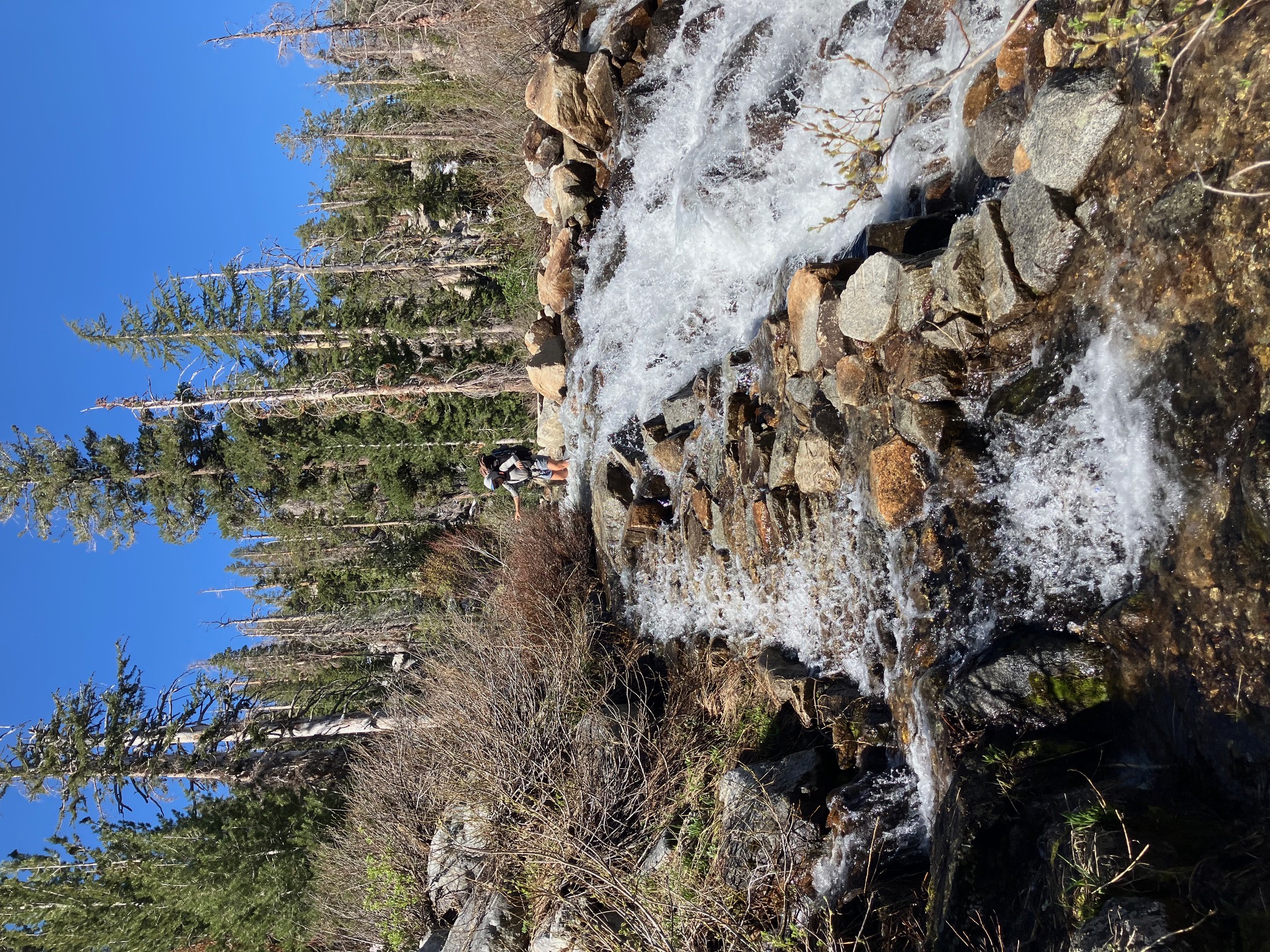
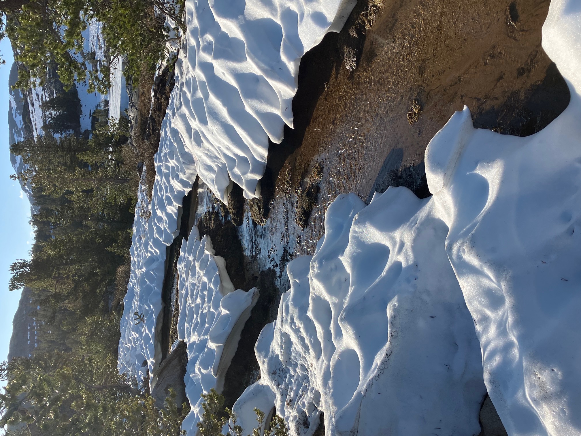
The melting snow sometimes turns the trail into a river.
Yet another spectacular alpine lake!
During peak melt the snow develops dimples (‘sun cups’) that grow by focusing sunlight into themselves. They’re very pretty but treacherous to walk on—the ridges remain icy while the centers turn into deep slush.
Yours truly at the 1000 mile marker!
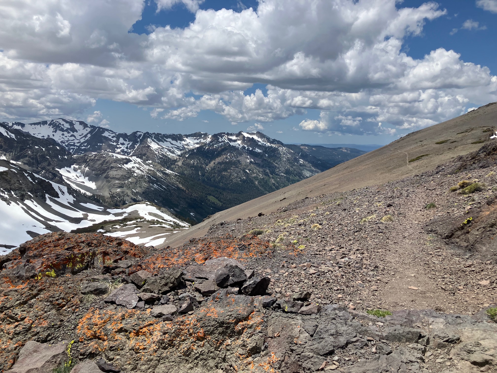
The last day before Sonora Pass included this amazing ridge walk. The terrain is getting more deserty again, with reddish gravel replacing the granite slabs. We had to bail off the ridge early because of a thunderstorm but got a ride into town and a good meal.
The next stop is Lake Tahoe!
Section 9: Kennedy Meadows North to Truckee
Im currently riding a bus from Reno to Mt. Shasta. Over the last section I made it to Truckee (mile 1154), stopping in Lake Tahoe for a rest day. I’ve only got two more weeks before I need to get off trail so I’ve decided to skip north to the Oregon border and hike south through the Trinity Alps for a final 150 mile section.
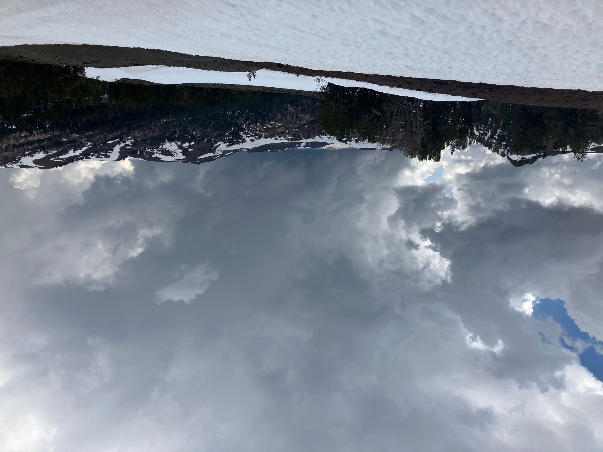
We had some intense afternoon thunderstorms the three days after Sonora Pass—this one dumped about an inch and a half of chickpea-sized hail on us before moving on.
The area north of Sonora Pass was alternate deserty rock and pine forest, with patchy snow throughout.
This tree has a nose!
Some cool rocks the day before arriving at Lake Tahoe.
Yet another stunning alpine lake! This one has almost completely filled its valley—just over the bank on the right is a sheer cliff.
Kiss and ZigZag taking a shade break under one of the magnificent trees—cedars I think—along the dry ridges.
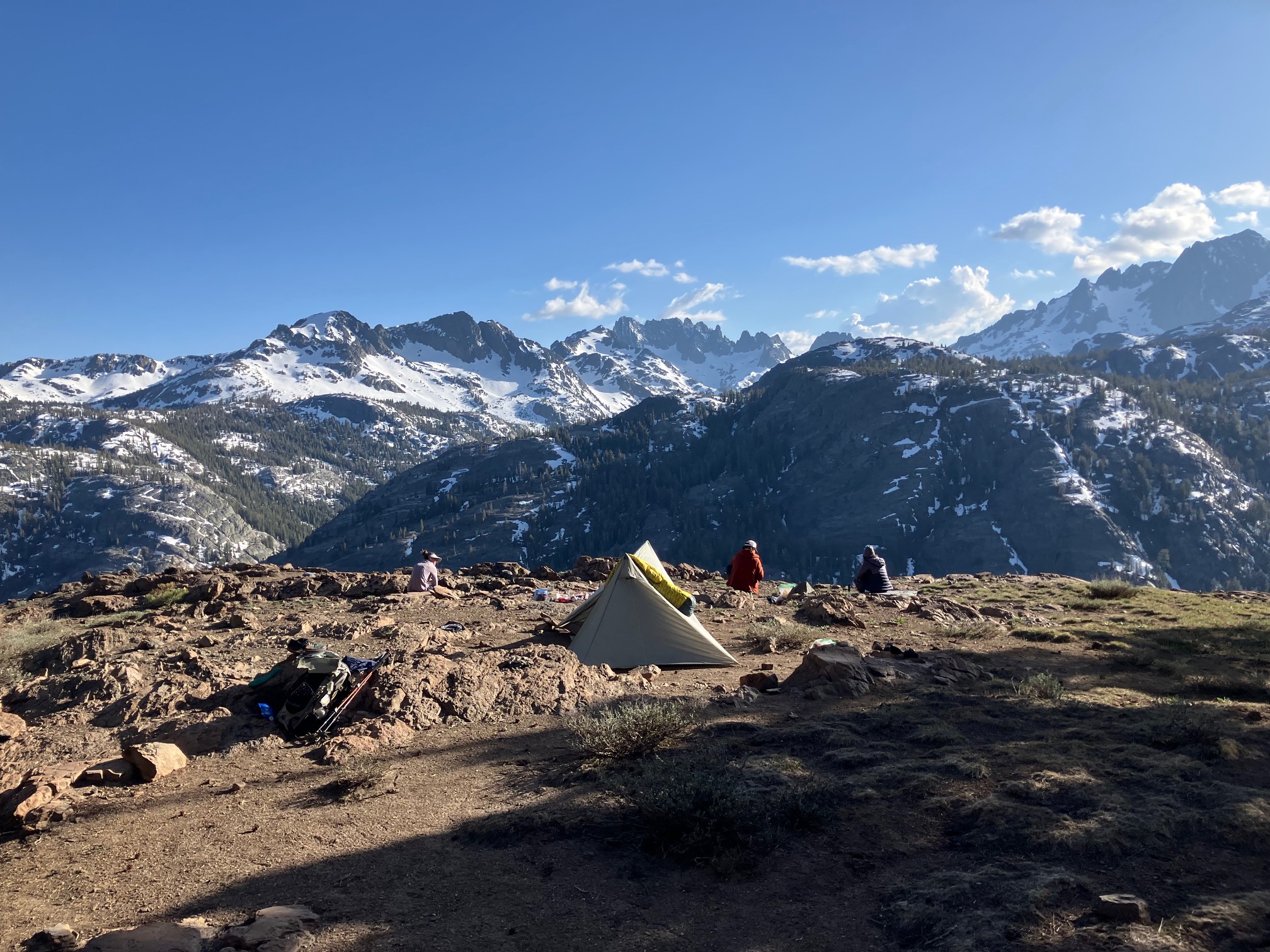
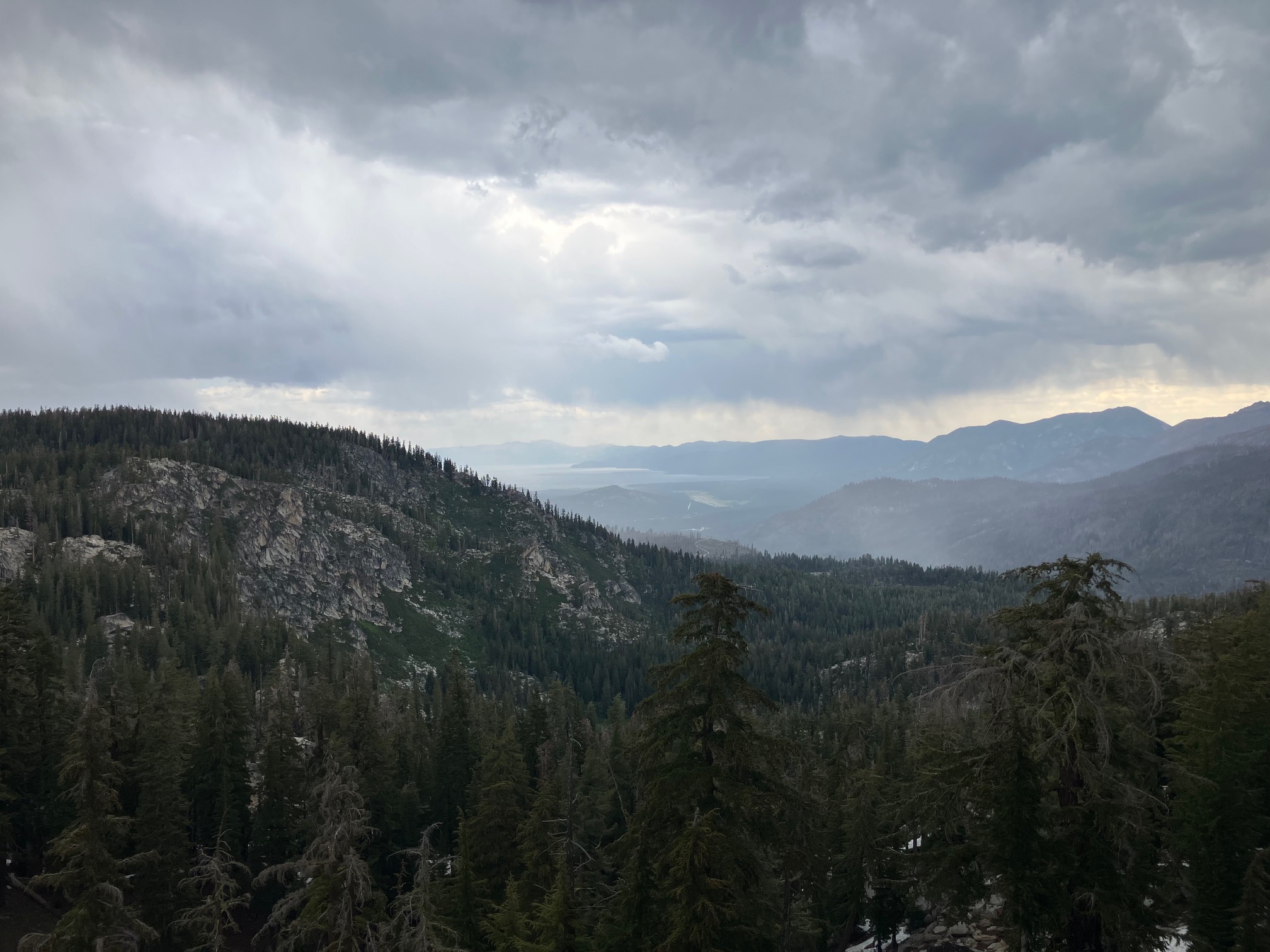
First view of Lake Tahoe in the distance, with yet another thunderstorm rolling in.
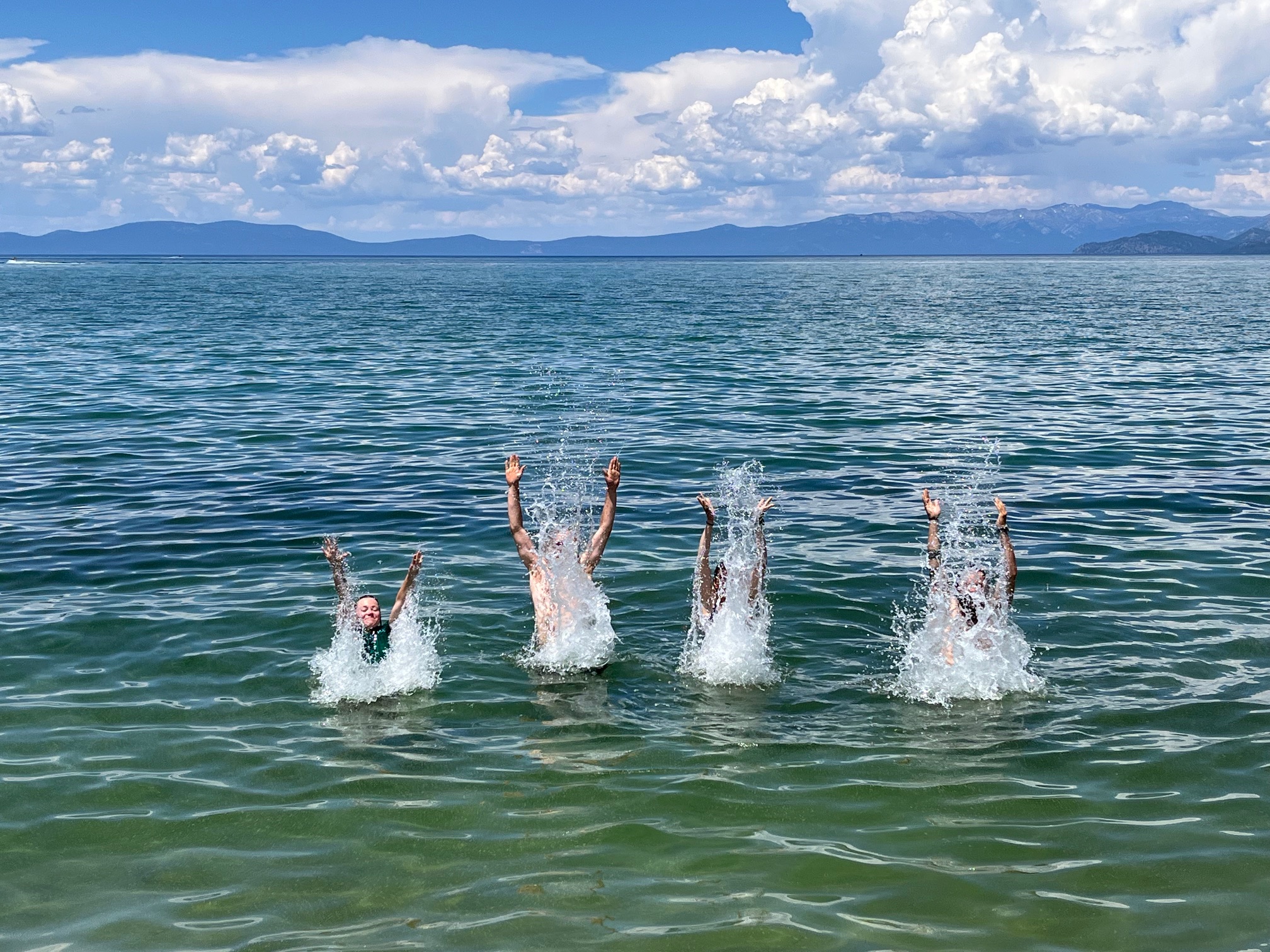
A glorious swim in the surprisingly warm Lake Tahoe.
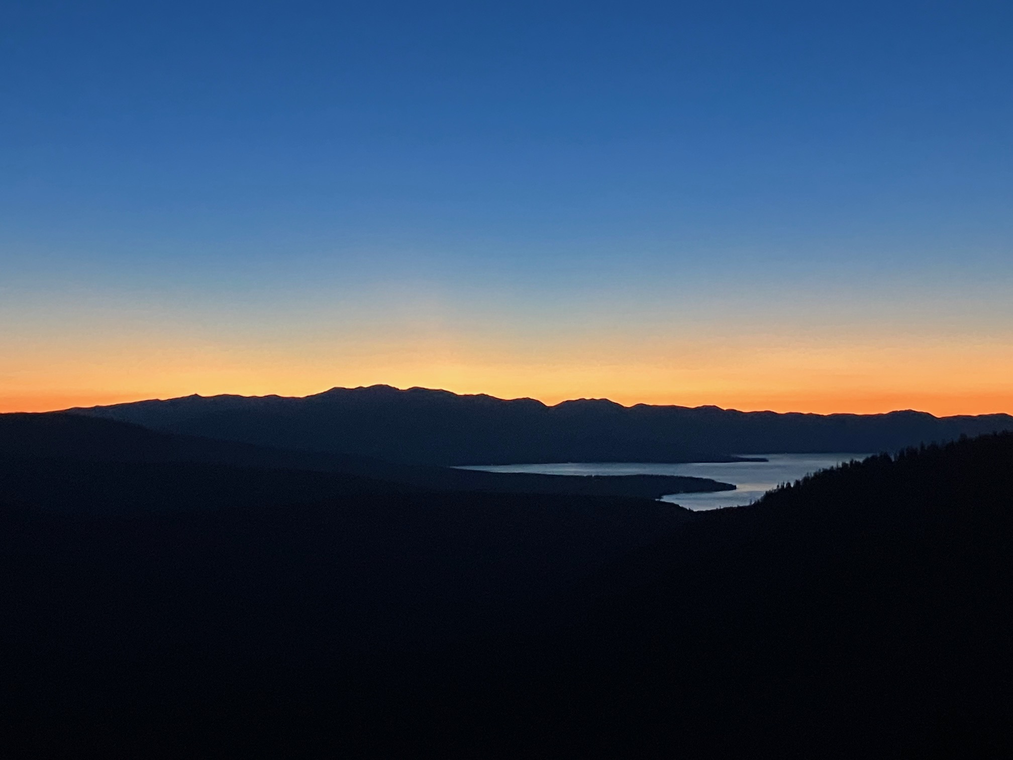
After leaving Lake Tahoe the PCT joins the Tahoe Rim Trail (TRT) for ~50 miles on the ridge to the west of the lake. Watching the sun rise over the lake as we walked along was unforgettable. I would definitely recommend the TRT to anyone looking for a shorter backpacking trip in the area.
The other side of the same ridge, which was covered in wildflowers when we crossed it.
This next section will be my last on the PCT for the season! I’ll have walked just about half the trail—Oregon and Washington will have to wait for another time.
Section 10: Seiad Valley to Mt. Shasta
I’m writing this on the flight home from Reno to Austin! After 3 months and 1,300 miles I’m saying goodbye to the PCT (for now!) and heading back to normal life. It’s been an absolute blast—everything I’d hoped and more—and it’s sad to go home after having only hiked half the trail. On the other hand, after three months I am a bit excited to do something other than walk every day…
For this final section I skipped up to the northern border of California and hiked south 150 miles to interstate 5. This section passes near Mt. Shasta and through some lovely mountains—much more low-key than the Sierra, and a great section to end on.
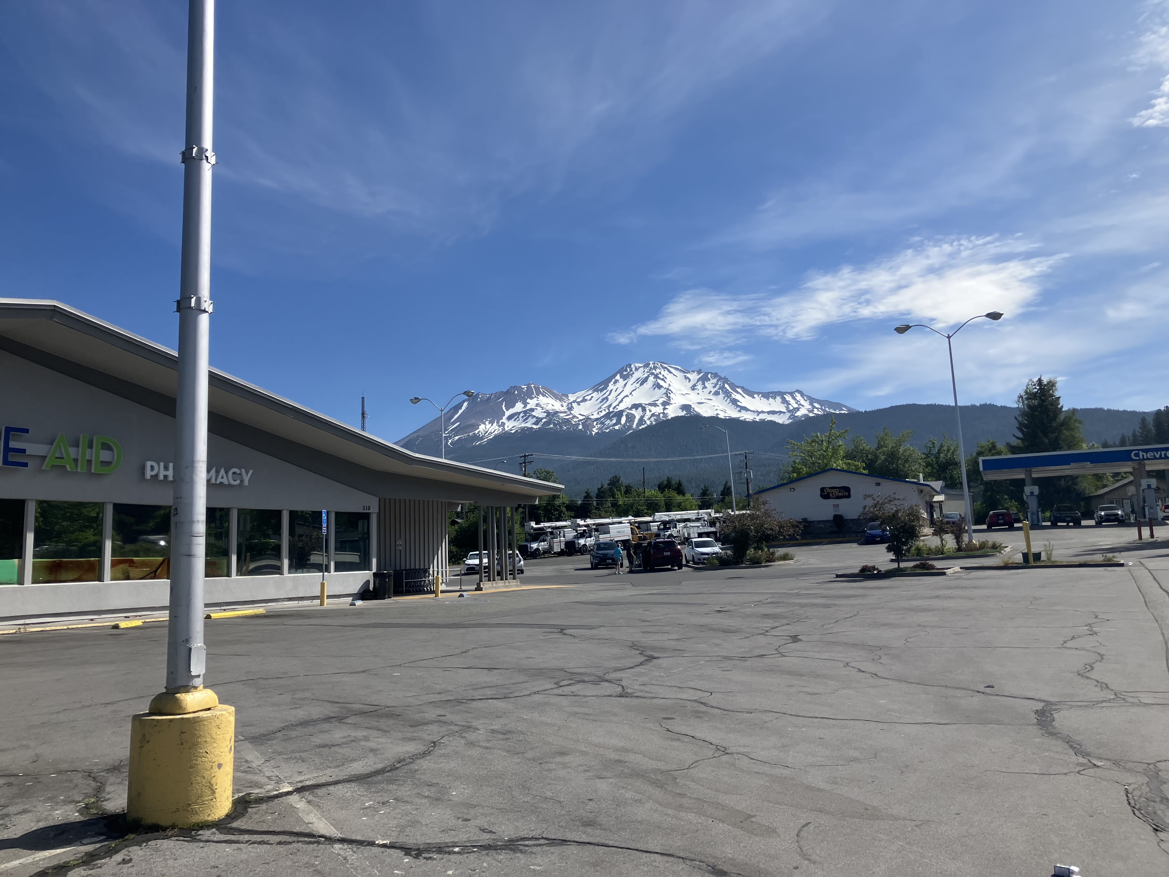
The bus from Reno dropped me off in Mt. Shasta (the town), which sits at the base of Mt. Shasta (the mountain). The latter is quite a sight, especially from a rite aid parking lot, but that’s California for you!
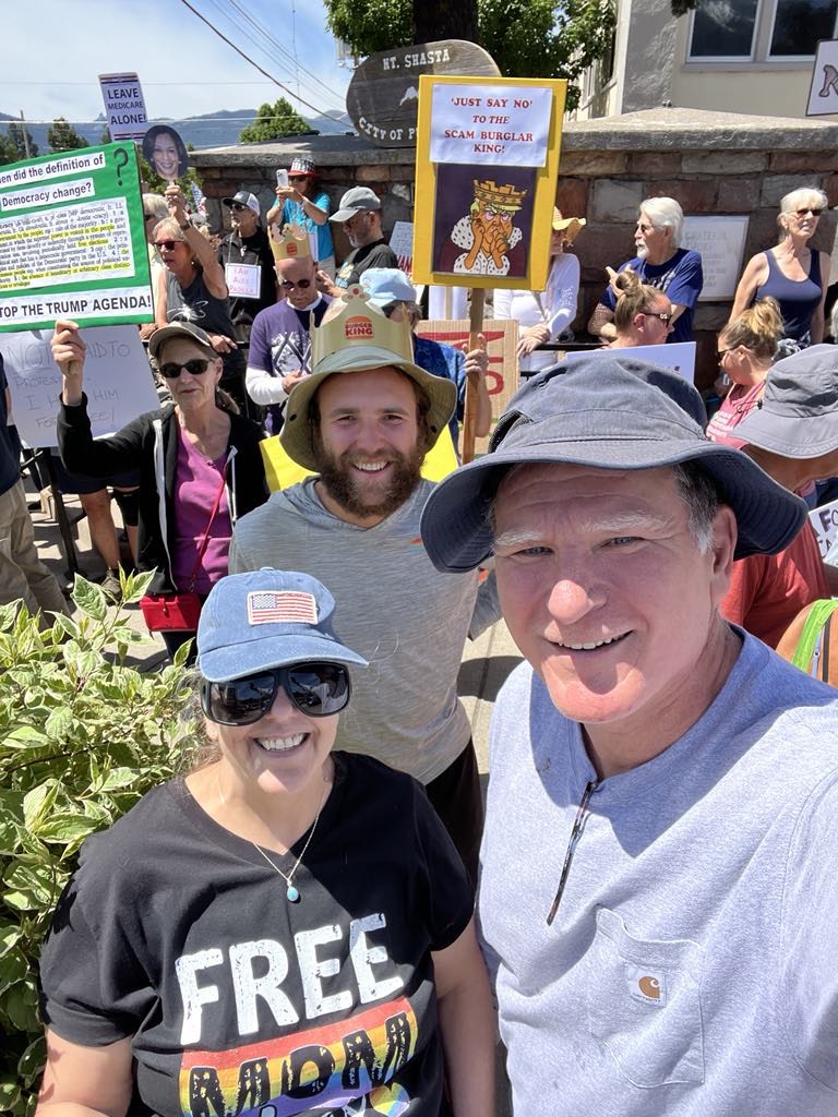
Jeff and Becky (front) were in town for a protest and gave me a ride back with them to their home in Seiad Valley for the night, near my starting trailhead.
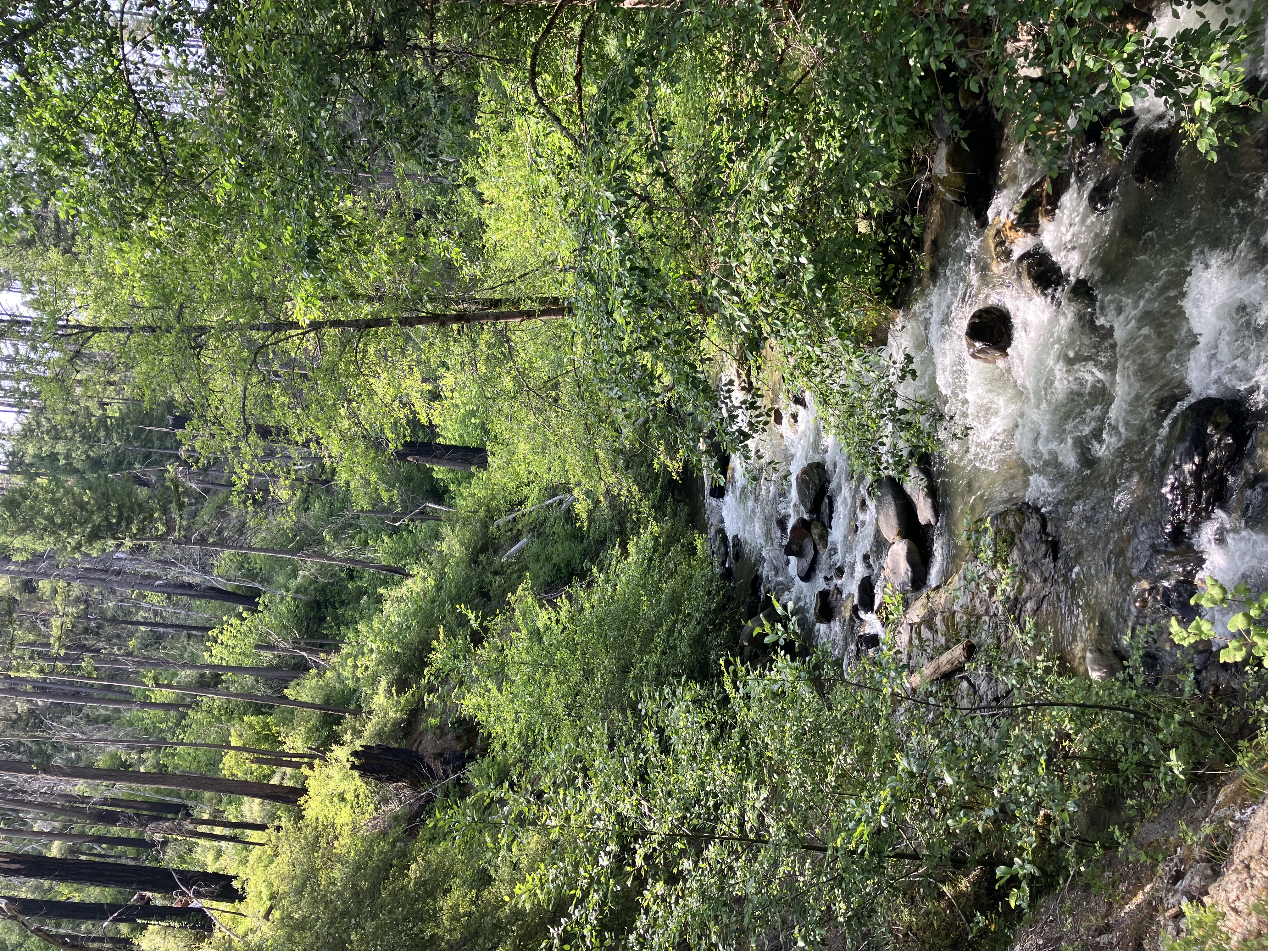
The first few miles followed a creek at around 1,500’. The moisture and low elevation made this the lushest section of trail I’ve encountered yet.
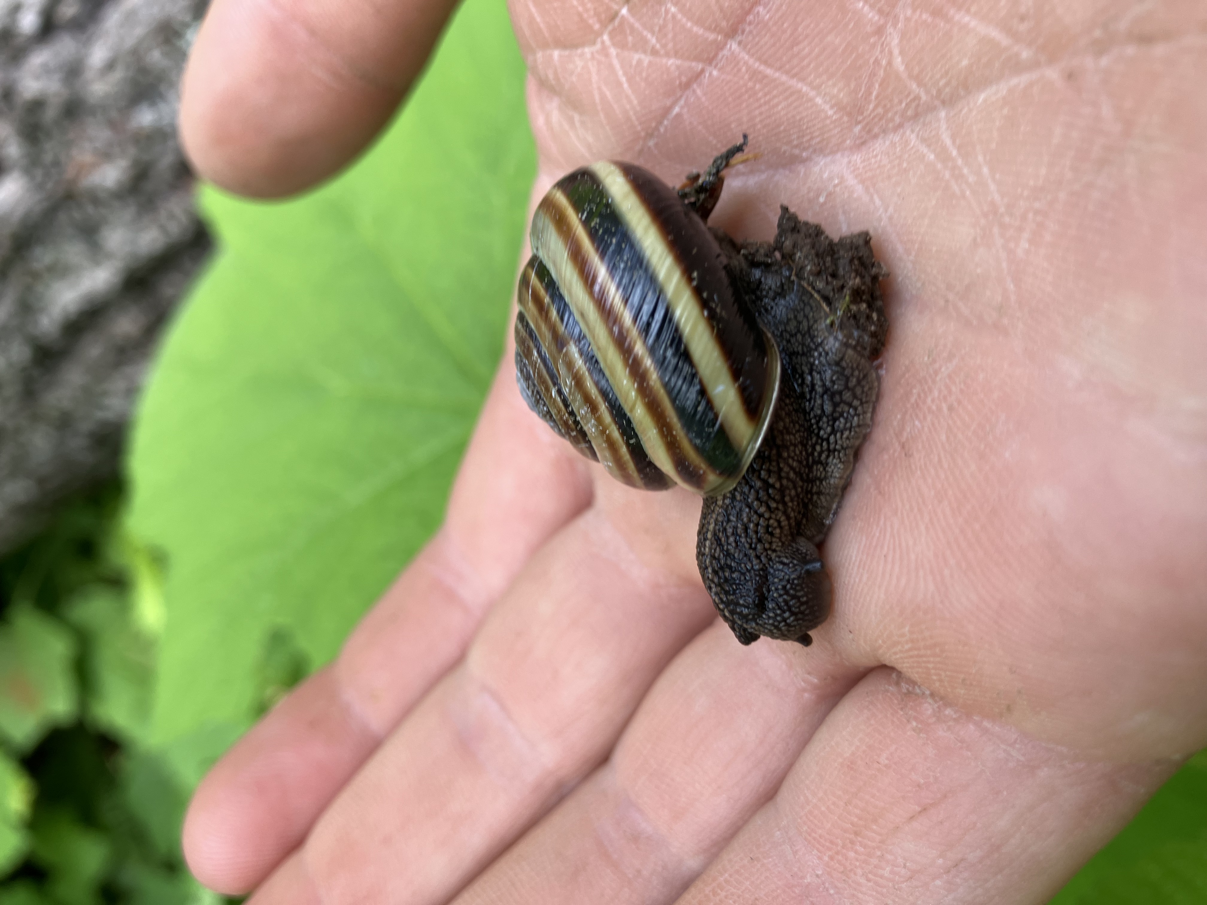
The local snails love the moisture! I also saw a bear on the far side of the creek, but didn’t get a good picture of it.
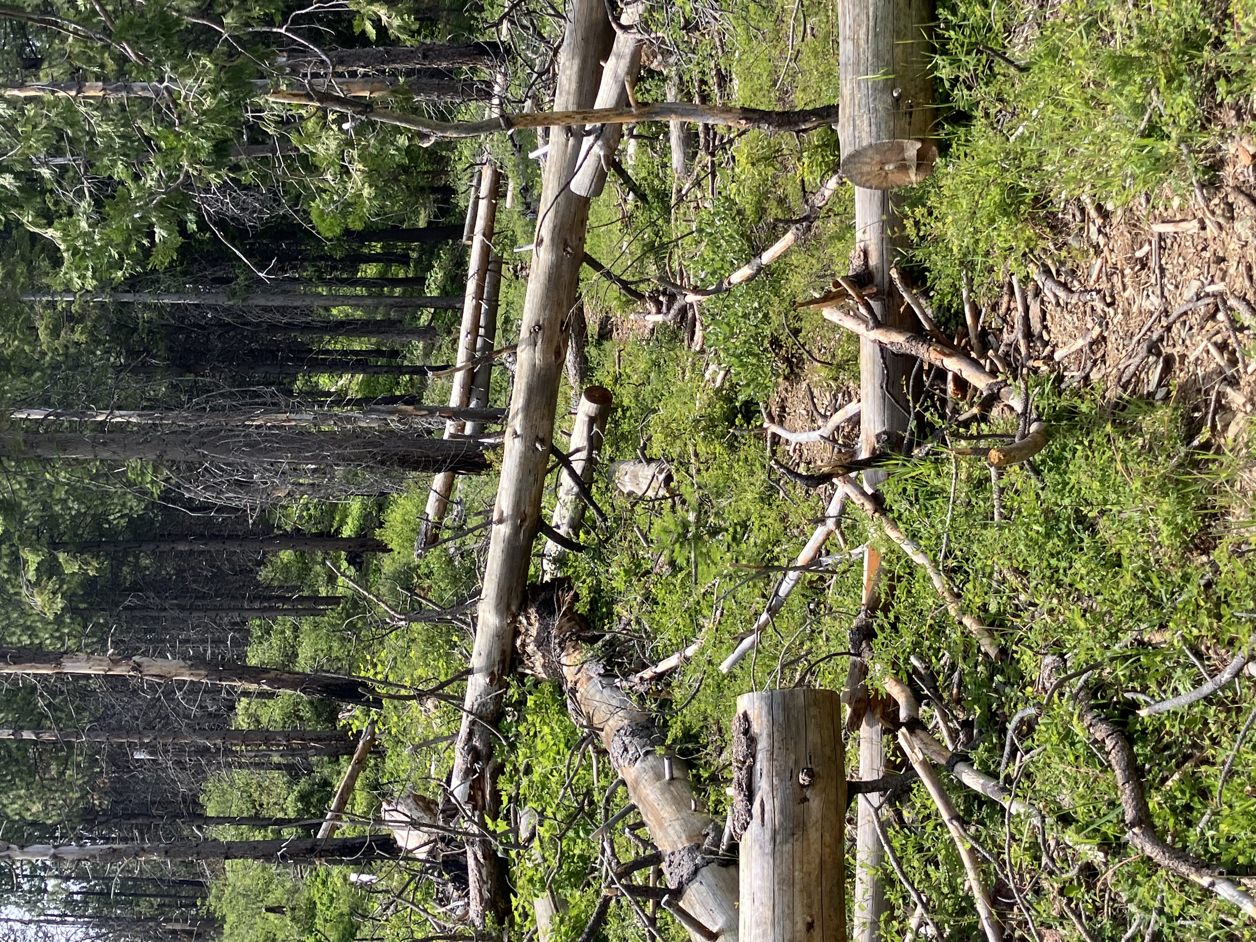
This section has had lots of fires recently, creating what I like to call a Backcountry Jungle-gym!
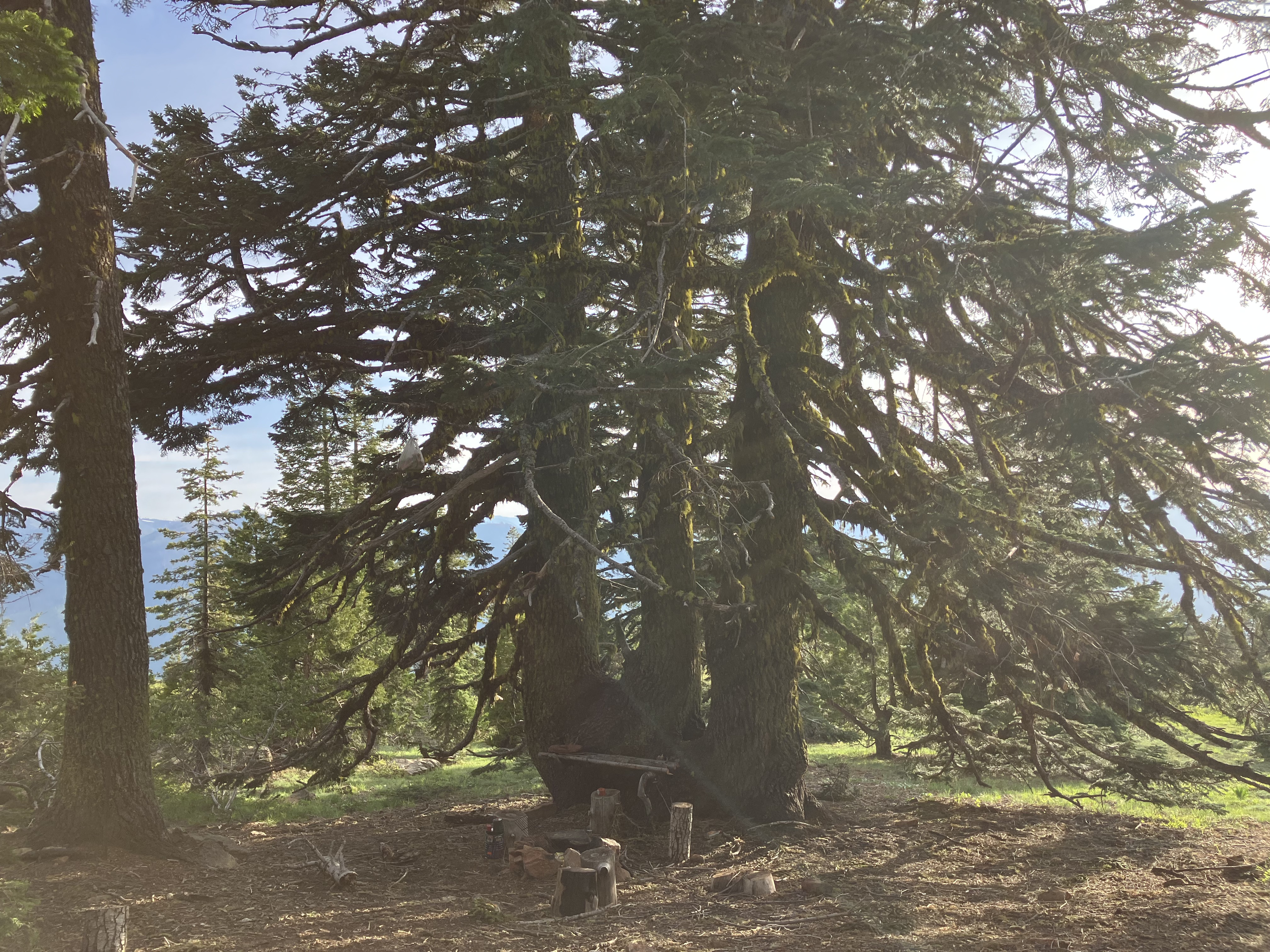
The first night I camped near this magnificent tree. It’s got a little bed built into it! Or maybe it’s an altar?
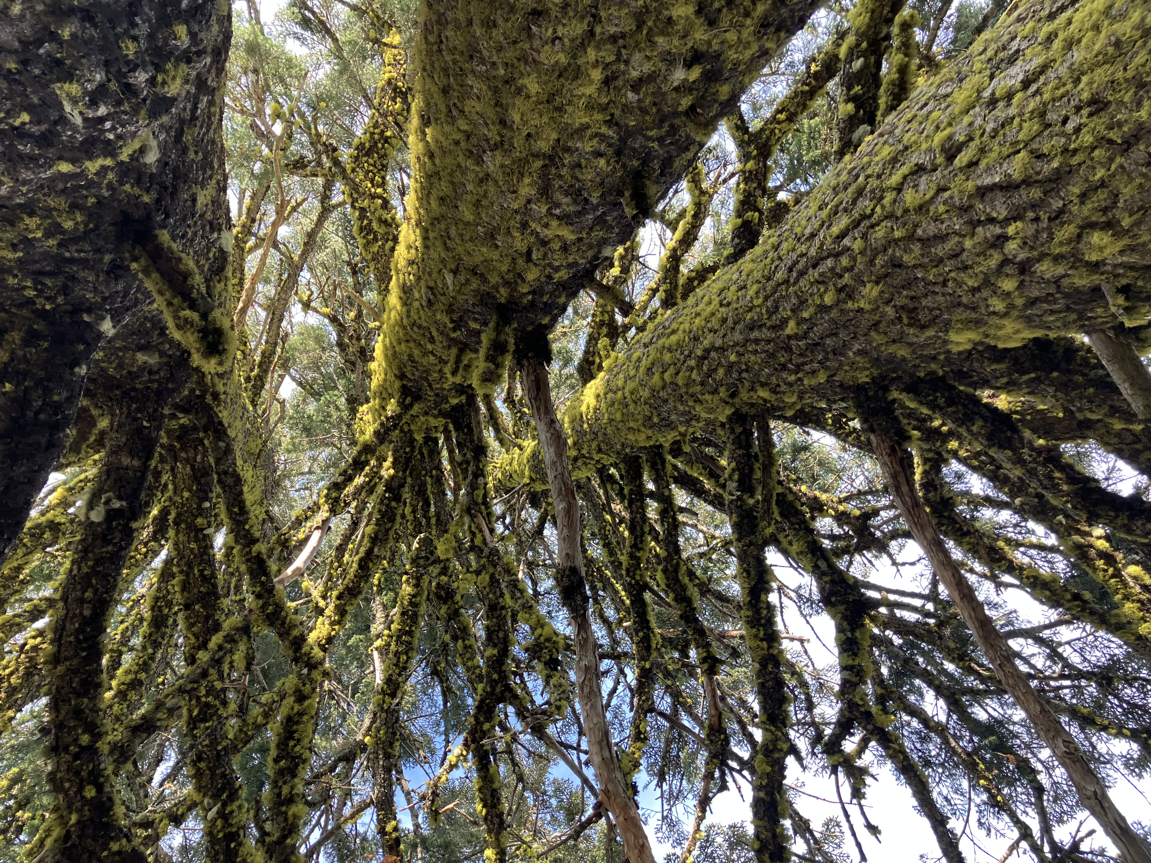
Looking up from the tree-bed into the lichen.
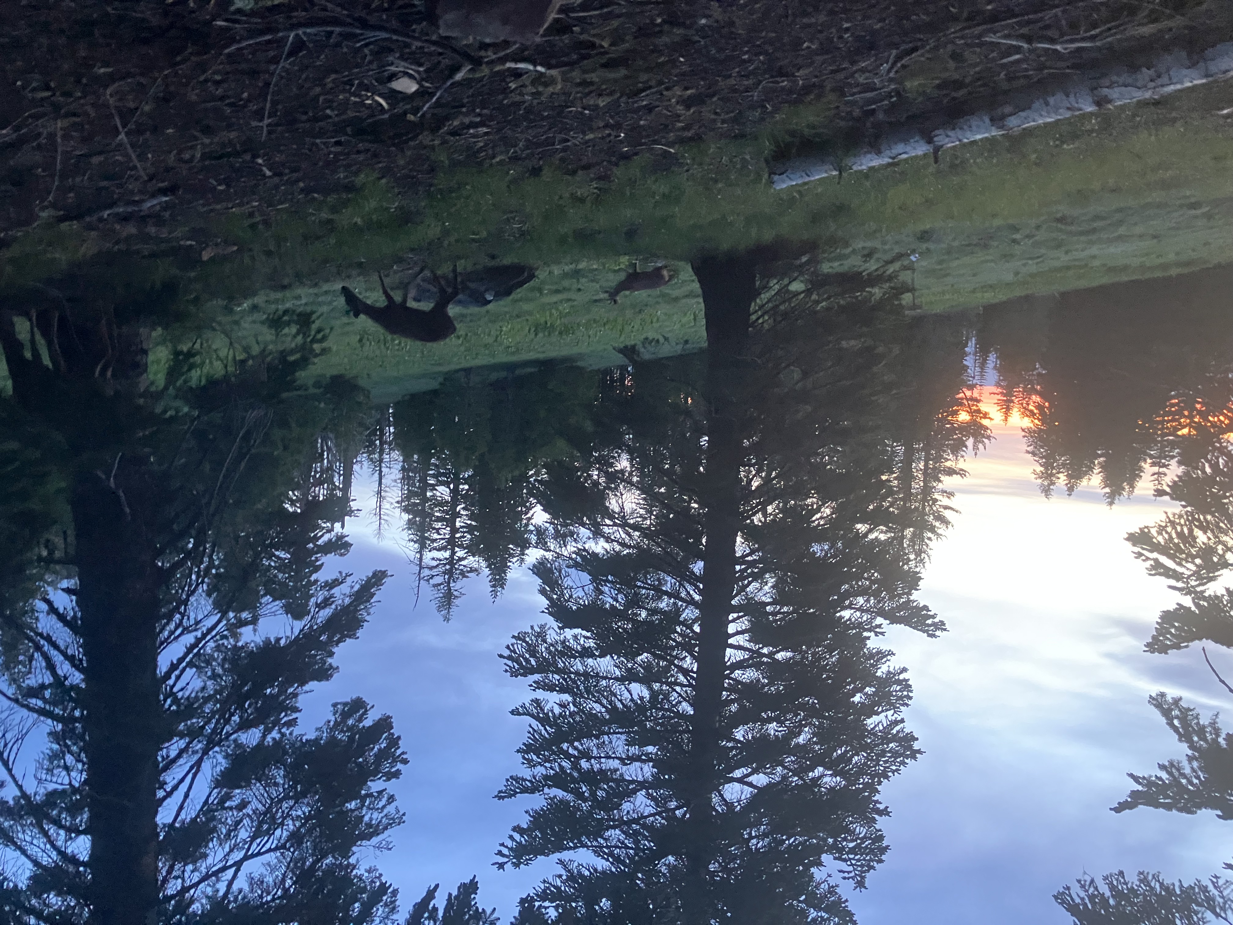
A herd of deer came by at sunset and hung out in the campsite all night.
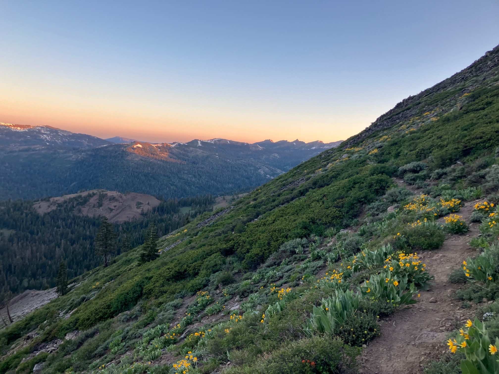
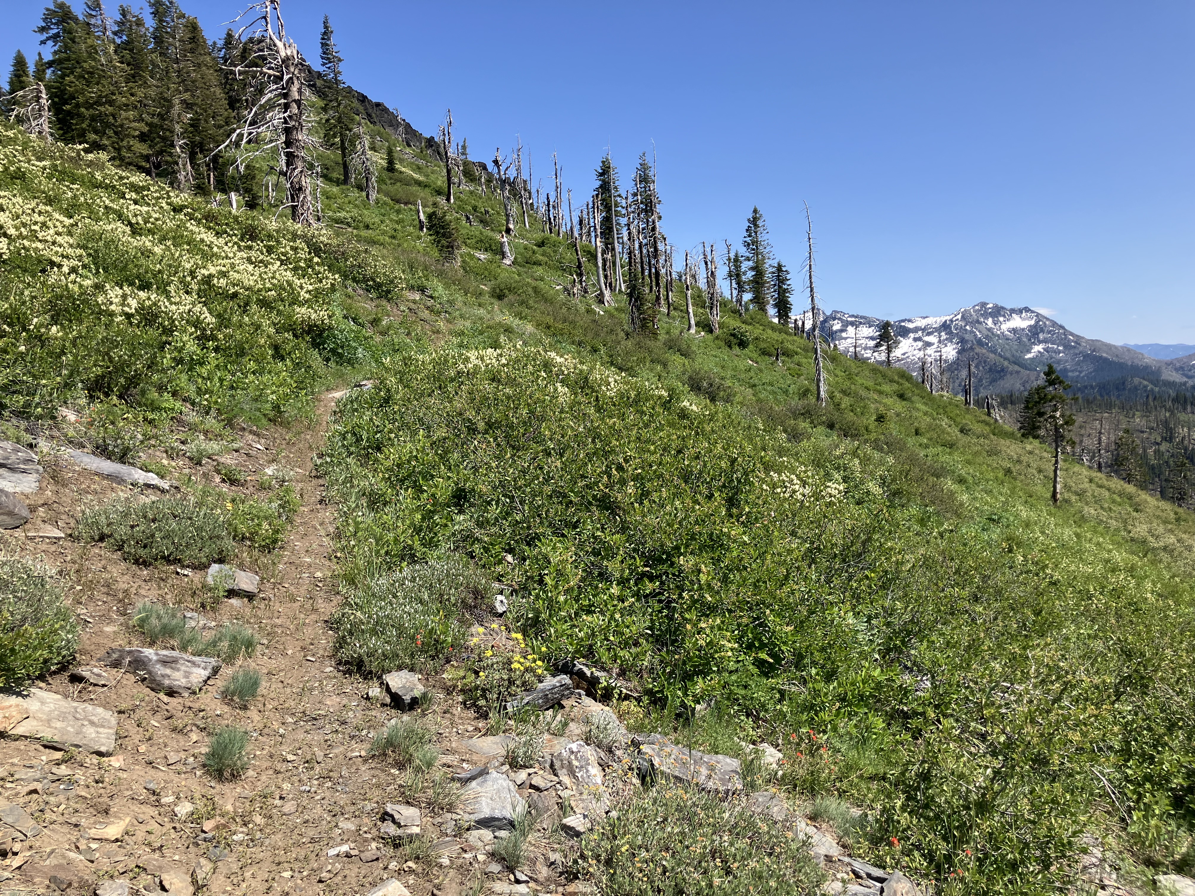
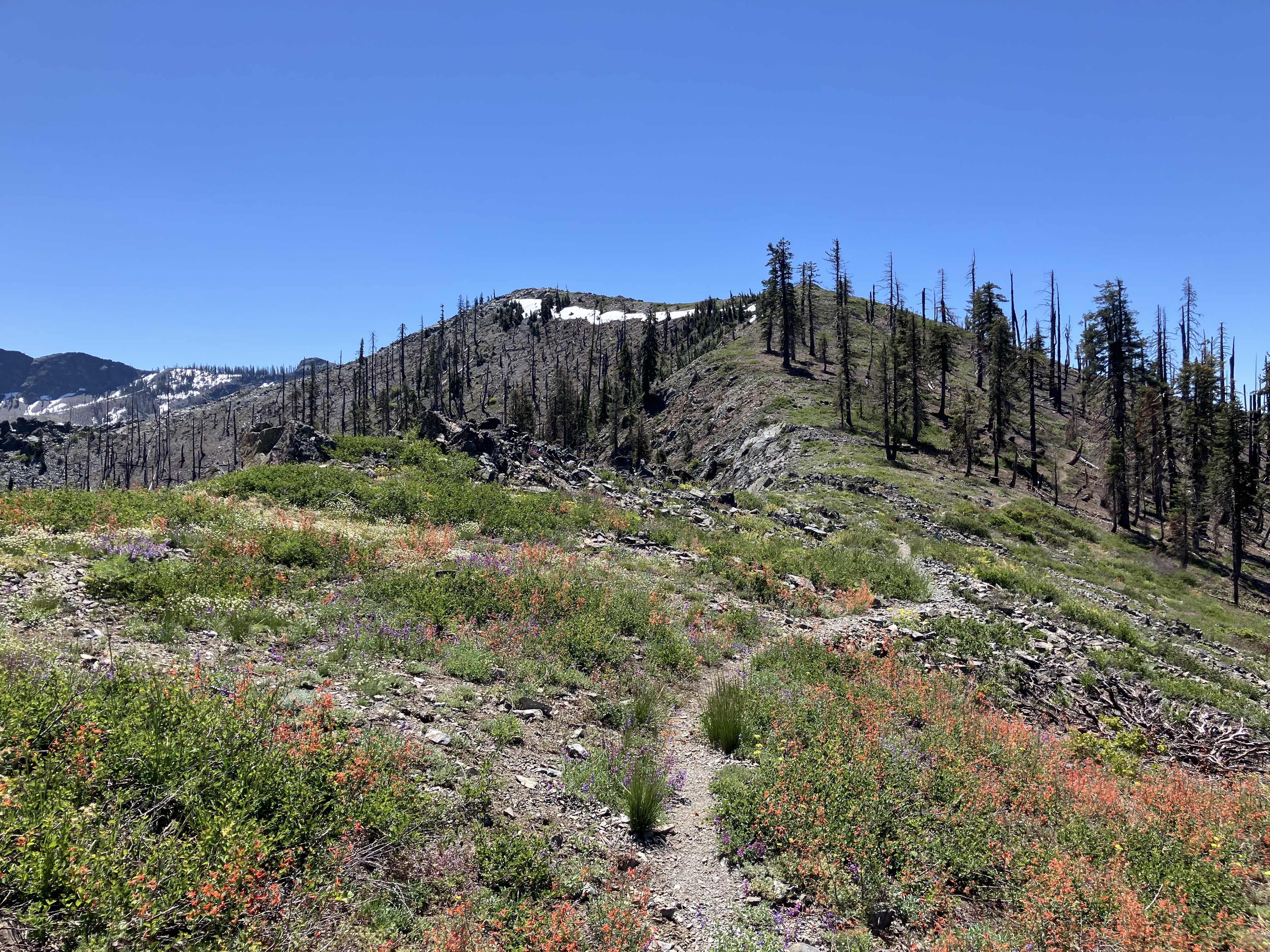
Most of this section followed a series of ridges at about 8,000’, leading to a drier landscape and many wildflowers.
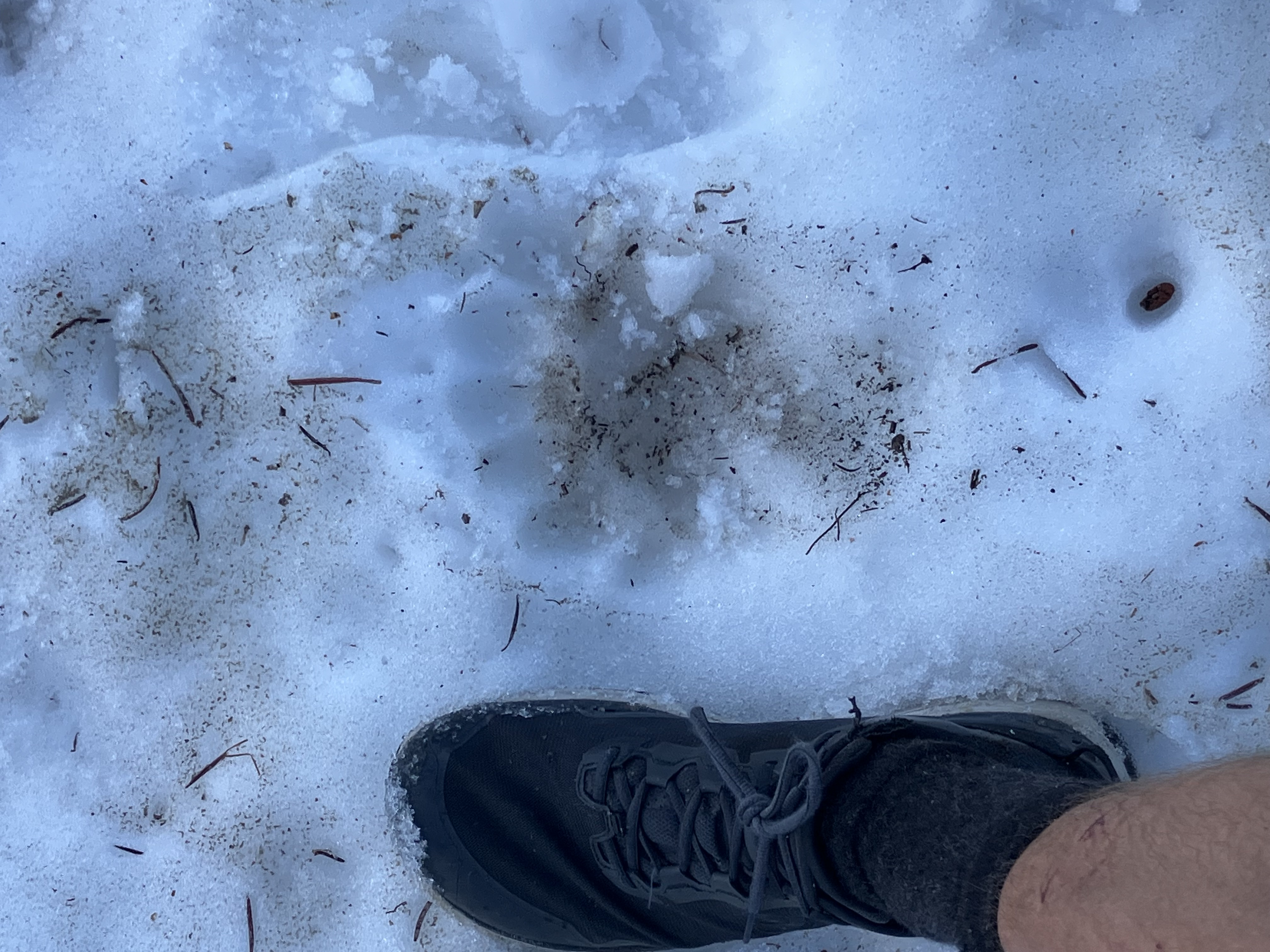
A bear print that appears to have six toes?!
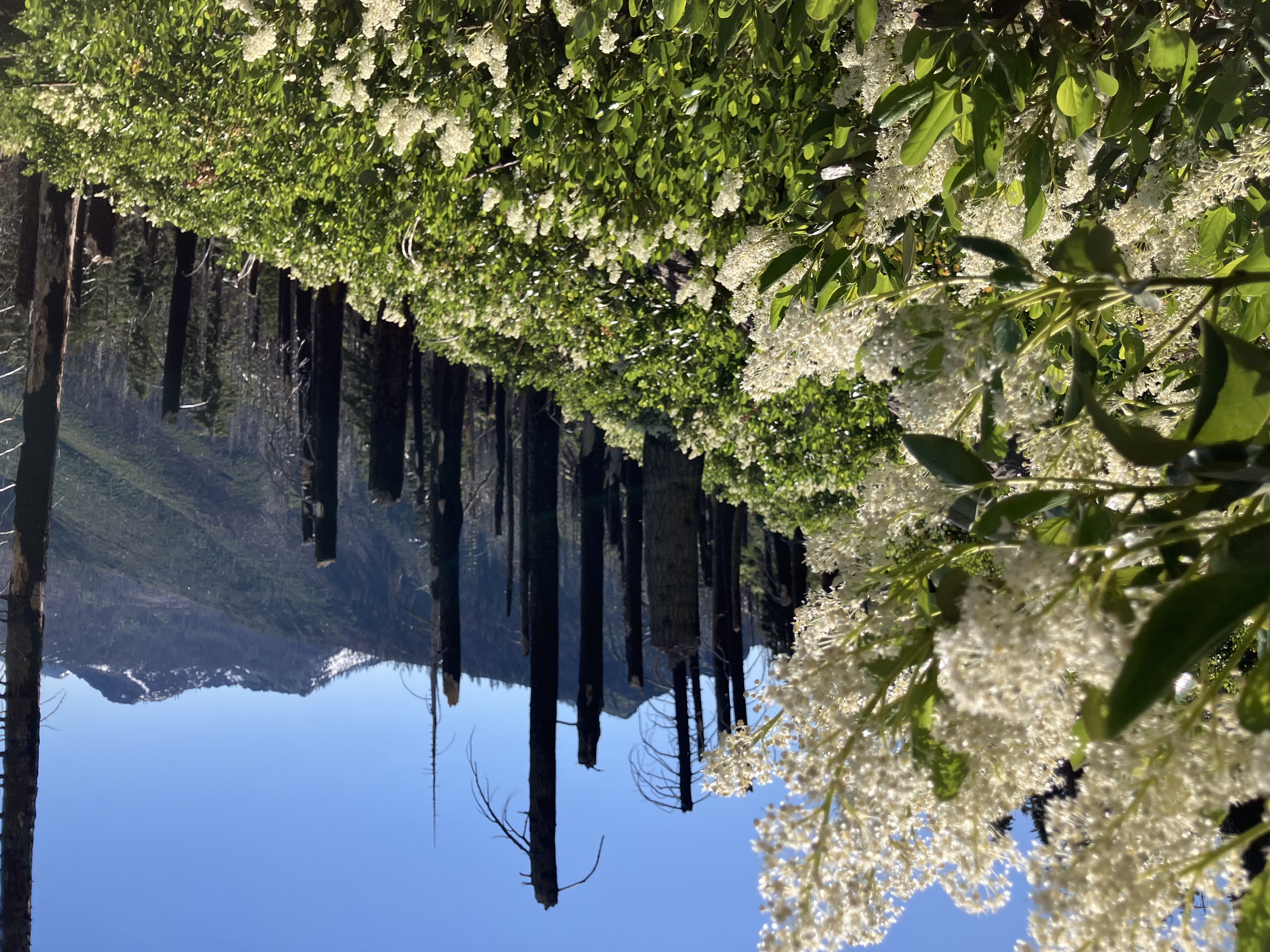
In some of the older burn sections the wildflowers have grown back. They make a sharp contrast with the still-standing burned trunks.
More flowers!
More flowers!
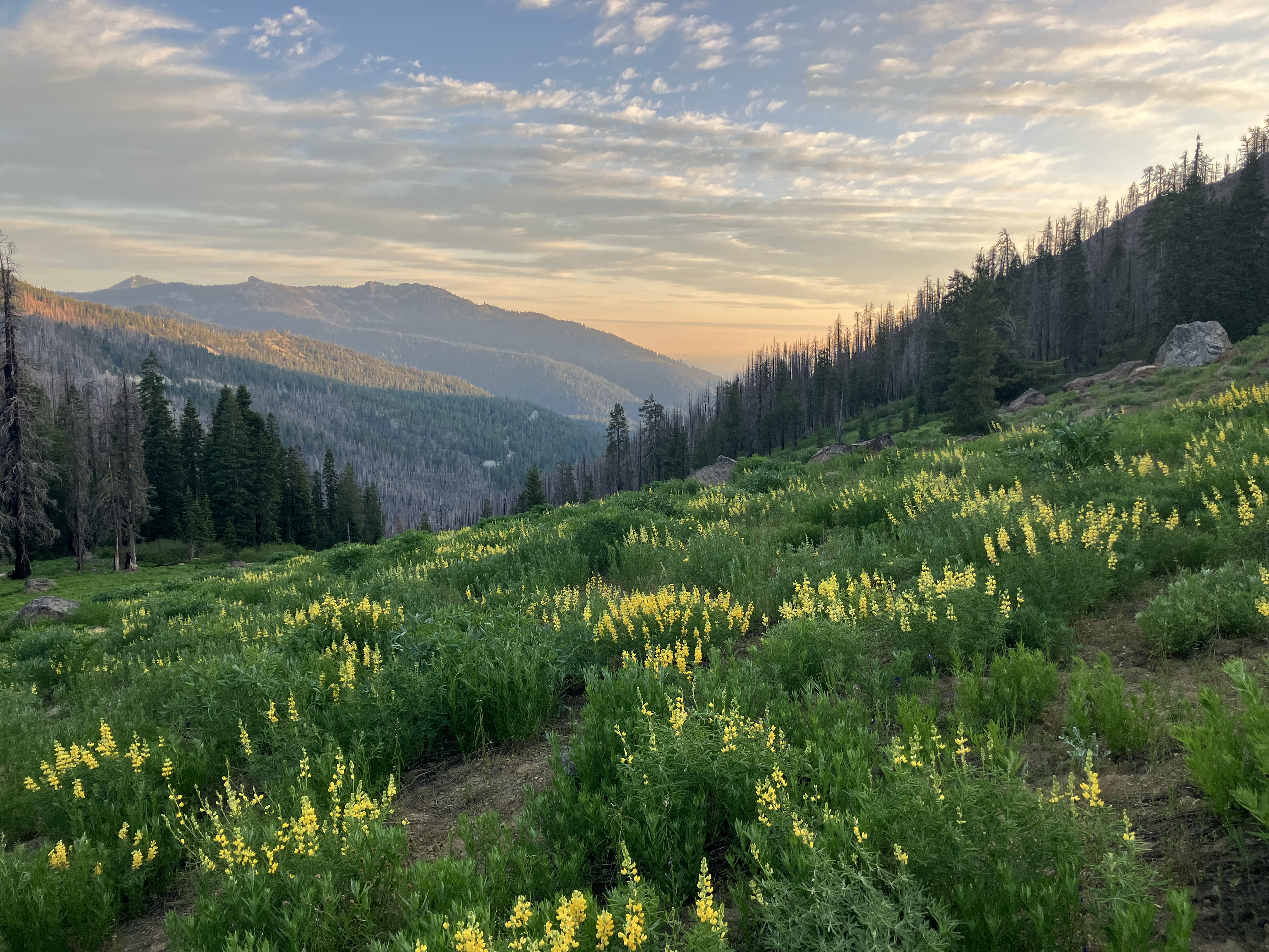
More flowers!
More flowers!
Mt. Shasta in the distance, looking properly volcanic.
For some reason this kind of lichen only starts growing 6’ off the ground, which makes a very cool visual effect. It reminds me of an Andy Goldsworthy sculpture.
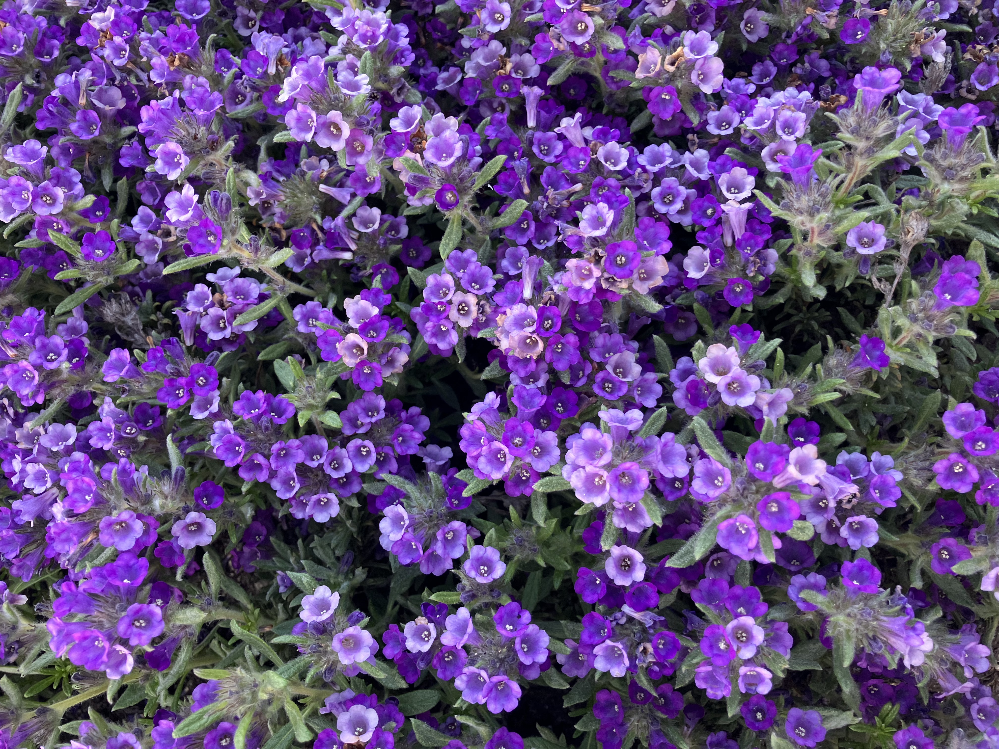
More flowers! According to ChatGPT these are Western Azaleas.
The section ends in Castle Crags state park, which has some really cool glacial rock formations. 
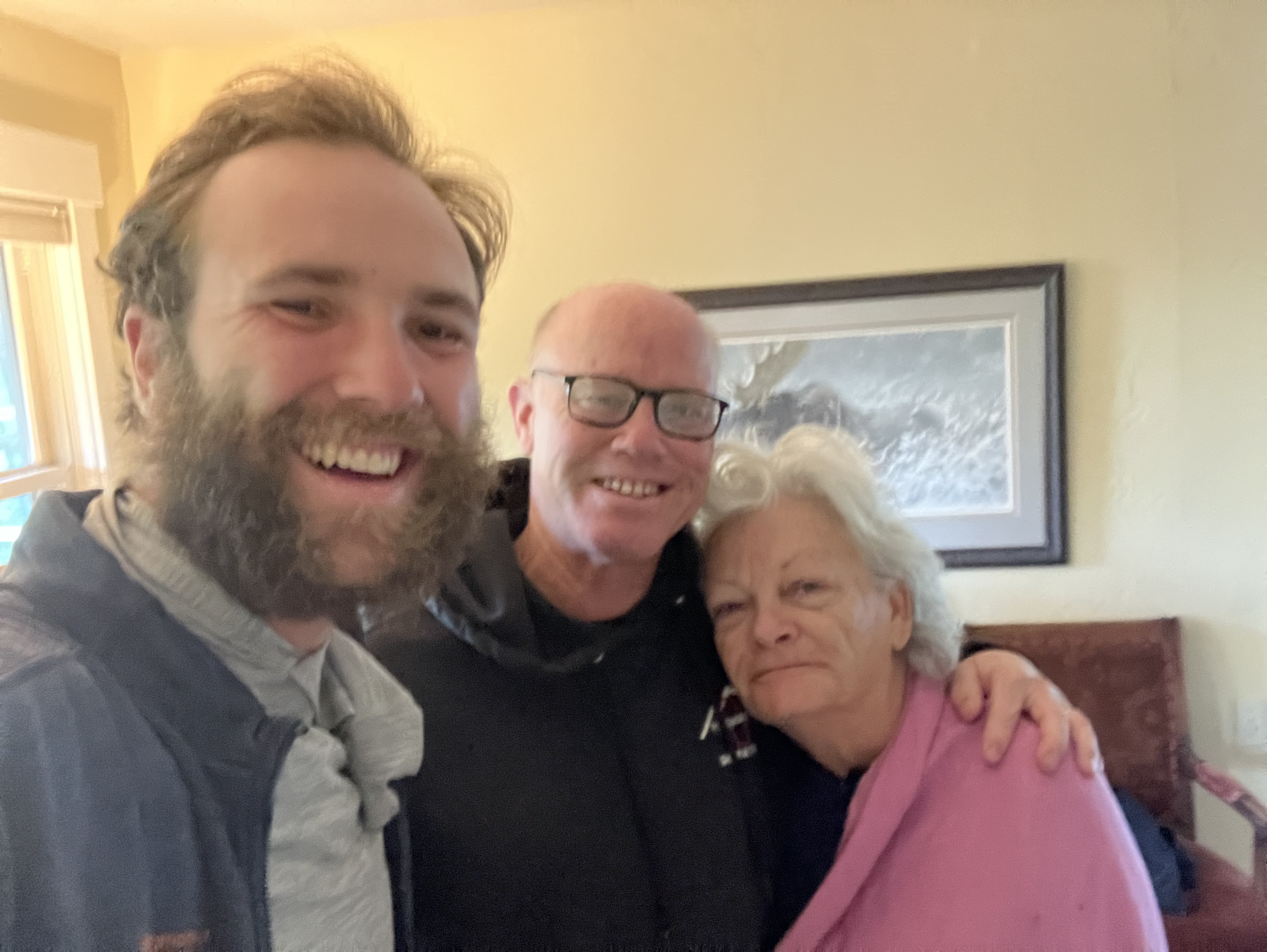
Donna and Randy hosted me for the night in Mt. Shasta, and I took a bus back to Reno in the morning.
And that’s it! No more trail notes for a while at least. Oregon and Washington will have to wait—hopefully not too long though. Thank you for coming on the journey with me!